Category:Public transport maps of New York (state)
Jump to navigation
Jump to search
Subcategories
This category has the following 9 subcategories, out of 9 total.
B
L
- Long Island Rail Road maps (83 F)
M
- Maps of Metro-North Railroad (17 F)
N
- NFTA Metro Rail system maps (4 F)
P
- PATH maps (45 F)
R
T
Media in category "Public transport maps of New York (state)"
The following 5 files are in this category, out of 5 total.
-
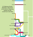 NY Waterway Weekday Peak Routes.png 1,350 × 1,524; 194 KB
-
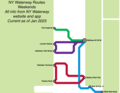 NY Waterway Weekend Routes.png 1,351 × 1,049; 140 KB
-
 RocklandBusMap.pdf 2,708 × 3,541; 1.35 MB
-
 RocklandBusMap2.pdf 2,708 × 3,541; 348 KB
-
 Transit Orange System Map.webp 2,740 × 1,716; 460 KB

