Category:Public transport maps of Mexico City
Jump to navigation
Jump to search
Subcategories
This category has the following 2 subcategories, out of 2 total.
M
- Mexico City Metrobús Maps (5 F)
- Mexico City subway maps (99 F)
Media in category "Public transport maps of Mexico City"
The following 18 files are in this category, out of 18 total.
-
 FSZMVM sistema1.png 1,000 × 1,334; 517 KB
-
 FSZMVM sistema2.png 1,000 × 1,334; 317 KB
-
 FSZMVM sistema3.png 1,000 × 1,334; 399 KB
-
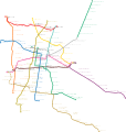 Mapa del Metro de la Ciudad de México.svg 3,091 × 3,247; 2.95 MB
-
 Mapa MI CDMX STE.png 14,776 × 19,701; 3.58 MB
-
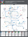
 Mapa STC Metro Movilidad Integrada.svg 2,015 × 2,848; 9.36 MB
-
 Mexico City Tramway Map 1910.jpg 6,064 × 4,416; 30.63 MB
-
 Mexico Tramways Company - Lines and properties in Mexico City LOC 2012593202.tif 6,548 × 4,698; 88.01 MB
-
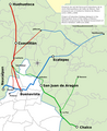
 Proyecto Ferrocarril Suburbano de la Zona Metropolitana del Valle de México.svg 1,065 × 1,308; 202 KB
-
 Proyecto Ferrocarril Suburbano de la Zona Metropolitana.png 800 × 983; 229 KB
-
 Red de Servicios STE-DF.png 557 × 1,057; 52 KB
-
 Red de transporte.png 800 × 1,171; 313 KB
-
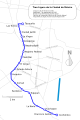
 Red del Ferrocarril Suburbano de la Zona Metropolitana del Valle de México.jpg 1,992 × 2,803; 1.8 MB
-
 Red del ferrocarril.jpg 426 × 599; 53 KB
-

-
 Transporte ZMVM.png 5,200 × 7,611; 1.78 MB
-
 Tren Ligero de la Ciudad de México.png 800 × 1,200; 379 KB
-
 Tren Ligero de la Ciudad de México.svg 800 × 1,200; 218 KB


