Category:Public transport maps of Madrid
Jump to navigation
Jump to search
Subcategories
This category has the following 5 subcategories, out of 5 total.
Media in category "Public transport maps of Madrid"
The following 13 files are in this category, out of 13 total.
-
Alcorcón Tren.svg 501 × 213; 211 KB
-
AlcrcnTren.png 401 × 170; 22 KB
-
CercaniasMadrid2018.png 1,970 × 1,802; 1.01 MB
-
CercaniasMadrid2024.png 2,383 × 2,383; 1.94 MB
-
Integratedmap copia.jpg 1,200 × 1,306; 1.16 MB
-
Juan Navalon Map.jpg 1,240 × 1,753; 677 KB
-
Madri na Espanha, 2016 41.jpg 2,448 × 3,264; 1.93 MB
-
Mapacomumicacionesparla.gif 567 × 578; 138 KB
-
Metro-undStraßenbahnGleisplanMadrid2022.png 16,879 × 13,588; 6.43 MB
-
RFi-1612-DIC-2016-Higgs.jpg 3,154 × 3,508; 5.15 MB
-
TransportesCosladaSanfernandox.png 2,440 × 1,496; 101 KB
-
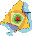
Zonas Abono Transportes Madrid dg.svg 372 × 420; 206 KB
-
Zonas Abono Transportes Madrid.svg 680 × 768; 346 KB


