Category:Public transport maps of Lyon
Jump to navigation
Jump to search
Subcategories
This category has the following 3 subcategories, out of 3 total.
M
- Maps of Lyon Tram (18 F)
T
- Trolleybus maps of Lyon (3 F)
Media in category "Public transport maps of Lyon"
The following 24 files are in this category, out of 24 total.
-
 Bellecour - Lyon Metro - map (35179767021).jpg 4,608 × 3,456; 6.03 MB
-
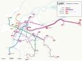
 Carte transports Lyon juillet 2022 version 2.png 3,840 × 2,160; 974 KB
-
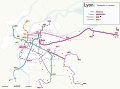
 Carte transports Lyon juillet 2022.png 3,840 × 2,160; 973 KB
-
 Extensions envisagées du métro Lyonnais.png 1,888 × 1,061; 197 KB
-
 Extensions envisagées métro Lyon.png 1,888 × 1,061; 195 KB
-
 Funiculaires de Lyon - plan.png 500 × 500; 13 KB
-
 Funiculaires de Lyon AncienActuels.svg 744 × 1,052; 34 KB
-
 Les chemins de Fer en région Lyonnaise.png 1,888 × 1,061; 304 KB
-
 Les chemins de fer en région lyonnaise.png 1,920 × 1,080; 410 KB
-
 Lyon - transports en commun - Farben nach Linienschema der TCL.png 3,723 × 2,767; 995 KB
-
 Lyon - transports en commun - Farben nach Transportmittel.png 3,723 × 2,767; 969 KB
-
 Lyon public transport (2024).svg 3,723 × 2,767; 1.76 MB
-
 Lyon public transport (planned).svg 3,723 × 2,767; 1.79 MB
-
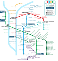
 Lyon public transport system map (with stations).png 7,401 × 5,319; 20.47 MB
-
 Lyon railways.png 964 × 794; 220 KB
-
 Metro-UndStraßenbahnGleis-UndOBusLeitungsplanLyon2020.png 8,873 × 9,269; 3.2 MB
-
 Plan du métro de Lyon en 1991.jpg 2,391 × 3,628; 2.56 MB
-
 Plan du réseau des transports en commun de la région lyonnaise en 1960.jpg 10,669 × 8,115; 11.97 MB
-
 Plan metro tram chemin.svg 3,723 × 2,767; 1.77 MB
-
 Plan-Lyon-Metro-Tramway.svg 800 × 830; 1.65 MB
-
 Projets de développement du métro de Lyon.png 1,888 × 1,061; 257 KB
-
 Reseau ferré Lyon 2023.png 3,840 × 2,160; 1.05 MB
-
 Réseau TER - Étoile ferroviaire lyonnaise.svg 512 × 392; 462 KB
-
 TW Lyon 1928.jpg 3,109 × 2,407; 2.05 MB
.jpg)


.svg)
.svg)
.png)