Category:Public transport maps of Hiroshima
Jump to navigation
Jump to search
Media in category "Public transport maps of Hiroshima"
The following 10 files are in this category, out of 10 total.
-
079 Hiroshima-Japan 2008-10.jpg 2,048 × 1,536; 418 KB
-
Astramline map.png 810 × 1,000; 134 KB
-
FareTable of JR Hiroshima Station 20170319.jpg 4,032 × 3,024; 1.75 MB
-
Hiroshima Electric Railway map.png 1,750 × 1,380; 282 KB
-
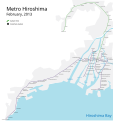
Hiroshima metro.svg 2,637 × 2,811; 36 KB
-
Hiroshima-shinai.PNG 364 × 400; 26 KB
-
HiroshimaStraßenbahnNetzentwicklung.png 8,802 × 7,674; 1.47 MB
-
Reseau hiroshima.png 1,123 × 605; 41 KB
-
StraßenbahnGleisplanHiroshima2014.png 9,902 × 9,124; 2.02 MB
-
Yokogawa-Eki Station Sign.jpg 3,888 × 2,916; 2.68 MB


