Category:Public transport maps of Hannover
Jump to navigation
Jump to search
Subcategories
This category has the following 2 subcategories, out of 2 total.
M
- Maps of S-Bahn Hannover (6 F)
T
- Tram maps of Hannover (58 F)
Media in category "Public transport maps of Hannover"
The following 12 files are in this category, out of 12 total.
-
 Halbe10b.PNG 22 × 16; 286 bytes
-
 Nachtsternverkehr Hannover.gif 500 × 400; 16.93 MB
-
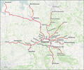 Regional-Bahn Hannover Dez 2014.png 3,100 × 2,556; 2.57 MB
-
 Regional-Bahn Hannover.png 3,100 × 2,153; 2.2 MB
-
 S-Bahn Hannover Map 2006.png 1,130 × 1,130; 156 KB
-
 S-Bahn Hannover Map.png 1,130 × 1,130; 154 KB
-
 S-Bahn Hannover Netzplan.svg 1,340 × 1,440; 4.85 MB
-
 Sbahnhannover.svg 1,050 × 1,000; 100 KB
-
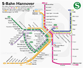 Schemaplan der S-Bahn Hannover.png 1,474 × 1,220; 321 KB
-
 Schematischer Gleisplan Tunnelnetz Stadtbahn Hannover.svg 676 × 547; 289 KB
-
 StadtbahnGleisplanHannover2017.png 11,960 × 8,882; 3.13 MB
-
 U-Bahnhof Sedanstraße-Lister Meile, 2, Oststadt, Hannover, Region Hannover.jpg 3,456 × 2,592; 4.84 MB


