Category:Public transport maps of Geneva
Jump to navigation
Jump to search
Subcategories
This category has the following 5 subcategories, out of 5 total.
Media in category "Public transport maps of Geneva"
The following 4 files are in this category, out of 4 total.
-
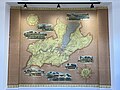 Bâtiment de l'horloge - JeP - Carte du réseau CGTE.jpg 4,032 × 3,024; 2.63 MB
-
 Carte Geneve chemin fer 1917.jpg 9,904 × 7,955; 1.69 MB
-
 Génève public transport system map (with stations).png 6,388 × 5,355; 14.98 MB
-
 StraßenbahnGleis-undTrolleybusLeitungsplanGenf2017.png 6,863 × 4,254; 1.27 MB


.png)