Category:Public transport maps of Florence
Jump to navigation
Jump to search
Subcategories
This category has the following 2 subcategories, out of 2 total.
T
- Tram maps of Florence (7 F)
- Trolleybus maps of Florence (2 F)
Media in category "Public transport maps of Florence"
The following 3 files are in this category, out of 3 total.
-
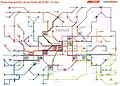 ATAFmapa.jpg 2,187 × 1,569; 362 KB
-
 StraßenbahnGleisplanFirenze2018.png 4,022 × 3,204; 464 KB
-
 StraßenbahnGleisplanFirenze2019.png 4,022 × 3,204; 465 KB


