Category:Public transport maps of Canada
Jump to navigation
Jump to search
This Category is for public transport maps of Canada. If you're looking for
- Aviation maps: refer to Category:Aviation maps of Canada
- Railway maps: refer to Category:Rail transport maps of Canada
Subcategories
This category has the following 4 subcategories, out of 4 total.
Media in category "Public transport maps of Canada"
The following 2 files are in this category, out of 2 total.
-
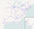 MegabusNorthAmericaMap.svg 1,536 × 1,280; 1.72 MB
-
 VIA Rail Corridor Schematic Map.png 2,450 × 532; 107 KB
