Category:Public transport maps of Bern
Jump to navigation
Jump to search
Subcategories
This category has the following 9 subcategories, out of 9 total.
2
T
- Tram maps of Bern (6 F)
Media in category "Public transport maps of Bern"
The following 10 files are in this category, out of 10 total.
-
 Bern public transport system map (with stations).png 3,866 × 4,810; 8.22 MB
-
 Busnetz Bern 2024.png 6,862 × 4,203; 15.34 MB
-
 Liniennetzplan Bern 2024.png 7,591 × 4,202; 16.71 MB
-
 NetzentwicklungRBS.png 5,949 × 6,815; 1.14 MB
-
 Karte der S-Bahn Bern.svg 1,033 × 844; 3.05 MB
-
 Trambahn-undTrolleybusNetzentwicklungBern.png 4,653 × 2,387; 916 KB
-
 TrambahnGleis-undTrolleybusLeitungsplanBern2018.png 7,621 × 2,537; 943 KB
-
 Tramnetz Bern 2022.png 5,129 × 3,192; 9.26 MB
-
 Trolleybusnetz Bern 2023.png 2,203 × 2,474; 3.91 MB
-
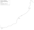 TrolleybusNetzentwicklungGümmenen.png 1,718 × 1,512; 89 KB


.png)