Category:Public footpaths in Wheldrake CP
Jump to navigation
Jump to search
English: Public footpaths in Wheldrake civil parish.
Media in category "Public footpaths in Wheldrake CP"
The following 22 files are in this category, out of 22 total.
-
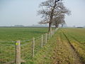
 Fieldside Footpath toward Sparrow Hall Farm. - geograph.org.uk - 2373994.jpg 3,264 × 2,448; 1.96 MB
-

-

-
 Footpath to Elvington - geograph.org.uk - 6062429.jpg 1,600 × 1,200; 562 KB
-
 Footpath to Warren House Farm - geograph.org.uk - 2379242.jpg 3,264 × 2,448; 1.72 MB
-
 Footpath to Wheldrake - geograph.org.uk - 5316041.jpg 1,024 × 768; 129 KB
-
 Footpath to Wheldrake - geograph.org.uk - 5316062.jpg 1,024 × 768; 151 KB
-

-

-
 Minster Way towards Swallow Hall - geograph.org.uk - 4098282.jpg 1,600 × 1,064; 649 KB
-
 Nature reserve path, parallel to the River Derwent - geograph.org.uk - 4105040.jpg 1,600 × 1,200; 767 KB
-
 New Field Boundary near "The Parks" - geograph.org.uk - 380268.jpg 640 × 480; 103 KB
-
 Path to Mount Pleasant Farm - geograph.org.uk - 5314648.jpg 1,024 × 768; 201 KB
-

-
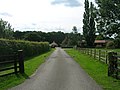
 Signpost at the end of Leonard Scales Lane - geograph.org.uk - 5267522.jpg 1,024 × 768; 141 KB
-
 The beginning of the footpath to Elvington - geograph.org.uk - 5314632.jpg 1,024 × 768; 218 KB
-
 The footpath to Elvington - geograph.org.uk - 5314634.jpg 1,024 × 768; 151 KB
-
 The footpath to Elvington - geograph.org.uk - 5314640.jpg 1,024 × 768; 199 KB
-
 The footpath to Elvington - geograph.org.uk - 5314645.jpg 1,024 × 768; 160 KB
-
 The footpath to Elvington - geograph.org.uk - 5314649.jpg 1,024 × 768; 218 KB
-
 Track north of Hagg Wood. - geograph.org.uk - 2373971.jpg 3,264 × 2,448; 2.23 MB
-
 Track to Haggwood Farm (footpath) - geograph.org.uk - 2561470.jpg 1,600 × 1,200; 520 KB


_leading_to_Mount_Pleasant_Farm,_Wheldrake_-_geograph.org.uk_-_374528.jpg)


_-_geograph.org.uk_-_2561470.jpg)