Category:Public footpaths in Marsden, West Yorkshire
Jump to navigation
Jump to search
Media in category "Public footpaths in Marsden, West Yorkshire"
The following 13 files are in this category, out of 13 total.
-
 A footpath on Warcock Hill heading towards Mount Road - geograph.org.uk - 5790311.jpg 4,000 × 3,000; 4.05 MB
-

-
 Boardwalk on the old route of the Colne Valley Circular Walk - geograph.org.uk - 3726742.jpg 1,536 × 2,048; 1.17 MB
-
 Colne Valley Circular Walk towards Meltham Road - geograph.org.uk - 5896634.jpg 1,600 × 1,087; 843 KB
-

-
 Pack Horse Road heading for Marsden - geograph.org.uk - 2738587.jpg 1,600 × 1,200; 260 KB
-
 Packhorse Track to Marsden Lane, Slaithwaite (geograph 6582974).jpg 2,000 × 1,501; 1.63 MB
-
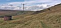 Path between the Standedge Tunnel air shafts on Marsden Moor - geograph.org.uk - 6276833.jpg 3,419 × 1,635; 1.21 MB
-
 Path junction on the Colne Valley Circular Walk - geograph.org.uk - 3606058.jpg 2,000 × 1,500; 1.41 MB
-

-
 Path to March Hill crossing Dan Clough, Marsden - geograph.org.uk - 5843342.jpg 2,000 × 1,500; 1.04 MB
-

-
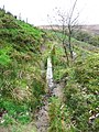
 View of the head of the Blackmoorfoot Conduit, from Scout - geograph.org.uk - 3606033.jpg 2,000 × 1,500; 1.09 MB


.jpg)


