Category:Public footpaths in Berkshire
Jump to navigation
Jump to search
Ceremonial counties of England: Bedfordshire · Berkshire · Buckinghamshire · Cambridgeshire · Cheshire · Cornwall · Cumbria · Derbyshire · Devon · Dorset · Durham · East Riding of Yorkshire · East Sussex · Essex · Gloucestershire · Greater London · Greater Manchester · Hampshire · Herefordshire · Hertfordshire · Kent · Lancashire · Leicestershire · Lincolnshire · Merseyside · Norfolk · North Yorkshire · Northamptonshire · Northumberland · Nottinghamshire · Oxfordshire · Rutland · Shropshire · Somerset · South Yorkshire · Staffordshire · Suffolk · Surrey · Tyne and Wear · Warwickshire · West Midlands · West Sussex · West Yorkshire · Wiltshire · Worcestershire
City-counties: Bristol · City of London
Former historic counties:
Other former counties:
City-counties: Bristol · City of London
Former historic counties:
Other former counties:
Subcategories
This category has the following 12 subcategories, out of 12 total.
- Towpaths in Berkshire (7 F)
A
H
R
- Ridgeway National Trail in Berkshire (130 F)
S
- Stiles in Berkshire (10 F)
T
- Test Way (8 F)
U
- Underpasses in Berkshire (5 F)
Media in category "Public footpaths in Berkshire"
The following 184 files are in this category, out of 184 total.
-
 Abury Lane, Swinley Park - geograph.org.uk - 126247.jpg 640 × 480; 72 KB
-
 And then the path turns right - geograph.org.uk - 746168.jpg 639 × 479; 215 KB
-
 Arch across the road - geograph.org.uk - 1509853.jpg 426 × 640; 114 KB
-

-
 Cottage by the footpath - geograph.org.uk - 1376251.jpg 450 × 600; 68 KB
-
 Bracknell Forest towards Caesar's Camp - geograph.org.uk - 21424.jpg 480 × 640; 72 KB
-
 Bridleways and Footpaths - geograph.org.uk - 11383.jpg 640 × 480; 382 KB
-
 By the tracks - geograph.org.uk - 762618.jpg 640 × 427; 127 KB
-
 Byway at Manor Farm near Chaddleworth - geograph.org.uk - 71256.jpg 640 × 480; 446 KB
-

-
 Clay Lane - geograph.org.uk - 1300012.jpg 640 × 480; 155 KB
-
 Clayfield Ride - geograph.org.uk - 1407388.jpg 480 × 640; 152 KB
-
 Courage Park 2019-07-07 11.52.06.jpg 3,024 × 4,032; 7.92 MB
-
 Courage Park 2019-07-07 11.52.21.jpg 3,024 × 4,032; 7.66 MB
-
 Courage Park 2019-07-07 11.52.30.jpg 3,024 × 4,032; 7.05 MB
-
 Courage Park 2019-07-07 11.52.34.jpg 3,024 × 4,032; 7.47 MB
-
 Crowthorne Wood - geograph.org.uk - 1115842.jpg 640 × 480; 86 KB
-
 Descent to Great Shefford - geograph.org.uk - 917053.jpg 640 × 418; 102 KB
-
 Entrance to footpath - geograph.org.uk - 350296.jpg 477 × 640; 136 KB
-
 Farm Entrance - geograph.org.uk - 6277.jpg 640 × 480; 529 KB
-

-
 Footpath across Barley Field - geograph.org.uk - 35846.jpg 640 × 480; 188 KB
-
 Footpath across field - geograph.org.uk - 879732.jpg 640 × 480; 70 KB
-

-
 Footpath alongside Blackhouse Wood - geograph.org.uk - 1407373.jpg 480 × 640; 86 KB
-
 Footpath alongside the M4 - geograph.org.uk - 911839.jpg 640 × 427; 121 KB
-
 Footpath and Bridleway - geograph.org.uk - 879752.jpg 640 × 480; 133 KB
-
 Footpath and Entrance to Hamstead Park - geograph.org.uk - 50346.jpg 640 × 480; 477 KB
-
 Footpath and Hyde End Wood - geograph.org.uk - 25867.jpg 640 × 480; 236 KB
-
 Footpath and old fence posts - geograph.org.uk - 1715774.jpg 1,704 × 2,272; 3.36 MB
-
 Footpath approaching Briff Lane - geograph.org.uk - 1081943.jpg 640 × 480; 142 KB
-
 Footpath at Hyde End Wood - geograph.org.uk - 25861.jpg 640 × 480; 236 KB
-
 Footpath at North Standen - geograph.org.uk - 1052446.jpg 640 × 427; 165 KB
-
 Footpath at North Standen - geograph.org.uk - 1052447.jpg 640 × 427; 187 KB
-
 Footpath at North Standen - geograph.org.uk - 1052458.jpg 640 × 427; 195 KB
-
 Footpath at North Standen - geograph.org.uk - 1052481.jpg 640 × 427; 172 KB
-
 Footpath at North Standen - geograph.org.uk - 1052484.jpg 640 × 427; 190 KB
-
 Footpath at Parkwood - geograph.org.uk - 5614.jpg 640 × 480; 471 KB
-
 Footpath at Tarman's Copse - geograph.org.uk - 1351084.jpg 640 × 480; 142 KB
-
 Footpath at the end - geograph.org.uk - 1627293.jpg 426 × 640; 111 KB
-
 Footpath at Trindledown Farm - geograph.org.uk - 73740.jpg 450 × 600; 130 KB
-
 Footpath behind Pangbourne College - geograph.org.uk - 915525.jpg 640 × 427; 104 KB
-
 Footpath below Crookham - geograph.org.uk - 1202544.jpg 640 × 480; 113 KB
-

-

-
 Footpath by woodland - geograph.org.uk - 1186716.jpg 480 × 640; 161 KB
-
 Footpath Entering Cock Marsh - geograph.org.uk - 517263.jpg 640 × 480; 143 KB
-
 Footpath follows hedge line - geograph.org.uk - 1570853.jpg 640 × 480; 68 KB
-
 Footpath from Burntbush Lane - geograph.org.uk - 974867.jpg 427 × 640; 213 KB
-
 Footpath from Holdaway's Farm - geograph.org.uk - 1223342.jpg 640 × 427; 176 KB
-
 Footpath from Standford Dingley - geograph.org.uk - 981327.jpg 640 × 427; 214 KB
-
 Footpath from Yattendon - geograph.org.uk - 987239.jpg 640 × 427; 164 KB
-
 Footpath in Ambarrow Court - geograph.org.uk - 1161747.jpg 480 × 640; 140 KB
-
 Footpath in Roundwood Copse - geograph.org.uk - 1202383.jpg 640 × 426; 185 KB
-
 Footpath into Bowler's Copse - geograph.org.uk - 1344785.jpg 640 × 425; 170 KB
-
 Footpath into Long Copse - geograph.org.uk - 1149987.jpg 640 × 428; 209 KB
-
 Footpath junction - geograph.org.uk - 1052807.jpg 640 × 427; 208 KB
-
 Footpath junction west of Compton - geograph.org.uk - 1154262.jpg 427 × 640; 194 KB
-
 Footpath near Ambrose Copse - geograph.org.uk - 987256.jpg 640 × 427; 182 KB
-
 Footpath near Burghfield Place - geograph.org.uk - 1381930.jpg 640 × 426; 190 KB
-
 Footpath near New Farm - geograph.org.uk - 20788.jpg 640 × 480; 239 KB
-
 Footpath near Skinner's Green - geograph.org.uk - 1181155.jpg 640 × 426; 210 KB
-
 Footpath near Wraysbury - geograph.org.uk - 156495.jpg 640 × 480; 166 KB
-
 Footpath next to the Enborne - geograph.org.uk - 1186929.jpg 640 × 427; 199 KB
-
 Footpath north of Old Warren - geograph.org.uk - 1550309.jpg 640 × 426; 172 KB
-
 Footpath off Downend Lane - geograph.org.uk - 1271555.jpg 640 × 480; 123 KB
-
 Footpath off Old Street - geograph.org.uk - 888836.jpg 640 × 427; 98 KB
-
 Footpath on Bucklebury common - geograph.org.uk - 1017146.jpg 640 × 480; 148 KB
-
 Footpath on Bucklebury Common - geograph.org.uk - 1087607.jpg 480 × 640; 164 KB
-
 Footpath on the left - geograph.org.uk - 1120239.jpg 640 × 426; 28 KB
-
 Footpath over the River Kennet - geograph.org.uk - 99616.jpg 640 × 481; 93 KB
-
 Footpath past Padworth Mill - geograph.org.uk - 1189234.jpg 426 × 640; 219 KB
-
 Footpath past the depot - geograph.org.uk - 1187777.jpg 426 × 640; 181 KB
-
 Footpath the Long Way Round - geograph.org.uk - 1299949.jpg 640 × 480; 54 KB
-
 Footpath this way - geograph.org.uk - 1187780.jpg 640 × 426; 195 KB
-
 Footpath through barley, Brightwalton - geograph.org.uk - 887796.jpg 640 × 480; 180 KB
-
 Footpath through barley, Sulham - geograph.org.uk - 848960.jpg 640 × 478; 191 KB
-
 Footpath through Boardhouse Plantation - geograph.org.uk - 5629.jpg 640 × 480; 583 KB
-
 Footpath through Little Park Farm - geograph.org.uk - 1223277.jpg 640 × 426; 164 KB
-

-

-
 Footpath through the rape - geograph.org.uk - 888916.jpg 640 × 427; 129 KB
-
 Footpath through the wheat - geograph.org.uk - 861564.jpg 640 × 427; 96 KB
-
 Footpath through the wheat - geograph.org.uk - 861572.jpg 427 × 640; 96 KB
-
 Footpath through the wheat - geograph.org.uk - 917040.jpg 640 × 418; 90 KB
-
 Footpath through the wheat - geograph.org.uk - 917045.jpg 427 × 640; 91 KB
-
 Footpath through the wheat - geograph.org.uk - 917077.jpg 640 × 427; 81 KB
-
 Footpath through wheat, Ashampstead - geograph.org.uk - 876250.jpg 640 × 480; 122 KB
-
 Footpath through wheat, Brightwalton - geograph.org.uk - 887788.jpg 640 × 480; 143 KB
-
 Footpath through wheat, Brightwalton - geograph.org.uk - 890782.jpg 640 × 480; 159 KB
-
 Footpath through wheat, Brightwalton - geograph.org.uk - 891511.jpg 640 × 480; 122 KB
-
 Footpath through wheat, Brightwalton - geograph.org.uk - 893421.jpg 640 × 480; 184 KB
-
 Footpath through wheat, Farnborough - geograph.org.uk - 838291.jpg 640 × 480; 143 KB
-
 Footpath to Barn Elms Farm - geograph.org.uk - 914186.jpg 427 × 640; 129 KB
-
 Footpath to Beedon - geograph.org.uk - 861596.jpg 640 × 427; 85 KB
-
 Footpath to Birch Farm - geograph.org.uk - 974754.jpg 640 × 427; 193 KB
-
 Footpath to Bower Farm - geograph.org.uk - 80267.jpg 640 × 481; 47 KB
-
 Footpath to Burntbush Lane - geograph.org.uk - 975036.jpg 640 × 427; 174 KB
-
 Footpath to Burntbush Lane - geograph.org.uk - 975049.jpg 640 × 427; 168 KB
-
 Footpath to Compton Downs - geograph.org.uk - 881736.jpg 640 × 480; 92 KB
-
 Footpath to Crookham Manor - geograph.org.uk - 1187785.jpg 640 × 427; 179 KB
-
 Footpath to Greenham Common - geograph.org.uk - 1186933.jpg 640 × 427; 176 KB
-
 Footpath to Mount Prosperous - geograph.org.uk - 1052663.jpg 640 × 427; 181 KB
-
 Footpath to Newbury - geograph.org.uk - 1180295.jpg 640 × 425; 173 KB
-
 Footpath to Nodmore - geograph.org.uk - 862873.jpg 427 × 640; 124 KB
-
 Footpath to Pangbourne - geograph.org.uk - 1714796.jpg 1,024 × 683; 91 KB
-
 Footpath to Radley Farm - geograph.org.uk - 1231123.jpg 640 × 480; 150 KB
-
 Footpath to Sandleford - geograph.org.uk - 1186683.jpg 640 × 428; 184 KB
-
 Footpath to Several Down - geograph.org.uk - 80324.jpg 640 × 481; 48 KB
-
 Footpath to Skinner's Green - geograph.org.uk - 1181144.jpg 640 × 426; 202 KB
-
 Footpath to Skinner's Green - geograph.org.uk - 1181156.jpg 640 × 427; 231 KB
-
 Footpath to Standen Manor - geograph.org.uk - 100976.jpg 640 × 481; 60 KB
-
 Footpath to Stanford Dingley - geograph.org.uk - 981358.jpg 427 × 640; 248 KB
-
 Footpath to Streatley Hill - geograph.org.uk - 1568614.jpg 640 × 480; 91 KB
-
 Footpath to The Lambden's - geograph.org.uk - 987998.jpg 640 × 427; 185 KB
-
 Footpath to the left - geograph.org.uk - 1509865.jpg 640 × 427; 142 KB
-

-
 Footpath to Tidmarsh - geograph.org.uk - 1714861.jpg 533 × 800; 105 KB
-
 Footpath to Tyneys Green - geograph.org.uk - 862745.jpg 640 × 427; 93 KB
-
 Footpath to Upper Basildon - geograph.org.uk - 746133.jpg 639 × 479; 208 KB
-
 Footpath to Wash Common - geograph.org.uk - 1186784.jpg 640 × 426; 192 KB
-
 Footpath to Wither's farm - geograph.org.uk - 1017082.jpg 640 × 480; 73 KB
-
 Footpath to Woodgreen Farm - geograph.org.uk - 1344895.jpg 640 × 425; 166 KB
-
 Footpath to Yattendon Lane - geograph.org.uk - 987568.jpg 640 × 427; 202 KB
-
 Footpath to Yew Tree Hill - geograph.org.uk - 1722219.jpg 640 × 480; 109 KB
-
 Footpath towards Hampstead Norreys - geograph.org.uk - 1150196.jpg 640 × 428; 189 KB
-
 Footpath towards Haw Farm - geograph.org.uk - 1150199.jpg 427 × 640; 210 KB
-
 Footpath towards Heather Piece - geograph.org.uk - 987082.jpg 427 × 640; 221 KB
-
 Footpath towards Marsh Lane - geograph.org.uk - 927967.jpg 640 × 427; 179 KB
-
 Footpath towards Padworth Mill - geograph.org.uk - 1189281.jpg 640 × 428; 164 KB
-
 Footpath towards Scrace's Farm - geograph.org.uk - 916022.jpg 640 × 427; 116 KB
-
 Footpath towards Skinner's Green - geograph.org.uk - 1526386.jpg 640 × 425; 209 KB
-
 Footpath towards The Gully - geograph.org.uk - 1052816.jpg 640 × 427; 161 KB
-
 Footpath towards Warren Farm - geograph.org.uk - 1156376.jpg 424 × 640; 164 KB
-
 Footpath towards Woolhampton - geograph.org.uk - 1224541.jpg 640 × 427; 195 KB
-
 Footpath towards Woolhampton - geograph.org.uk - 1224551.jpg 640 × 428; 205 KB
-
 Footpath, Lambourn Woodlands - geograph.org.uk - 1652158.jpg 480 × 640; 231 KB
-
 Footpath, Moon's Copse - geograph.org.uk - 1650320.jpg 640 × 480; 203 KB
-
 Footpath, Ufton Nervet - geograph.org.uk - 1560601.jpg 640 × 480; 141 KB
-
 Footpath, Upper Lambourn - geograph.org.uk - 1658037.jpg 640 × 480; 133 KB
-
 Footpath, Waltham St Lawrence - geograph.org.uk - 3487432.jpg 2,048 × 1,536; 1.86 MB
-
 Forest Track - geograph.org.uk - 1115583.jpg 640 × 480; 110 KB
-
 Freeman's Marsh - geograph.org.uk - 842312.jpg 640 × 480; 40 KB
-
 Gravel track near Upper Star Post - geograph.org.uk - 1156805.jpg 480 × 640; 103 KB
-
 Hanworth, Bracknell - geograph.org.uk - 115293.jpg 640 × 480; 92 KB
-
 Heath and woodland near Bramshill House - geograph.org.uk - 181830.jpg 640 × 478; 149 KB
-
 Junction of Byways - geograph.org.uk - 59927.jpg 640 × 480; 176 KB
-
 Line of the Footpath at Mud Hall Cottage - geograph.org.uk - 71362.jpg 640 × 480; 402 KB
-
 Luckley Path, Wokingham - geograph.org.uk - 1288622.jpg 480 × 640; 116 KB
-
 No cycles - geograph.org.uk - 1566116.jpg 480 × 640; 127 KB
-
 Old railway, East Garston - geograph.org.uk - 230182.jpg 478 × 640; 203 KB
-
 Pasture at North Standen - geograph.org.uk - 1052452.jpg 640 × 427; 158 KB
-
 Pastures, Lambourn Woodlands - geograph.org.uk - 724868.jpg 640 × 480; 189 KB
-
 Path at Hut Hill, Crowthorne Wood - geograph.org.uk - 1270684.jpg 640 × 480; 134 KB
-
 Path at Ludgrove - geograph.org.uk - 1219286.jpg 640 × 480; 149 KB
-
 Path below the railway embankment - geograph.org.uk - 1470279.jpg 480 × 640; 156 KB
-
 Path from Dowlesgreen - geograph.org.uk - 1299906.jpg 640 × 480; 110 KB
-
 Path from Holt Copse - geograph.org.uk - 1288694.jpg 640 × 480; 155 KB
-
 Path leading to Crowthorne Wood - geograph.org.uk - 1181923.jpg 480 × 640; 130 KB
-
 Path to the Church at Chaddleworth - geograph.org.uk - 71302.jpg 640 × 480; 584 KB
-
 Prospect Park, Reading - geograph.org.uk - 604957.jpg 640 × 480; 147 KB
-
 Prospect Park, Reading - geograph.org.uk - 604959.jpg 640 × 480; 145 KB
-
 Railway bridge over the Kennet and Avon Canal between Kintbury and Hungerford 01.jpg 4,128 × 3,096; 12.07 MB
-
 Railway bridge over the Kennet and Avon Canal between Kintbury and Hungerford 02.jpg 5,152 × 3,864; 5.09 MB
-
 Restricted byway to Upper Basildon - geograph.org.uk - 746130.jpg 639 × 479; 205 KB
-
 Ride from Surrey Hill - geograph.org.uk - 1262460.jpg 640 × 480; 106 KB
-
 Shady footpath - geograph.org.uk - 1349991.jpg 640 × 480; 157 KB
-
 The River Thames, Sonning - geograph.org.uk - 919674.jpg 640 × 480; 155 KB
-
 St. Denys' churchyard - geograph.org.uk - 981344.jpg 640 × 427; 203 KB
-
 Streatley Warren - geograph.org.uk - 746193.jpg 639 × 479; 202 KB
-
 The cat path - geograph.org.uk - 1288665.jpg 640 × 480; 118 KB
-
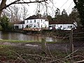 The Dundas Arms, Kintbury.jpg 4,128 × 3,096; 8.13 MB
-
 The Green Way - geograph.org.uk - 1238474.jpg 640 × 480; 93 KB
-
-
 Titcomb Farm - geograph.org.uk - 57675.jpg 640 × 480; 188 KB
-
 Track beside Virginia Water - geograph.org.uk - 107907.jpg 640 × 480; 88 KB
-
 Track near Caesar's Camp - geograph.org.uk - 1118061.jpg 640 × 480; 105 KB
-
 Track near Caesar's Camp, Swinley Forest - geograph.org.uk - 729734.jpg 640 × 640; 288 KB
-
 Track near Cranbourne Tower - geograph.org.uk - 129814.jpg 640 × 480; 78 KB
-
 Track near Gravel Hill - geograph.org.uk - 1118071.jpg 640 × 480; 105 KB
-
 Wansdyke, Old Dyke Lane, Inkpen 01.jpg 4,000 × 3,000; 5.58 MB
-
 Whiteknights Campus 2016-04-19 18.30.34.jpg 3,264 × 1,836; 4.4 MB
-
 Windsor Great Park - geograph.org.uk - 61706.jpg 640 × 480; 81 KB
-
 Windsor Ride - geograph.org.uk - 1205836.jpg 640 × 454; 120 KB


