Category:Public footpaths in Bath, Somerset
Jump to navigation
Jump to search
Media in category "Public footpaths in Bath, Somerset"
The following 15 files are in this category, out of 15 total.
-
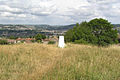
 Bathampton Down remains of tramway.jpg 1,146 × 1,600; 805 KB
-
 BOAT east of North Stoke - geograph.org.uk - 1479184.jpg 640 × 480; 80 KB
-
 Footpath Beechen Cliff - geograph.org.uk - 593856.jpg 640 × 480; 175 KB
-
 Footpath Beechen Cliff - geograph.org.uk - 593874.jpg 640 × 480; 170 KB
-
 Footpath, University of Bath - geograph.org.uk - 2143458.jpg 1,500 × 2,000; 219 KB
-
 Houses on Beechen Cliff - geograph.org.uk - 940654.jpg 640 × 480; 104 KB
-
 Path near the viewpoint on Beechen Cliff - geograph.org.uk - 598495.jpg 480 × 640; 163 KB
-
 Path near the viewpoint on Beechen Cliff - geograph.org.uk - 598502.jpg 640 × 480; 153 KB
-

-

-
 Public footpath to Rush Hill - geograph.org.uk - 364760.jpg 480 × 640; 144 KB
-
 Twerton Roundhill in Bath (geograph 1967301).jpg 1,600 × 1,069; 590 KB
-
 Who's pinched my tunnel^^ - geograph.org.uk - 47843.jpg 640 × 427; 139 KB
-
 Footpath off Combe Hay Lane - geograph.org.uk - 358364.jpg 480 × 640; 134 KB
-
 The path to Rainbow Wood Farm - geograph.org.uk - 172017.jpg 640 × 480; 125 KB


.jpg)


