Category:Protestant Church (Brünlos)
Jump to navigation
Jump to search
| Object location | | View all coordinates using: OpenStreetMap |
|---|
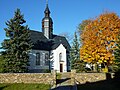
church building in Zwönitz, Germany  | |||||
| Upload media | |||||
| Instance of | |||||
|---|---|---|---|---|---|
| Location | Zwönitz, Erzgebirgskreis, Saxony, Germany | ||||
| Street address |
| ||||
| Heritage designation | |||||
| Inception |
| ||||
 | |||||
| (Wikidata) |
Media in category "Protestant Church (Brünlos)"
The following 16 files are in this category, out of 16 total.
-
 Brünloser Kirche.jpg 3,872 × 2,592; 2.71 MB
-
 Ev.-luth-Kirche Brünlos (1).jpg 4,000 × 3,000; 1.6 MB
-
 Ev.-luth-Kirche Brünlos (2).jpg 4,000 × 3,000; 3.5 MB
-
 Ev.-luth-Kirche Brünlos (3).jpg 3,000 × 4,000; 1.24 MB
-
 Ev.-luth-Kirche Brünlos, Portal.jpg 3,000 × 4,000; 1.96 MB
-
 Ev.-luth. Kirche Brünlos (10).jpg 4,000 × 3,000; 3.2 MB
-
 Ev.-luth. Kirche Brünlos (2).jpg 4,000 × 3,000; 3.88 MB
-
 Ev.-luth. Kirche Brünlos (3).jpg 4,000 × 3,000; 3.64 MB
-
 Ev.-luth. Kirche Brünlos (6).jpg 3,000 × 4,000; 1.68 MB
-
 Ev.-luth. Kirche Brünlos (7).jpg 4,000 × 3,000; 1.58 MB
-
 Ev.-luth. Kirche Brünlos (8).jpg 4,000 × 3,000; 3.22 MB
-
 Kirche Brünlos.jpg 1,922 × 2,518; 753 KB
-
 Kirche Brünlos2.jpg 1,944 × 2,592; 660 KB
-
 Kirche von Brünlos.jpg 3,648 × 2,736; 6.07 MB
-
 Osterbrunnen Brünlos 2024 mit Kirche.jpg 4,000 × 3,000; 4.07 MB
-
 Osterbrunnen Brünlos mit Kirche.jpg 3,000 × 4,000; 1.89 MB

.jpg)
.jpg)
.jpg)

.jpg)
.jpg)
.jpg)
.jpg)
.jpg)
.jpg)


