Category:Prinsegracht 80A, The Hague
Jump to navigation
Jump to search
| Object location | | View all coordinates using: OpenStreetMap |
|---|
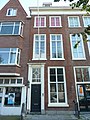
building in The Hague, Netherlands  | |||||
| Upload media | |||||
| Instance of | |||||
|---|---|---|---|---|---|
| Location | The Hague, South Holland, Netherlands | ||||
| Located on street | |||||
| Heritage designation |
| ||||
 | |||||
|
This is a category about rijksmonument number 17941
|
| Address |
|
Media in category "Prinsegracht 80A, The Hague"
The following 9 files are in this category, out of 9 total.
-
 Den Haag - Prinsegracht 80.JPG 2,736 × 3,648; 4.21 MB
-

-
 INTERIEUR, KLEINE KAMER, WANDSCHILDERINGEN, DETAIL - 's-Gravenhage - 20278367 - RCE.jpg 1,183 × 1,200; 189 KB
-
 INTERIEUR, KLEINE KAMER, WANDSCHILDERINGEN, DETAIL - 's-Gravenhage - 20278368 - RCE.jpg 1,195 × 1,200; 172 KB
-
 INTERIEUR, KLEINE KAMER, WANDSCHILDERINGEN, DETAIL - 's-Gravenhage - 20278369 - RCE.jpg 1,193 × 1,200; 165 KB
-
 INTERIEUR, KLEINE KAMER, WANDSCHILDERINGEN, DETAIL - 's-Gravenhage - 20278370 - RCE.jpg 1,200 × 1,152; 171 KB
-
 INTERIEUR, KLEINE KAMER, WANDSCHILDERINGEN, DETAIL - 's-Gravenhage - 20278371 - RCE.jpg 1,200 × 1,196; 181 KB
-
 INTERIEUR, KLEINE KAMER, WANDSCHILDERINGEN, DETAIL - 's-Gravenhage - 20278372 - RCE.jpg 1,198 × 1,200; 162 KB
-


