Category:Prinsegracht 41, The Hague
Jump to navigation
Jump to search
| Object location | | View all coordinates using: OpenStreetMap |
|---|
building in The Hague, Netherlands  | |||||
| Upload media | |||||
| Instance of | |||||
|---|---|---|---|---|---|
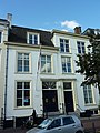
| Location | The Hague, South Holland, Netherlands | ||||
| Located on street |
| ||||
| Heritage designation |
| ||||
 | |||||
|
This is a category about rijksmonument number 17901
|
| Address |
|
Media in category "Prinsegracht 41, The Hague"
The following 4 files are in this category, out of 4 total.
-
 Den Haag - Prinsegracht 41 en 39.JPG 2,736 × 3,648; 4.16 MB
-
 Den Haag - Prinsegracht 41.JPG 1,692 × 3,303; 1.96 MB
-
 Exterieur OVERZICHT VOORGEVELS - 's-Gravenhage - 20262251 - RCE.jpg 1,200 × 772; 180 KB
-
 Exterieur OVERZICHT VOORGEVELS - 's-Gravenhage - 20262254 - RCE.jpg 1,200 × 807; 174 KB


