Category:Preußischer Rundsockelstein (Kroppenstedt)
Jump to navigation
Jump to search
| Object location | | View all coordinates using: OpenStreetMap |
|---|
_Am_Kirchhof_P1110361.jpg) | |||||
| Upload media | |||||
| Instance of |
| ||||
|---|---|---|---|---|---|
| Location | Kroppenstedt, Börde, Saxony-Anhalt, Germany | ||||
 | |||||
Media in category "Preußischer Rundsockelstein (Kroppenstedt)"
The following 7 files are in this category, out of 7 total.
-
 Kroppenstedt, Preußischer Rundsockelstein vor Heimatmuseum (1).jpg 1,536 × 2,048; 622 KB
-
 Kroppenstedt, Preußischer Rundsockelstein vor Heimatmuseum (2).jpg 3,000 × 4,000; 3.19 MB
-
 Kroppenstedt, Preußischer Rundsockelstein vor Heimatmuseum (3).jpg 3,000 × 4,000; 2.92 MB
-
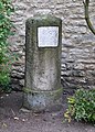 Meilenstein (Kroppenstedt) Am Kirchhof P1110361.jpg 2,066 × 2,886; 1.33 MB
-
 Meilenstein (Kroppenstedt) Am Kirchhof P1110362.jpg 3,116 × 2,452; 1.37 MB
-
 Meilenstein (Kroppenstedt) Am Kirchhof P1110364.jpg 2,365 × 3,196; 1.52 MB
-
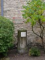
 Museum (Kroppenstedt) Am Kirchplatz P1110358.jpg 2,498 × 1,817; 1.25 MB
.jpg)
.jpg)
.jpg)
_Am_Kirchhof_P1110362.jpg)
_Am_Kirchhof_P1110364.jpg)
_Am_Kirchplatz_P1110358.jpg)