Category:Prestonville, Brighton
Jump to navigation
Jump to search
suburb of Brighton, East Sussex, England, UK | |||||
| Upload media | |||||
| Instance of | |||||
|---|---|---|---|---|---|
| Part of | |||||
| Location | Brighton and Hove, East Sussex, South East England, England | ||||
 | |||||
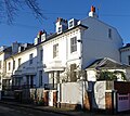
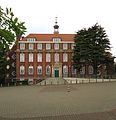
Prestonville is a residential area to the northwest of Brighton, part of the English city of Brighton and Hove. It consists mostly of middle-class housing dating from the second half of the 19th century.
Subcategories
This category has the following 14 subcategories, out of 14 total.
A
- Al-Quds Mosque, Brighton (2 F)
D
- Dyke Tavern, Brighton (3 F)
E
G
L
M
- Milligan House, Brighton (5 F)
O
P
Media in category "Prestonville, Brighton"
The following 106 files are in this category, out of 106 total.
-
36 Exeter Street, Prestonville, Brighton (August 2013).JPG 2,400 × 1,800; 774 KB
-
Al Quds Mosque, Dyke Road - geograph.org.uk - 540242.jpg 479 × 640; 146 KB
-
Belmont - geograph.org.uk - 1163806.jpg 640 × 480; 79 KB
-
Brick Housing in Prestonville, Brighton (August 2014).JPG 1,500 × 2,000; 586 KB
-
Brigden Street - geograph.org.uk - 536423.jpg 467 × 640; 105 KB
-
Brighton Hove & Sussex Sixth Form College.jpg 3,286 × 3,406; 2.22 MB
-
Brighton Open Air Theatre - geograph.org.uk - 6849809.jpg 1,600 × 1,200; 507 KB
-
Brighton, Brigden Street - geograph.org.uk - 842180.jpg 640 × 480; 60 KB
-
Brighton, Stafford Road - geograph.org.uk - 842090.jpg 640 × 480; 69 KB
-
Buxton Road - geograph.org.uk - 1163776.jpg 480 × 640; 88 KB
-
Buxton Road - geograph.org.uk - 539795.jpg 640 × 485; 121 KB
-
Caburn Road - geograph.org.uk - 1163856.jpg 428 × 640; 59 KB
-
East-Northeastward view from Stanford Road, Prestonville, Brighton (December 2013).JPG 3,600 × 2,600; 2.07 MB
-
East-Southeastward view from Highcroft Villas, Prestonville, Brighton (August 2013).JPG 2,400 × 1,800; 982 KB
-
East-Southeastward view from Stanford Road, Prestonville, Brighton (December 2013) (1).JPG 3,600 × 2,600; 1.91 MB
-
East-Southeastward view from Stanford Road, Prestonville, Brighton (December 2013) (2).JPG 3,600 × 2,600; 1.97 MB
-
Eastward view along Old Shoreham Road, Prestonville, Brighton (August 2013).JPG 1,800 × 2,000; 755 KB
-
Eastward view along The Drove, Prestonville, Brighton (August 2014).JPG 1,400 × 2,000; 450 KB
-
Eastward view along York Grove, Prestonville, Brighton (December 2012).JPG 2,500 × 1,600; 953 KB
-
Eastward view from Highcroft Villas, Prestonville (August 2013).JPG 2,500 × 1,500; 857 KB
-
Eastward view from Stanford Road, Prestonville, Brighton (December 2013) (1).JPG 2,500 × 1,900; 1.04 MB
-
Eastward view from Stanford Road, Prestonville, Brighton (December 2013) (2).JPG 2,500 × 1,900; 1.02 MB
-
Eastward view from Stanford Road, Prestonville, Brighton (December 2013) (3).JPG 3,600 × 2,600; 2.05 MB
-
GX03 STZ (Route 77) at Dyke Road, Prestonville, Brighton (26-08-2013).JPG 1,800 × 2,200; 780 KB
-
Hamilton Road, Brighton.jpg 1,200 × 1,600; 222 KB
-
Hampstead Road - geograph.org.uk - 1556865.jpg 640 × 480; 92 KB
-
Housing at Dyke Road–The Drove junction, Prestonville, Brighton (October 2010).JPG 2,500 × 1,500; 826 KB
-
Housing at Park View Terrace, Prestonville, Brighton (August 2013).JPG 2,400 × 1,400; 621 KB
-
Housing in Prestonville, Brighton (December 2013, seen from Howard Place).JPG 2,400 × 1,600; 1.88 MB
-
Housing on East Side of Exeter Street, Prestonville, Brighton (August 2013).JPG 2,500 × 1,500; 693 KB
-
Housing on Exeter Street, Prestonville, Brighton (August 2013).JPG 2,400 × 1,600; 709 KB
-
Housing on Millers Road, Prestonville, Brighton (August 2013).JPG 2,400 × 1,600; 868 KB
-
Housing on Millers Road, Prestonville, Brighton (January 2011).JPG 2,400 × 1,800; 945 KB
-
Housing on North side of Upper Hamilton Road, Prestonville, Brighton (December 2013).JPG 2,400 × 1,400; 620 KB
-
Housing on Northeast side of Compton Road, Prestonville, Brighton (August 2014).JPG 2,000 × 1,400; 549 KB
-
Housing on South side of Old Shoreham Road, Prestonville, Brighton (August 2013) (1).JPG 2,400 × 1,600; 683 KB
-
Housing on South side of Old Shoreham Road, Prestonville, Brighton (August 2013) (2).JPG 2,400 × 1,600; 716 KB
-
Housing on South Side of Old Shoreham Road, Prestonville, Brighton (December 2013).JPG 2,500 × 1,500; 665 KB
-
Housing on Southwest side of Compton Road, Prestonville, Brighton (August 2014).JPG 2,000 × 1,200; 497 KB
-
Housing on Stanford Road, Prestonville, Brighton (December 2013).JPG 3,400 × 2,200; 1.54 MB
-
Housing on West side of Inwood Crescent, Prestonville, Brighton (August 2014).JPG 1,400 × 1,400; 366 KB
-
Junction of Millers Road and Highcroft Villas, Prestonville, Brighton (August 2014).JPG 2,000 × 1,400; 492 KB
-
North-Northeastward view from Stanford Road, Prestonville, Brighton (December 2013).JPG 3,600 × 2,600; 1.98 MB
-
Northward view along Millers Road, Prestonville, Brighton (August 2014) (1).JPG 2,000 × 1,400; 553 KB
-
Northward view along Millers Road, Prestonville, Brighton (August 2014) (2).JPG 2,000 × 1,400; 588 KB
-
Northward view along Millers Road, Prestonville, Brighton (August 2016) (1).JPG 3,200 × 2,400; 1.45 MB
-
Northward view along Millers Road, Prestonville, Brighton (August 2016) (2).JPG 3,200 × 2,400; 1.53 MB
-
Northward view along Millers Road, Prestonville, Brighton (August 2016) (3).JPG 2,800 × 2,200; 1.23 MB
-
Old Buildings on Howard Terrace, Prestonville, Brighton (July 2019).JPG 1,600 × 1,800; 1.12 MB
-
OpenStreetMap of Prestonville, Brighton.png 850 × 1,150; 704 KB
-
Port Hall, 70 Dyke Road, Prestonville, Brighton (NHLE Code 1380458) (May 2016).JPG 1,700 × 1,100; 556 KB
-
Port Hall, 70 Dyke Road, Prestonville, Brighton (NHLE Code 1380458) (September 2010).JPG 2,200 × 1,800; 904 KB
-
Preston Park - geograph.org.uk - 6872585.jpg 4,031 × 2,689; 7.7 MB
-
Preston Park - geograph.org.uk - 6872587.jpg 3,979 × 2,654; 7.76 MB
-
Preston Park - geograph.org.uk - 6872605.jpg 3,410 × 2,275; 7.74 MB
-
Preston Park Clock Tower - geograph.org.uk - 6872588.jpg 3,460 × 2,595; 7.67 MB
-
Preston Park Clock Tower - geograph.org.uk - 6872591.jpg 2,807 × 3,509; 7.62 MB
-
Queens Barracks, 198 Dyke Road, Prestonville, Brighton (August 2014).JPG 2,000 × 1,400; 465 KB
-
Southeastward view from Highcroft Villas, Prestonville (August 2013) (1).JPG 1,000 × 700; 184 KB
-
Southeastward view from Highcroft Villas, Prestonville (August 2013) (2).JPG 1,000 × 600; 166 KB
-
Southeastward view from Highcroft Villas, Prestonville (August 2013) (3).JPG 2,400 × 1,600; 870 KB
-
Southeastward view from Highcroft Villas, Prestonville (August 2013) (4).JPG 2,400 × 1,400; 713 KB
-
Southeastward view from Stanford Road, Prestonville, Brighton (December 2013) (1).JPG 3,600 × 2,600; 2.01 MB
-
Southeastward view from Stanford Road, Prestonville, Brighton (December 2013) (2).JPG 3,600 × 2,600; 1.92 MB
-
Southeastward view from Stanford Road, Prestonville, Brighton (December 2013) (3).JPG 3,600 × 2,600; 1.94 MB
-
Southeastward view from Stanford Road, Prestonville, Brighton (December 2013) (4).JPG 3,600 × 2,400; 1.93 MB
-
Stage at Brighton Open Air Theatre - geograph.org.uk - 6849806.jpg 1,600 × 1,200; 370 KB
-
Territorial Army Centre, Dyke Road - geograph.org.uk - 540822.jpg 640 × 487; 140 KB
-
The Turret, 48 Highcroft Villas, Prestonville, Brighton (August 2014).JPG 1,500 × 1,200; 375 KB
-
View Northwestwards from Howard Place towards Prestonville, Brighton (December 2013).JPG 2,500 × 1,800; 1,010 KB
-
View Southwestwards towards Prestonville from Preston Drove, Brighton (September 2011).jpg 2,400 × 1,800; 1.21 MB
-
View towards Prestonville from Howard Place, Brighton (December 2012).JPG 2,500 × 1,700; 1.89 MB
-
Westward view along The Drove, Prestonville, Brighton (August 2014).JPG 2,000 × 1,400; 456 KB


