Category:Prestbury, Cheshire
Jump to navigation
Jump to search
village and civil parish in Cheshire East, England  | |||||
| Upload media | |||||
| Instance of | |||||
|---|---|---|---|---|---|
| Location | Cheshire East, Cheshire, North West England, England | ||||
| Population |
| ||||
 | |||||
Subcategories
This category has the following 6 subcategories, out of 6 total.
B
- Bradley Mount (1 F)
- Butley Town (4 F)
N
P
- Prestbury railway station (11 F)
- Prestbury Tunnel (2 F)
Media in category "Prestbury, Cheshire"
The following 190 files are in this category, out of 190 total.
-
 1–4 The Village, Prestbury.jpg 1,800 × 1,350; 365 KB
-
 A long way from home - geograph.org.uk - 4130829.jpg 4,290 × 3,062; 6.3 MB
-
 A roadside mere Chelford Road, Prestbury - geograph.org.uk - 2327262.jpg 4,000 × 3,000; 4.83 MB
-
 A523 - B5358 junction - geograph.org.uk - 2204535.jpg 640 × 463; 86 KB
-
 Abbey Mill, Shirley Drive, Prestbury - geograph.org.uk - 6589496.jpg 3,024 × 4,032; 3.12 MB
-
 Aline Miller Photo.jpg 1,191 × 1,263; 419 KB
-
 An unusual sight! - geograph.org.uk - 4130648.jpg 5,897 × 3,932; 7.31 MB
-
 Autumn leaves on Butley Lanes - geograph.org.uk - 2705399.jpg 2,272 × 1,704; 1.87 MB
-
 B5358 - geograph.org.uk - 4319034.jpg 640 × 430; 46 KB
-
 B5358 - geograph.org.uk - 4383273.jpg 640 × 430; 35 KB
-
 B5358 - geograph.org.uk - 4830269.jpg 640 × 426; 41 KB
-
 B5358 - geograph.org.uk - 4830272.jpg 640 × 363; 35 KB
-
 Balsam closeup - geograph.org.uk - 4666177.jpg 5,211 × 3,766; 6.02 MB
-
 Bank erosion River Bollin - geograph.org.uk - 2361721.jpg 4,000 × 3,000; 4.78 MB
-
 Barn at entrance to Park House Farm - geograph.org.uk - 6588242.jpg 3,024 × 4,032; 3.25 MB
-
 Blot on the Landscape? - geograph.org.uk - 4130619.jpg 5,448 × 3,632; 5.99 MB
-
 Bollin footbridge - geograph.org.uk - 4130634.jpg 6,000 × 4,000; 7.42 MB
-
 Bollin Grove, Prestbury - geograph.org.uk - 6588292.jpg 3,024 × 4,032; 3.15 MB
-
 Bollin meanders - geograph.org.uk - 2833690.jpg 5,184 × 3,456; 4.6 MB
-
 Bollin Valley near Prestbury - geograph.org.uk - 4830278.jpg 640 × 426; 62 KB
-
 Bollin Valley Way, South of Prestbury - geograph.org.uk - 6590276.jpg 1,200 × 1,600; 567 KB
-
 Bollin Way crossing by footbridge - geograph.org.uk - 2361845.jpg 4,000 × 3,000; 5.34 MB
-
 Bonis Hall Lane - geograph.org.uk - 2125074.jpg 640 × 425; 91 KB
-
 Bonis Hall Lane by junction with Butley Lane - geograph.org.uk - 2475069.jpg 1,024 × 720; 103 KB
-

-
 Box Tree House, Prestbury.jpg 1,800 × 1,350; 445 KB
-
 Brickwall ruin or modern art? - geograph.org.uk - 2394264.jpg 4,000 × 3,000; 4.36 MB
-
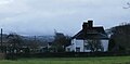
 Bridge Hotel, Prestbury.jpg 1,800 × 1,350; 411 KB
-
 Bridge over River Bollin - geograph.org.uk - 2124055.jpg 640 × 425; 125 KB
-
 Broken Cross - geograph.org.uk - 62859.jpg 640 × 494; 104 KB
-
 Brooks Cottage, Prestbury.jpg 1,800 × 1,350; 693 KB
-

-
 Butley Lanes, Prestbury - geograph.org.uk - 2361628.jpg 4,000 × 3,000; 4.77 MB
-
 Butley Town - Well Lane - geograph.org.uk - 6676345.jpg 5,184 × 2,912; 3.94 MB
-
 Car dealership, Wilmslow Rd - geograph.org.uk - 2475087.jpg 1,024 × 692; 62 KB
-
 Carr House - geograph.org.uk - 2125129.jpg 640 × 425; 69 KB
-
 Cattle grazing - geograph.org.uk - 4319053.jpg 640 × 430; 39 KB
-
 Cattle resting - geograph.org.uk - 4319052.jpg 640 × 430; 40 KB
-
 Cheshire countryside - geograph.org.uk - 4873482.jpg 640 × 434; 52 KB
-
 Church House and Ravenstone, Prestbury.jpg 1,800 × 1,350; 422 KB
-
 Course of the River Bollin - geograph.org.uk - 4130571.jpg 5,674 × 3,783; 7.25 MB
-
 Covering up - geograph.org.uk - 4131586.jpg 3,467 × 2,553; 5.2 MB
-
 Crossing the footbridge - geograph.org.uk - 4666695.jpg 6,000 × 4,000; 6.92 MB
-
 Crossroads on Prestbury Road - geograph.org.uk - 2771590.jpg 640 × 480; 60 KB
-
 Dandy Farm - geograph.org.uk - 2125133.jpg 640 × 425; 77 KB
-

-
 Entrance to Sandy Head Farm - geograph.org.uk - 6585396.jpg 3,024 × 4,032; 4.45 MB
-
 Farmhouse at Woodside Farm - geograph.org.uk - 4788799.jpg 1,358 × 672; 192 KB
-
 Farmland at Howlanehead - geograph.org.uk - 6585399.jpg 4,032 × 3,024; 2.54 MB
-
 Farmland by the West Coast Main line - geograph.org.uk - 4383305.jpg 640 × 430; 32 KB
-
 Farmland by the West Coast Main line - geograph.org.uk - 4830264.jpg 640 × 426; 45 KB
-
 Farmland near Prestbury - geograph.org.uk - 6591506.jpg 3,024 × 4,032; 3.56 MB
-
 Farmland North of Prestbury - geograph.org.uk - 6585408.jpg 4,032 × 3,024; 2.67 MB
-
 Fields over the Hedgerow - Bonis Hall Lane - geograph.org.uk - 4788137.jpg 4,122 × 1,995; 1.97 MB
-
 Fine Holstein Cow - geograph.org.uk - 4666716.jpg 5,035 × 3,429; 4.62 MB
-
 Flash Farm - geograph.org.uk - 4570791.jpg 5,184 × 3,456; 1.75 MB
-
 Football pitch off Butley Lanes - geograph.org.uk - 2124423.jpg 640 × 425; 89 KB
-
 Footbridge and Mast North of Prestbury - geograph.org.uk - 6585409.jpg 3,024 × 4,032; 2.56 MB
-
 Footbridge over the River Bollin - geograph.org.uk - 4592718.jpg 3,648 × 2,736; 6.49 MB
-
 Footbridge over the River Bollin - geograph.org.uk - 4721029.jpg 3,648 × 2,736; 2.74 MB
-
 Footbridge over the River Bollin - geograph.org.uk - 6589503.jpg 4,032 × 3,024; 4.24 MB
-
 Footpath from Chelford Road, Prestbury - geograph.org.uk - 2327228.jpg 3,791 × 2,843; 4.44 MB
-
 Footpath under Railway Line - geograph.org.uk - 6590581.jpg 3,024 × 4,032; 3.68 MB
-
 Footpath^ - geograph.org.uk - 2392903.jpg 4,000 × 3,000; 4.42 MB
-
 Former Prestbury Library.jpg 1,800 × 1,350; 602 KB
-
 Golf Course, Tytherington - geograph.org.uk - 6591519.jpg 4,032 × 3,024; 4.86 MB
-
 Green energy ^ - geograph.org.uk - 4131611.jpg 5,038 × 3,563; 6.31 MB
-
 Greenbank Farm - geograph.org.uk - 4565843.jpg 5,184 × 3,456; 1.71 MB
-
 Henry's Café and Gascoigne Halman, Prestbury.jpg 1,800 × 1,350; 427 KB
-
 Himalayan Balsam - geograph.org.uk - 4666171.jpg 6,000 × 4,000; 7.17 MB
-
 Honesty Box - geograph.org.uk - 4131503.jpg 5,325 × 3,594; 6.78 MB
-
 Horses grazing - geograph.org.uk - 4383270.jpg 640 × 430; 32 KB
-
 House on Bonis Hall Lane - geograph.org.uk - 2259820.jpg 640 × 465; 34 KB
-
 Houses on Bonis Hall Lane - geograph.org.uk - 2475114.jpg 1,024 × 708; 112 KB
-
 Howlanehead - geograph.org.uk - 6472987.jpg 1,024 × 681; 80 KB
-
 Howlanehead and Sandy Head Farm - geograph.org.uk - 6585402.jpg 4,032 × 3,024; 2.9 MB
-
 Howlanehead and Sandy Head Farm - geograph.org.uk - 6585407.jpg 4,032 × 3,024; 2.42 MB
-
 Junction of A523 and B5358, north of Prestbury - geograph.org.uk - 3571461.jpg 1,600 × 899; 250 KB
-
 Junction of Badger Road and Brocklehurst Drive, Prestbury - geograph.org.uk - 6588262.jpg 3,024 × 4,032; 3.65 MB
-
 Junction of Bonis Hall-Lees-Mill Lanes - geograph.org.uk - 2392927.jpg 4,000 × 3,000; 4.52 MB
-
 K6 phonebox, Prestbury.jpg 1,800 × 1,350; 623 KB
-
 Legh Arms, Prestbury.jpg 1,800 × 1,350; 357 KB
-
 Lilac Cottage, Prestbury.jpg 1,800 × 1,350; 1.57 MB
-
 Line of Hornbeam trees bordering road at Bollin Grove - geograph.org.uk - 6588277.jpg 3,024 × 4,032; 3.95 MB
-
 London - Manchester Mainline North of Prestbury - geograph.org.uk - 6585410.jpg 3,024 × 4,032; 3.01 MB
-
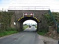 Low Bridge - geograph.org.uk - 248377.jpg 640 × 480; 118 KB
-
 Low Rail Bridge on the B5358 - geograph.org.uk - 2755606.jpg 3,640 × 2,107; 3.12 MB
-
 Low Railway Bridge - geograph.org.uk - 4788135.jpg 3,743 × 2,543; 2.39 MB
-
 Macclesfield Road, Prestbury (Cheshire).jpg 640 × 480; 60 KB
-
 Macclesfield Road, Prestbury - geograph.org.uk - 2325802.jpg 4,000 × 3,000; 4.12 MB
-
 Macclesfield Road, Prestbury - geograph.org.uk - 4051838.jpg 4,912 × 3,264; 4.44 MB
-
 Manor House, Prestbury.jpg 1,800 × 1,350; 486 KB
-
 Meanders of the Bollin - geograph.org.uk - 4130837.jpg 6,000 × 4,000; 5.99 MB
-
 Memorial Plaque, Bollin Grove - geograph.org.uk - 6588285.jpg 3,024 × 4,032; 2.78 MB
-
 Mill Lane and Carr House Farm - geograph.org.uk - 3164242.jpg 640 × 481; 522 KB
-
 Moat - geograph.org.uk - 2394159.jpg 4,000 × 3,000; 5.3 MB
-
 Modern House under construction in Prestbury - geograph.org.uk - 6589398.jpg 3,024 × 4,032; 3.25 MB
-
 More bank erosion River Bollin - geograph.org.uk - 2361763.jpg 4,000 × 3,000; 4.67 MB
-
 New Road, Prestbury - geograph.org.uk - 6471918.jpg 1,280 × 833; 488 KB
-
 North of Prestbury - geograph.org.uk - 3314488.jpg 640 × 386; 46 KB
-
 Nursery, London Rd - geograph.org.uk - 4873479.jpg 640 × 527; 65 KB
-
 Observing the 'last flight' of the Vulcan - geograph.org.uk - 5093807.jpg 1,192 × 1,295; 1.17 MB
-
 Off Bonis Hall Lane - geograph.org.uk - 2125059.jpg 640 × 425; 89 KB
-
 Off Butley Lanes - geograph.org.uk - 2124829.jpg 640 × 425; 98 KB
-
 Off Butley Lanes - geograph.org.uk - 2125026.jpg 640 × 425; 95 KB
-

-

-

-

-
 On the Bollin Bridge - geograph.org.uk - 4130564.jpg 6,000 × 4,000; 6.39 MB
-
 Packsaddle Park - geograph.org.uk - 4565065.jpg 4,869 × 3,265; 1.8 MB
-
 Pasture south of Prestbury - geograph.org.uk - 6472992.jpg 1,024 × 681; 148 KB
-
 Pasture, Heybridge farm, Prestbury - geograph.org.uk - 6591512.jpg 4,032 × 3,024; 2.6 MB
-
 Peak & Northern Footpath Sign No 559 - geograph.org.uk - 6585251.jpg 3,024 × 4,032; 3.2 MB
-
 Pear Tree Cottage, Prestbury.jpg 1,800 × 1,350; 482 KB
-
 Plaque, Springfields Car Park - geograph.org.uk - 2130518.jpg 640 × 425; 160 KB
-
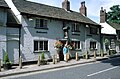 Prestbury - Admiral Rodney.jpg 640 × 423; 101 KB
-
 Prestbury - geograph.org.uk - 4319033.jpg 640 × 430; 45 KB
-
 Prestbury - geograph.org.uk - 4565057.jpg 4,592 × 2,864; 1.76 MB
-
 Prestbury Bowling Club, Prestbury - geograph.org.uk - 2392845.jpg 640 × 480; 81 KB
-
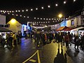 Prestbury Christmas Street Party - geograph.org.uk - 2728529.jpg 4,000 × 3,000; 2.72 MB
-
 Prestbury Christmas Street Party - i - geograph.org.uk - 2728512.jpg 4,000 × 3,000; 2.21 MB
-
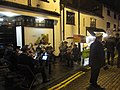 Prestbury Christmas Street Party = ii - geograph.org.uk - 2728519.jpg 4,000 × 3,000; 2.28 MB
-
 Prestbury from the River Bollin.gif 304 × 197; 56 KB
-
 Prestbury Hall.jpg 1,800 × 1,350; 539 KB
-
 Prestbury in Cheshire (Bryant map, 1831).jpg 287 × 172; 21 KB
-
 Prestbury in Cheshire - the Village, northwest side.jpg 450 × 310; 63 KB
-
 Prestbury Lane-New Road-Butley Lanes junction - geograph.org.uk - 5096790.jpg 3,648 × 2,432; 4.53 MB
-
 Prestbury Library - geograph.org.uk - 6589376.jpg 4,032 × 3,024; 2.5 MB
-
 Prestbury near Macclesfield - New Rd - geograph.org.uk - 6676341.jpg 5,184 × 2,912; 3.97 MB
-

-
 Prestbury village - geograph.org.uk - 2312332.jpg 2,272 × 1,704; 854 KB
-
 Prestbury Village - geograph.org.uk - 2323847.jpg 2,272 × 1,704; 707 KB
-
 Prestbury Village - geograph.org.uk - 6589395.jpg 1,024 × 768; 210 KB
-
 Prestbury village stocks outside St Peter's church - geograph.org.uk - 5096775.jpg 3,648 × 2,432; 3.73 MB
-

-
 Proliferation of Himalayan Balsam, Bollin Valley Way - geograph.org.uk - 6590574.jpg 3,024 × 4,032; 5.28 MB
-
 Rider of the Range - geograph.org.uk - 4131537.jpg 3,217 × 2,301; 7.68 MB
-
 River Bollin - geograph.org.uk - 2124046.jpg 640 × 425; 113 KB
-
 River Bollin - geograph.org.uk - 4742394.jpg 640 × 308; 54 KB
-
 River Bollin at rear of Bollin Grove - geograph.org.uk - 2361668.jpg 4,000 × 3,000; 5.25 MB
-
 River Bollin footbridge - geograph.org.uk - 4051831.jpg 4,912 × 3,264; 6 MB
-
 River Bollin, Bollin Grove Prestbury - geograph.org.uk - 6588309.jpg 3,024 × 4,032; 4.95 MB
-
 River Bollin, nr. Prestbury - geograph.org.uk - 163700.jpg 640 × 427; 170 KB
-
 River Dean - geograph.org.uk - 2125175.jpg 640 × 425; 102 KB
-
 River Dean - geograph.org.uk - 3164258.jpg 640 × 481; 609 KB
-
 River Dean - geograph.org.uk - 3164281.jpg 640 × 481; 846 KB
-
 Sewage works outfall River Bollin - geograph.org.uk - 2361814.jpg 3,000 × 4,000; 6.37 MB
-
 Sheep - geograph.org.uk - 2128803.jpg 640 × 425; 99 KB
-
 Sitting on the fence - geograph.org.uk - 4131560.jpg 5,352 × 3,554; 5.37 MB
-
 Snowscene near Prestbury - geograph.org.uk - 2204552.jpg 640 × 430; 124 KB
-
 South of Prestbury - geograph.org.uk - 3314484.jpg 640 × 348; 47 KB
-
 South of Prestbury - geograph.org.uk - 6472990.jpg 1,024 × 580; 93 KB
-
 Spittle Bridge over the River Bollin - geograph.org.uk - 2361690.jpg 4,000 × 3,000; 4.49 MB
-
 Spittle House, Prestbury.JPG 1,200 × 900; 296 KB
-
 Springfields Car Park - geograph.org.uk - 2130505.jpg 425 × 640; 126 KB
-
 Springtime in Prestbury - geograph.org.uk - 2361655.jpg 3,000 × 4,000; 6.91 MB
-
 Stone Post, Howlanehead - geograph.org.uk - 6585406.jpg 1,200 × 1,600; 584 KB
-
 Sufficient deflection? - geograph.org.uk - 2361786.jpg 4,000 × 3,000; 5.37 MB
-
 Superb Cheshire cattle - geograph.org.uk - 4130707.jpg 4,788 × 3,251; 5.84 MB
-
 Swanwick House, Prestbury.jpg 1,800 × 1,350; 434 KB
-
 Taking to the water - geograph.org.uk - 2361832.jpg 4,000 × 3,000; 5.58 MB
-
 The Coast, Prestbury.jpg 1,800 × 1,350; 365 KB
-
 The Horners, Prestbury.jpg 1,800 × 1,350; 316 KB
-
 The Old School House - geograph.org.uk - 3164237.jpg 640 × 481; 449 KB
-
 The Red House and Bacchus Restaurant, Prestbury.jpg 1,800 × 1,350; 383 KB
-
 The Silk Road towards Macclesfield - geograph.org.uk - 4788142.jpg 2,271 × 1,846; 894 KB
-
 The Vicarage, Prestbury.jpg 1,800 × 1,350; 393 KB
-
 The Village.gif 191 × 250; 2 KB
-
 Tiffin Kitchen, Prestbury.jpg 1,800 × 1,350; 364 KB
-
 Top o th' Hill - geograph.org.uk - 98583.jpg 640 × 480; 170 KB
-
 Top o' th' Hill Farm, Prestbury - geograph.org.uk - 2392877.jpg 4,000 × 3,000; 3.6 MB
-
 Towards Bonis Wood - geograph.org.uk - 2125107.jpg 640 × 425; 85 KB
-
 Towards Butley Lanes - geograph.org.uk - 2124081.jpg 640 × 425; 84 KB
-
 Unicorn House, Prestbury.jpg 1,800 × 1,350; 479 KB
-
 Unrepaired stile - geograph.org.uk - 4666705.jpg 5,690 × 3,793; 6.86 MB
-
 Village stocks, Prestbury.jpg 1,800 × 1,350; 601 KB
-
 Wooden Owl carving at Prestbury Station.jpg 3,168 × 4,752; 5 MB
-
 WW2 pillbox - geograph.org.uk - 2393041.jpg 4,000 × 3,000; 4.77 MB
-
 Yellow bike fever in Prestbury - geograph.org.uk - 5096784.jpg 3,648 × 2,432; 3.97 MB
-
 A538 at Tytherington - geograph.org.uk - 248461.jpg 640 × 480; 149 KB
-
 Hello-Goodbye Macclesfield - geograph.org.uk - 158379.jpg 640 × 480; 163 KB
-
 Localized Flooding, Whirley Grove - geograph.org.uk - 158368.jpg 640 × 480; 99 KB
-
 Macclesfield Cemetery - urn garden - geograph.org.uk - 145286.jpg 610 × 458; 72 KB
-
 Near Fittontown Farm, Macclesfield - geograph.org.uk - 158362.jpg 640 × 480; 115 KB
-
 Outskirts of Henbury - geograph.org.uk - 150890.jpg 640 × 480; 183 KB
-
 Sandy Lane Lake - geograph.org.uk - 62463.jpg 640 × 480; 114 KB
-
 Signpost near Prestbury - geograph.org.uk - 158300.jpg 640 × 459; 134 KB
-
 The Coach House, Macclesfield - geograph.org.uk - 150887.jpg 640 × 466; 104 KB
-
 Whirley Lane near Macclesfield - geograph.org.uk - 150888.jpg 640 × 464; 157 KB


.jpg)


.jpg)


