Category:Pressig
Jump to navigation
Jump to search
market municipality of Germany     | |||||
| Upload media | |||||
| Instance of |
| ||||
|---|---|---|---|---|---|
| Part of |
| ||||
| Location | Kronach, Upper Franconia, Bavaria, Germany | ||||
| Population |
| ||||
| Area |
| ||||
| Elevation above sea level |
| ||||
| official website | |||||
 | |||||
Subcategories
This category has the following 8 subcategories, out of 8 total.
Media in category "Pressig"
The following 6 files are in this category, out of 6 total.
-
 Belastmarken Pressig ReiKi.jpg 1,500 × 1,058; 534 KB
-
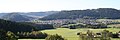 Blick auf Pressig (Standort oberhalb von Brauersdorf) (2).jpg 3,368 × 1,128; 2.14 MB
-
 Digitales Orthofoto von Pressig (Bayerische Vermessungsverwaltung).tif 22,500 × 30,000; 1.38 GB
-
 Pressig im Landkreis Kronach.png 412 × 549; 51 KB
-
 Pressig in KC.svg 456 × 555; 1.05 MB
-
 Pressig, KC - Rothenkirchen - Pfarrkirche v O.jpg 4,489 × 2,480; 960 KB


_(2).jpg)