Category:Prescote
Jump to navigation
Jump to search
English: Prescote is a hamlet and civil parish about north of Banbury in Oxfordshire Its boundaries are the River Cherwell in the southeast, a tributary of the Cherwell called Highfurlong Brook in the west, and Oxfordshire's boundary with Northamptonshire in the northeast.
civil parish in Cherwell district, Oxfordshire, England  | |||||
| Upload media | |||||
| Instance of | |||||
|---|---|---|---|---|---|
| Location | Cherwell, Oxfordshire, South East England, England | ||||
| Population |
| ||||
 | |||||
Media in category "Prescote"
The following 9 files are in this category, out of 9 total.
-
 Cropredy Marina - geograph.org.uk - 6142250.jpg 1,280 × 851; 259 KB
-
 Cropredy Marina along the Oxford Canal - geograph.org.uk - 4491894.jpg 1,024 × 668; 190 KB
-
 Fisherman's Cottage on Appletree Lane - geograph.org.uk - 4491858.jpg 1,024 × 763; 301 KB
-
 Path round the edge of the field - geograph.org.uk - 2699683.jpg 640 × 480; 91 KB
-
 Bridleway, Prescote - geograph.org.uk - 662737.jpg 640 × 480; 172 KB
-
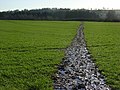 Bridleway, Prescote - geograph.org.uk - 662744.jpg 640 × 480; 165 KB
-
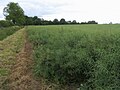
 Farmland, Prescote - geograph.org.uk - 662750.jpg 640 × 480; 125 KB
-
 Seven Shires Way - geograph.org.uk - 2699665.jpg 640 × 480; 91 KB
-
 Seven Shires Way - geograph.org.uk - 2699685.jpg 640 × 480; 104 KB


