Category:Power line Sils-Fällanden
Jump to navigation
Jump to search
| Upload media | |||||
| Instance of | |||||
|---|---|---|---|---|---|
| Location |
| ||||
| Connects with |
| ||||
| Frequency |
| ||||
| |||||
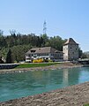
Deutsch: 380-kV-Leitung Sils–Fällanden in der Schweiz
Media in category "Power line Sils-Fällanden"
The following 73 files are in this category, out of 73 total.
-
2012 'Seegfrörni' - Greifensee - Fällanden - Niederuster 2012-02-16 13-49-28 (SX230).JPG 4,000 × 3,000; 2.54 MB
-
2012-06-24-See-Gaster (Foto Dietrich Michael Weidmann) 058.JPG 3,872 × 2,592; 3.98 MB
-
2012-06-24-See-Gaster (Foto Dietrich Michael Weidmann) 061.JPG 3,872 × 2,592; 3.51 MB
-
2012-06-24-See-Gaster (Foto Dietrich Michael Weidmann) 062.JPG 3,872 × 2,592; 4 MB
-
2012-06-24-See-Gaster (Foto Dietrich Michael Weidmann) 064.JPG 3,872 × 2,592; 2.56 MB
-
2012-12-25 Uster (Foto Dietrich Michael Weidmann) 034.JPG 3,872 × 2,592; 4.29 MB
-
6-Linthkanal-Jud.jpg 1,575 × 1,051; 1.34 MB
-
7-Wildtierkorridor-Jud.jpg 1,575 × 1,051; 1.41 MB
-
A3 Churfirsten.jpg 3,456 × 2,304; 3.48 MB
-
A53 - Barenberg-Rütiwald IMG 9409.JPG 3,888 × 2,592; 4.84 MB
-
Adlisberg - Benglen-Uster-Wetzikon - Loorenchop IMG 4252.JPG 3,264 × 2,448; 1.85 MB
-
Autohof Rastplatz Heidilandin der Schweiz neben der A13 - panoramio.jpg 3,072 × 2,304; 3.48 MB
-
Benkner Büchel Giessen.JPG 2,816 × 2,112; 1.24 MB
-
Bubikon (Wolfhausen-Barenberg) IMG 9413.JPG 3,188 × 2,390; 2.13 MB
-
Bubikon IMG 4939.JPG 3,118 × 2,338; 1.86 MB
-
Bubikon IMG 4940.JPG 4,288 × 2,848; 5.46 MB
-
Bubikon IMG 5493.JPG 4,288 × 2,848; 6.23 MB
-
Bubikon Widerzell - Egelsee - Bubikon Büelhölzli IMG 4934.JPG 4,176 × 2,772; 2.86 MB
-
Bunker Linthebene01.JPG 2,816 × 2,112; 1.59 MB
-
Chüemettler - Federispitz - Bubikon (Egelsee) 2010-11-11 15-04-14.JPG 4,288 × 2,848; 5.02 MB
-
Egelsee (Bubikon) IMG 4936.JPG 4,176 × 2,772; 3.91 MB
-
Egelsee (Bubikon) IMG 5119.JPG 3,264 × 2,448; 2.12 MB
-
EWZ in Sils im Domleschg.jpg 4,000 × 3,000; 3.18 MB
-
Federispitz und Glarner Alpen - Grynau - Linthkanal 2015-11-10 14-26-56.JPG 6,000 × 4,000; 6.86 MB
-
Flums.jpg 590 × 400; 63 KB
-
Fläsch.jpg 1,145 × 840; 342 KB
-
Fällanden - Glatt IMG 6532.jpg 3,264 × 2,448; 2.82 MB
-
Grynau - Federispitz-Chüemettler - Linthkanal 2015-11-10 14-37-05.JPG 6,000 × 4,000; 6.04 MB
-
Grynau - Friedgrabenkanal - Buechberg 2015-11-10 14-07-45.JPG 6,000 × 4,000; 14.73 MB
-
Grynau - Linth - 1995 Brücke 2015-11-10 13-43-16.JPG 6,000 × 4,000; 6.87 MB
-
Grynau - Turm - Federispitz - Linthkanal 2015-11-10 14-38-21.JPG 4,000 × 6,000; 10.62 MB
-
Grynau - Turm - Linthkanal 2015-11-10 14-27-07.JPG 6,000 × 4,000; 5.59 MB
-
Grynau - Turm und Scheune - Linthkanal 2015-11-10 14-28-49.JPG 6,000 × 4,000; 12.93 MB
-
Grüningen - Adletshusen IMG 7739.JPG 3,888 × 2,592; 4.66 MB
-
Grüningen - Itzikon IMG 7756.JPG 3,888 × 2,592; 2.15 MB
-
Grüningen - Itzikon IMG 7761.JPG 3,888 × 2,592; 5.18 MB
-
Grüningen - Itzikon IMG 7764.JPG 3,888 × 2,592; 5.06 MB
-
Hombrechtikon - Lützelsee IMG 7835.JPG 3,888 × 2,592; 2.36 MB
-
Landschaft bei Buttikon im Kanton Schwyz - panoramio.jpg 3,475 × 1,532; 726 KB
-
Linth Reichenburg.jpg 1,600 × 1,200; 498 KB
-
Linthebene - Grynau 2015-11-10 13-39-32.JPG 6,000 × 4,000; 7.45 MB
-
Linthebene - Grynau 2015-11-10 13-44-05.JPG 6,000 × 4,000; 6.34 MB
-
Linthwerk2013 1.JPG 4,608 × 3,456; 2.92 MB
-
Linthwerk2013 2.JPG 4,608 × 3,456; 2.93 MB
-
Linthwerk2013 4.JPG 4,608 × 3,456; 2.9 MB
-
Linthwerk2013 7.JPG 4,608 × 3,456; 2.92 MB
-
Lätten Hinterwannwis Maur.jpg 3,264 × 2,448; 8.45 MB
-
Mastrils.jpg 3,456 × 2,304; 3.13 MB
-
Obstalden 237.jpg 3,872 × 2,592; 4.34 MB
-
Rodels von Norden.jpg 2,592 × 1,944; 1.95 MB
-
Rothenbrunnen Ortenstein.jpg 3,456 × 2,304; 4.48 MB
-
Rüti - Hüllistein IMG 4648.JPG 2,448 × 3,264; 3.47 MB
-
Rüti - Schützenweg IMG 4777 ShiftN.jpg 2,394 × 3,746; 4.85 MB
-
Schloss Grynau 2013.JPG 4,608 × 3,456; 2.86 MB
-
Schloss Grynau in Bildmitte 2013 (cropped).JPG 2,459 × 2,910; 1.23 MB
-
Schmerikon 2008 Zentrum.jpg 1,000 × 750; 530 KB
-
Schmerikon IMG 2113.JPG 3,888 × 2,592; 4.56 MB
-
Schmerikon IMG 2121.JPG 3,888 × 2,592; 5.01 MB
-
Schmerikon IMG 2125.JPG 3,888 × 2,592; 5.02 MB
-
Schmerikon4.JPG 3,456 × 4,608; 3.27 MB
-
Schmerikon6.JPG 4,608 × 3,456; 3 MB
-
Schmerikon7.JPG 4,608 × 3,456; 3.27 MB
-
Schmerikoner Ried 2015-11-10 14-43-27.JPG 6,000 × 4,000; 16.33 MB
-
Schmerikoner Ried 2015-11-10 14-53-47.JPG 6,000 × 4,000; 14.58 MB
-
See-Gaster 574.jpg 1,600 × 1,200; 203 KB
-
Seeufer DSC2438.jpg 2,000 × 1,072; 936 KB
-
Sils im Domleschg-Power plant of the Elektrizitätswerke Zürich (EWZ)-01.jpg 4,592 × 2,576; 3.59 MB
-
Speer Chüemettler Federispitze.jpg 1,442 × 833; 105 KB
-
Speer-Chüemettler-Federispitz - Grynau - Linthkanal 2015-11-10 14-29-52.JPG 6,000 × 4,000; 14.73 MB
-
Speer-Chüemettler-Federispitz - Grynau - Linthkanal 2015-11-10 14-30-00.JPG 6,000 × 4,000; 13.51 MB
-
Speer-Chüemettler-Federispitz - Grynau Turm und Scheune- Linthkanal 2015-11-10 14-37-36.JPG 6,000 × 4,000; 13.04 MB
-
Towards Thusis National Biker Route 6 - panoramio.jpg 1,280 × 768; 543 KB
-
Volketswil vidita ek de Pfaffhausen.jpg 1,600 × 1,200; 365 KB


