Category:Potters Marston
Jump to navigation
Jump to search
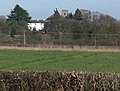
English: Potters Marston is a village and civil parish in the district of Blaby in Leicestershire, England. It has a population of around 40, and is roughly between Huncote and Stoney Stanton, but closest to Croft. It has a view of the remaining side of croft quarry and has 12 houses. The Church has a congregation of around 10 people, and was originally and barn which became a school house.

human settlement in United Kingdom | |||||
| Upload media | |||||
| Instance of | |||||
|---|---|---|---|---|---|
| Location | Blaby, Leicestershire, East Midlands, England | ||||
| Population |
| ||||
 | |||||
Media in category "Potters Marston"
The following 66 files are in this category, out of 66 total.
-
 Bridleway towards Croft - geograph.org.uk - 5295160.jpg 640 × 480; 68 KB
-
 Calor Gas site, Stoney Stanton - geograph.org.uk - 4808944.jpg 640 × 480; 128 KB
-
 Church Farm - geograph.org.uk - 4811110.jpg 640 × 407; 36 KB
-
 Church Farm - geograph.org.uk - 5295154.jpg 640 × 408; 32 KB
-

-

-

-
 Croft Hill - geograph.org.uk - 2876127.jpg 2,708 × 1,692; 1.99 MB
-
 Croft House and church tower - geograph.org.uk - 2876126.jpg 2,345 × 1,782; 1.99 MB
-
 Croft Road near Thurlaston - geograph.org.uk - 5832245.jpg 1,600 × 900; 648 KB
-
 Croft-Thurlaston Lane - geograph.org.uk - 6110292.jpg 1,600 × 1,200; 457 KB
-
 Cyclists along Stanton Lane - geograph.org.uk - 2876115.jpg 2,532 × 2,248; 2.48 MB
-
 Entrance to Dovecote Court - geograph.org.uk - 4354534.jpg 1,600 × 1,088; 433 KB
-
 Farmland in the Soar Valley - geograph.org.uk - 4449110.jpg 640 × 426; 54 KB
-
 Field at Potters Marston - geograph.org.uk - 5761170.jpg 1,600 × 900; 278 KB
-
 Field off Stanton Lane - geograph.org.uk - 5295161.jpg 640 × 480; 54 KB
-
 Fields next to the M69 motorway - geograph.org.uk - 4354589.jpg 1,600 × 1,174; 519 KB
-
 Fire^ - geograph.org.uk - 867411.jpg 640 × 360; 53 KB
-
 Granite rocks on Croft Hill - geograph.org.uk - 3268947.jpg 4,000 × 3,000; 3.58 MB
-
 Houses at Potters Marston - geograph.org.uk - 4189613.jpg 1,600 × 1,279; 371 KB
-
 Houses on Stanton Lane - geograph.org.uk - 5295163.jpg 640 × 480; 57 KB
-
 Line to Hinckley - geograph.org.uk - 4808910.jpg 640 × 480; 71 KB
-

-
 M69 at Marker 119.5 - geograph.org.uk - 4589227.jpg 1,600 × 1,006; 298 KB
-
 M69 motorway approaching Pingle Lane - geograph.org.uk - 3589476.jpg 640 × 480; 52 KB
-
 Pingle Lane - geograph.org.uk - 5295150.jpg 640 × 480; 41 KB
-
 Pingle Lane bridge, M69 - geograph.org.uk - 3589481.jpg 640 × 480; 59 KB
-
 Pingle Lane near Potters Marston Hall - geograph.org.uk - 4354480.jpg 1,600 × 1,054; 305 KB
-
 Potters Marston church - geograph.org.uk - 5808664.jpg 4,000 × 3,000; 3.07 MB
-
 Potters Marston church 2.jpg 573 × 368; 65 KB
-
 Pylon in the Soar Valley - geograph.org.uk - 4449107.jpg 640 × 426; 33 KB
-
 Pylon in the Soar Valley - geograph.org.uk - 4449108.jpg 640 × 426; 34 KB
-

-
 Pylons at Potters Marston - geograph.org.uk - 284997.jpg 640 × 480; 52 KB
-
 Railway bridge - geograph.org.uk - 5807390.jpg 4,000 × 3,000; 3.18 MB
-

-
 Road to Potters Marston - geograph.org.uk - 4808914.jpg 640 × 480; 54 KB
-
 Small tributary of Thurlaston Brook - geograph.org.uk - 4354580.jpg 1,600 × 1,154; 526 KB
-
 Stanton Lane - geograph.org.uk - 5295158.jpg 640 × 480; 50 KB
-
 Stanton Lane - geograph.org.uk - 5295164.jpg 640 × 480; 66 KB
-
 Stanton Lane at Potters Marston - geograph.org.uk - 2876113.jpg 2,672 × 2,183; 2.17 MB
-
 Stanton Lane at Potters Marston - geograph.org.uk - 2876122.jpg 3,264 × 2,448; 3.77 MB
-
 Stanton Lane eastwards - geograph.org.uk - 4811108.jpg 640 × 429; 35 KB
-
 Stanton Lane eastwards - geograph.org.uk - 4811111.jpg 640 × 467; 36 KB
-
 Stanton Lane near Croft Hill - geograph.org.uk - 2876129.jpg 2,511 × 1,910; 1.84 MB
-
 Stanton Lane westwards - geograph.org.uk - 4811109.jpg 640 × 494; 56 KB
-
 Stanton Lane westwards - geograph.org.uk - 4811112.jpg 640 × 421; 38 KB
-
 The South Leicestershire Railway looking towards Nuneaton - geograph.org.uk - 5808679.jpg 4,000 × 3,000; 3.32 MB
-
 Thurlaston Brook - geograph.org.uk - 4808916.jpg 480 × 640; 72 KB
-
 Track to Stoney Stanton - geograph.org.uk - 4808939.jpg 480 × 640; 123 KB
-
 Track to Stoney Stanton - geograph.org.uk - 4808941.jpg 480 × 640; 110 KB
-
 Track to Stoney Stanton - geograph.org.uk - 4808942.jpg 480 × 640; 106 KB
-
 View towards Low Spinney Wind Farm - geograph.org.uk - 2876116.jpg 1,689 × 1,554; 1.06 MB
-
 View towards Potters Marston - geograph.org.uk - 2877580.jpg 3,264 × 2,448; 3.87 MB
-
 Welcome to Potters Marston - geograph.org.uk - 511559.jpg 620 × 640; 116 KB
-
 Westwards from Croft Hill - geograph.org.uk - 4812410.jpg 640 × 399; 79 KB
-

-
 Young crop field off Stanton Lane - geograph.org.uk - 5295157.jpg 640 × 480; 47 KB
-
 Electricity Pylons - geograph.org.uk - 511594.jpg 537 × 640; 109 KB
-
 Huncote Road, Potters Marston - geograph.org.uk - 511579.jpg 640 × 514; 94 KB
-
 Leicestershire Farmland - geograph.org.uk - 511599.jpg 540 × 640; 139 KB
-
 M69 Motorway towards Leicester - geograph.org.uk - 677866.jpg 640 × 400; 58 KB
-
 Pingle Lane at Potters Marston - geograph.org.uk - 677897.jpg 640 × 440; 73 KB
-
 Potters Marston Hall - geograph.org.uk - 677893.jpg 640 × 437; 52 KB
-
 Stanton Lane near Croft - geograph.org.uk - 511632.jpg 640 × 437; 119 KB
-
 Stanton Lane, Potters Marston - geograph.org.uk - 511586.jpg 640 × 542; 102 KB


_-_geograph.org.uk_-_6561685.jpg)
_-_geograph.org.uk_-_6561687.jpg)
_-_geograph.org.uk_-_6561690.jpg)


