Category:Postwick with Witton
Jump to navigation
Jump to search
English: Postwick with Witton is a civil parish in the English county of Norfolk, comprising the two nearby villages of Postwick and Witton. Postwick is some to the north-east, north of the A47.
civil parish in Norfolk, UK | |||||
| Upload media | |||||
| Pronunciation audio | |||||
|---|---|---|---|---|---|
| Instance of | |||||
| Location | Broadland, Norfolk, East of England, England | ||||
| Has part(s) | |||||
| Population |
| ||||
| Area |
| ||||
 | |||||
Subcategories
This category has the following 4 subcategories, out of 4 total.
P
R
S
W
Media in category "Postwick with Witton"
The following 200 files are in this category, out of 374 total.
(previous page) (next page)-

-
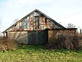
 1920s greenhouses - geograph.org.uk - 5266432.jpg 640 × 486; 355 KB
-
 1920s greenhouses - geograph.org.uk - 5266433.jpg 640 × 480; 348 KB
-
 1940s building - geograph.org.uk - 5271606.jpg 640 × 480; 338 KB
-
 1940s generator house (interior) - geograph.org.uk - 5271610.jpg 640 × 480; 396 KB
-
 1940s generator house - geograph.org.uk - 5271609.jpg 640 × 526; 453 KB
-
 1950s boiler house (chimney) - geograph.org.uk - 5271652.jpg 640 × 480; 373 KB
-
 1950s boiler house - geograph.org.uk - 5271648.jpg 640 × 480; 354 KB
-
 1950s boiler house - geograph.org.uk - 5271656.jpg 640 × 480; 321 KB
-
 1950s galvanised steel water tank - geograph.org.uk - 5266633.jpg 640 × 553; 343 KB
-
 1950s greenhouse (interior) - geograph.org.uk - 5266451.jpg 640 × 543; 573 KB
-
 1950s greenhouse (ventilation windows) - geograph.org.uk - 5266461.jpg 640 × 480; 342 KB
-
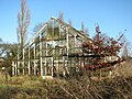 1950s greenhouse - geograph.org.uk - 5266440.jpg 640 × 480; 417 KB
-
 1950s greenhouse - geograph.org.uk - 5266455.jpg 640 × 480; 381 KB
-
 1950s greenhouse - geograph.org.uk - 5266457.jpg 640 × 480; 398 KB
-
 1950s greenhouses - geograph.org.uk - 5266448.jpg 640 × 480; 422 KB
-
 1950s greenhouses - geograph.org.uk - 5266521.jpg 640 × 480; 387 KB
-
 1950s hot water storage tank - geograph.org.uk - 5271620.jpg 621 × 542; 374 KB
-
 1950s hot water storage tank - geograph.org.uk - 5271621.jpg 640 × 480; 442 KB
-
 1950s industrial boiler - geograph.org.uk - 5271628.jpg 587 × 640; 507 KB
-
 1950s lighting - geograph.org.uk - 5266621.jpg 640 × 600; 421 KB
-
 1950s lighting - geograph.org.uk - 5266636.jpg 640 × 610; 515 KB
-
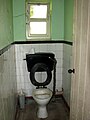 1950s toilet - geograph.org.uk - 5266611.jpg 480 × 640; 263 KB
-
 1950s water tank - geograph.org.uk - 5271613.jpg 640 × 521; 395 KB
-
 1950s water tank - geograph.org.uk - 5271614.jpg 640 × 480; 452 KB
-
 1950s water tank - geograph.org.uk - 5271615.jpg 640 × 480; 364 KB
-
 1950s wiring and insulators - geograph.org.uk - 5266632.jpg 639 × 640; 367 KB
-
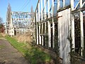
 1950s work shed - geograph.org.uk - 5271627.jpg 640 × 480; 408 KB
-
 1950s workshed window - geograph.org.uk - 5266628.jpg 640 × 581; 456 KB
-
 300Y Josephine - geograph.org.uk - 5332234.jpg 640 × 360; 217 KB
-

-
 A bend on the River Yare - geograph.org.uk - 5332285.jpg 640 × 360; 295 KB
-
 A blustery day on the River Yare - geograph.org.uk - 5332306.jpg 640 × 360; 310 KB
-
 A fishing peg on the River Yare - geograph.org.uk - 5332267.jpg 640 × 360; 293 KB
-
 A former piggery (interior) - geograph.org.uk - 5271608.jpg 640 × 566; 420 KB
-
 A former piggery - geograph.org.uk - 5271607.jpg 640 × 480; 367 KB
-
 A high level water tank - geograph.org.uk - 5265417.jpg 640 × 490; 352 KB
-
 A long hedgerow - geograph.org.uk - 919889.jpg 640 × 442; 112 KB
-
 A small stack of logs - geograph.org.uk - 5332219.jpg 640 × 360; 353 KB
-
 A soggy field entrance - geograph.org.uk - 919916.jpg 480 × 640; 204 KB
-
 A WW2 Morrison Shelter - geograph.org.uk - 5265436.jpg 640 × 480; 342 KB
-

-
 A47 approaching the roadworks - geograph.org.uk - 4364130.jpg 1,024 × 769; 225 KB
-

-
 After the rain - geograph.org.uk - 919913.jpg 480 × 640; 169 KB
-
 Alder growing beside the River Yare - geograph.org.uk - 5332304.jpg 640 × 579; 474 KB
-

-
 Approaching the A47 on Yarmouth Road - geograph.org.uk - 5971785.jpg 800 × 600; 138 KB
-
 Arable crop south of Postwick Lane - geograph.org.uk - 3634677.jpg 1,024 × 768; 159 KB
-
 Arqiva site number 54810 - geograph.org.uk - 5332339.jpg 640 × 360; 312 KB
-
-
 Arqiva transmission mast site (sign) - geograph.org.uk - 5332336.jpg 640 × 360; 326 KB
-
 Arqiva transmission mast site (sign) - geograph.org.uk - 5332343.jpg 640 × 360; 269 KB
-
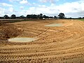
 Balancing Pond, Postwick Park and Ride Extension - geograph.org.uk - 6347260.jpg 4,096 × 3,072; 6.04 MB
-
 Balancing Pond, Postwick Park and Ride Extension - geograph.org.uk - 6347261.jpg 4,096 × 3,072; 4.75 MB
-
 Bare trees growing on field boundary - geograph.org.uk - 1068275.jpg 640 × 454; 126 KB
-
 Barn conversion in Oak's Lane - geograph.org.uk - 6079142.jpg 800 × 588; 182 KB
-
 Barn conversions by Cherry Tree Farm - geograph.org.uk - 3967001.jpg 640 × 480; 166 KB
-
-
 Beneath the Postwick viaduct - geograph.org.uk - 5385357.jpg 471 × 640; 274 KB
-
 Big shed at Cherry Tree Farm - geograph.org.uk - 3967006.jpg 640 × 480; 121 KB
-
 Bins awaiting collection in Ferry Lane - geograph.org.uk - 6079161.jpg 800 × 575; 128 KB
-
 Boats moored by the Ferry House Inn - geograph.org.uk - 5332316.jpg 640 × 360; 250 KB
-
 Bollards at the end of Mill Lane - geograph.org.uk - 1531963.jpg 640 × 480; 87 KB
-
 Bridge over railway line - geograph.org.uk - 1531934.jpg 640 × 480; 66 KB
-

-
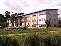
 Broadland Business Park (South) - geograph.org.uk - 5528827.jpg 640 × 477; 277 KB
-
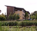
 Broadland Business Park (South) - geograph.org.uk - 5528879.jpg 640 × 480; 286 KB
-
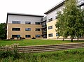
 Broadland Business Park (South) - geograph.org.uk - 5528898.jpg 640 × 480; 308 KB
-
-

-

-
 Broadland Business Park - Lovewell Blake - geograph.org.uk - 5528823.jpg 640 × 476; 304 KB
-
 Broadland Business Park - Lovewell Blake - geograph.org.uk - 5528832.jpg 640 × 480; 305 KB
-
 Broadland Business Park - Old Chapel Way - geograph.org.uk - 5528990.jpg 640 × 474; 250 KB
-
 Broadland Business Park - the lake - geograph.org.uk - 5529007.jpg 640 × 477; 386 KB
-
 Broadland Business Park - the lake - geograph.org.uk - 5529010.jpg 640 × 622; 593 KB
-

-
 Brundall Allotments - geograph.org.uk - 6347235.jpg 4,096 × 3,072; 6.66 MB
-

-
 Business premises in Memorial Way - geograph.org.uk - 4822186.jpg 640 × 360; 250 KB
-
 Business premises in Memorial Way - geograph.org.uk - 4822189.jpg 640 × 360; 278 KB
-

-
 Cemetery in Memorial Way Norwich - geograph.org.uk - 5528891.jpg 3,456 × 2,592; 3.97 MB
-

-

-
 Church Road bridge - geograph.org.uk - 5332119.jpg 640 × 360; 247 KB
-
 Cow parsley beside Witton Lane - geograph.org.uk - 3966991.jpg 640 × 480; 220 KB
-
 Crop field north of Smee Lane - geograph.org.uk - 5262559.jpg 640 × 480; 321 KB
-
 Crop field towards woodland - geograph.org.uk - 4796150.jpg 640 × 419; 49 KB
-
 Crossing the boundary - geograph.org.uk - 1068292.jpg 480 × 640; 153 KB
-
 Cruiser travelling up the River Yare - geograph.org.uk - 5332214.jpg 640 × 417; 241 KB
-
 Cultivated field - geograph.org.uk - 5262564.jpg 640 × 480; 380 KB
-
 Daffodils on the bank of the River Yare - geograph.org.uk - 2319248.jpg 480 × 640; 202 KB
-
 Daffodils on the bank of the River Yare - geograph.org.uk - 2319251.jpg 640 × 480; 200 KB
-
 December sunshine on winter crop - geograph.org.uk - 1068411.jpg 640 × 363; 92 KB
-

-
 Derelict boat by Hall Farm, Postwick - geograph.org.uk - 2319214.jpg 640 × 480; 178 KB
-
-
 Direct Rail diesel locomotive - geograph.org.uk - 5332116.jpg 640 × 360; 382 KB
-
 Disused cemetery in Memorial Way - geograph.org.uk - 5630712.jpg 640 × 543; 480 KB
-
 Disused cemetery in Memorial Way - geograph.org.uk - 5630734.jpg 640 × 471; 343 KB
-
 Ditch by Hall Farm, Postwick - geograph.org.uk - 2319217.jpg 480 × 640; 189 KB
-
 Door into greenhouse ^4 - geograph.org.uk - 5266631.jpg 487 × 640; 404 KB
-
 Dwelling by St Margaret's church - geograph.org.uk - 3966993.jpg 640 × 480; 158 KB
-
 Dwellings at Cherry Tree Farm - geograph.org.uk - 3967002.jpg 640 × 451; 148 KB
-
 D^F McCarthy Ltd in Memorial Way - geograph.org.uk - 4822188.jpg 640 × 360; 260 KB
-
 D^F McCarthy Ltd in Memorial Way - geograph.org.uk - 4822191.jpg 640 × 360; 258 KB
-
 D^F McCarthy Ltd in Memorial Way - geograph.org.uk - 4822192.jpg 640 × 360; 234 KB
-
 Early 20th century greenhouse (interior) - geograph.org.uk - 5266430.jpg 640 × 480; 418 KB
-
 Early 20th century greenhouse - geograph.org.uk - 5266425.jpg 640 × 480; 351 KB
-
 Entrance to the Shell Garage - geograph.org.uk - 3488302.jpg 3,072 × 2,304; 1.25 MB
-
 Farm Building - geograph.org.uk - 1809928.jpg 1,600 × 1,200; 693 KB
-
 Farmland north-west of Postwick - geograph.org.uk - 3634638.jpg 1,024 × 768; 110 KB
-
 Farmland with Swiss roll straw bales - geograph.org.uk - 3634631.jpg 1,024 × 768; 119 KB
-
 Farmland, Postwick - geograph.org.uk - 4792100.jpg 640 × 418; 35 KB
-
 Fenced in - geograph.org.uk - 6079150.jpg 800 × 583; 154 KB
-
 Ferry Lane Wood (sign) - geograph.org.uk - 5332139.jpg 640 × 360; 435 KB
-
 Ferry Lane Wood - geograph.org.uk - 5332141.jpg 640 × 360; 408 KB
-
 Field at Apple Tree Farm - geograph.org.uk - 3134137.jpg 640 × 480; 127 KB
-
 Field between Yarmouth Road and the A47 - geograph.org.uk - 5971775.jpg 800 × 600; 105 KB
-
 Field Cottages - geograph.org.uk - 3753928.jpg 640 × 480; 148 KB
-
 Field Cottages seen from the field - geograph.org.uk - 3753931.jpg 640 × 480; 165 KB
-
 Field entrance on Ferry Lane - geograph.org.uk - 3753920.jpg 640 × 480; 135 KB
-
 Field gate beside Witton Lane - geograph.org.uk - 916491.jpg 480 × 640; 124 KB
-
 Flat farmland near Postwick - geograph.org.uk - 4796151.jpg 640 × 430; 40 KB
-
 Flooding, Postwick Marshes - geograph.org.uk - 3777061.jpg 1,600 × 1,074; 393 KB
-

-
-
 Footpath at The Wilderness - geograph.org.uk - 6079147.jpg 800 × 524; 138 KB
-

-

-

-

-
 Former engineering workshop - geograph.org.uk - 5266606.jpg 640 × 480; 380 KB
-
 Former staff toilet block - geograph.org.uk - 5266607.jpg 640 × 480; 433 KB
-
 Gap in a boundary hedge - geograph.org.uk - 5630737.jpg 530 × 640; 498 KB
-
 Gate into a private wood - geograph.org.uk - 5332129.jpg 640 × 360; 356 KB
-

-
 Gate on a path beside the River Yare - geograph.org.uk - 5332241.jpg 640 × 360; 318 KB
-
-
 Gate onto Ferry Lane at Surlingham Ferry - geograph.org.uk - 5332312.jpg 640 × 360; 345 KB
-
 Glass top of a 1950s boiler house - geograph.org.uk - 5271659.jpg 640 × 480; 486 KB
-
 GoGoHares - Kicks - geograph.org.uk - 5822118.jpg 640 × 558; 87 KB
-
 GoGoHares - Kicks - geograph.org.uk - 5822120.jpg 565 × 640; 85 KB
-
 Graves in disused cemetery - geograph.org.uk - 5630718.jpg 640 × 480; 399 KB
-
 Grazing by the River Yare - geograph.org.uk - 2319226.jpg 640 × 557; 180 KB
-
 Greenhouse windows ventilation regulator - geograph.org.uk - 5266634.jpg 640 × 573; 622 KB
-

-
 Here comes the ferryman - geograph.org.uk - 5332198.jpg 640 × 379; 301 KB
-
 Here ends the water ski area - geograph.org.uk - 2319221.jpg 640 × 480; 123 KB
-
 House in Ferry Lane - geograph.org.uk - 6079163.jpg 800 × 600; 163 KB
-
 House in Mill Lane - geograph.org.uk - 1531957.jpg 640 × 480; 105 KB
-
 House in Mill Lane - geograph.org.uk - 1531971.jpg 640 × 506; 99 KB
-
 Houses in Ferry Lane - geograph.org.uk - 6079155.jpg 800 × 570; 123 KB
-
 Houses in Oak's Lane - geograph.org.uk - 6079133.jpg 800 × 577; 148 KB
-
 Houses in Oak's Lane - geograph.org.uk - 6079140.jpg 800 × 570; 145 KB
-

-

-
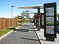
 Information boards for the workers - geograph.org.uk - 5046509.jpg 640 × 373; 285 KB
-
 Information for the men who work here - geograph.org.uk - 5046513.jpg 640 × 402; 278 KB
-
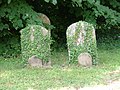 Ivy covered gravestones - geograph.org.uk - 3134041.jpg 640 × 480; 126 KB
-

-
 Lake on the Broadland Business Park - geograph.org.uk - 5528925.jpg 3,456 × 2,592; 3.7 MB
-
-
 Little Chef becomes McDonald's - geograph.org.uk - 3440076.jpg 640 × 418; 126 KB
-
-
-
 Mallard duck - geograph.org.uk - 5528957.jpg 3,456 × 2,592; 3.83 MB
-
 Mature willow tree beside the River Yare - geograph.org.uk - 5332272.jpg 640 × 360; 363 KB
-
-
 Memorial in disused cemetery - geograph.org.uk - 5630720.jpg 640 × 480; 375 KB
-
 Memorial in disused cemetery - geograph.org.uk - 5630721.jpg 640 × 566; 463 KB
-
 Memorial in disused cemetery - geograph.org.uk - 5630722.jpg 640 × 478; 385 KB
-
 Memorial in disused cemetery - geograph.org.uk - 5630742.jpg 640 × 584; 527 KB
-
 Memorial in Memorial Way - geograph.org.uk - 5528897.jpg 3,456 × 2,592; 3.94 MB
-
 Memorial in Memorial Way - geograph.org.uk - 5528900.jpg 3,456 × 2,592; 3.95 MB
-
 Mill Lane - geograph.org.uk - 1531955.jpg 640 × 455; 83 KB
-
 Modern greenhouses - geograph.org.uk - 5266437.jpg 640 × 480; 359 KB
-
-
 Nearing Norwich - geograph.org.uk - 1412661.jpg 480 × 640; 76 KB
-
 Nuts, whole hazelnuts.... - geograph.org.uk - 5528972.jpg 3,456 × 2,592; 3.77 MB
-
 Oak trees on the cemetery boundary - geograph.org.uk - 5630733.jpg 640 × 480; 383 KB
-

-
 Offices at the Broadland Business Park - geograph.org.uk - 5528915.jpg 640 × 480; 285 KB
-
 Oilseed rape crop by Appletree Farm - geograph.org.uk - 5262611.jpg 640 × 480; 354 KB
-
 Old and new - geograph.org.uk - 919884.jpg 480 × 640; 136 KB
-
 Old Farm Buildings - geograph.org.uk - 1809926.jpg 1,600 × 1,200; 445 KB
-

-
 On the edge of Ferry Lane Wood - geograph.org.uk - 5332185.jpg 640 × 360; 372 KB
-
 Ordnance Survey 1GL Bolt - geograph.org.uk - 4216480.jpg 640 × 480; 103 KB
-
 Path along the River Yare - geograph.org.uk - 5332260.jpg 640 × 360; 296 KB
-

-

-
 Path from Smee Lane to the A47 - geograph.org.uk - 1068141.jpg 640 × 480; 152 KB
-

-
 Path past boilerhouse and workshed - geograph.org.uk - 5271632.jpg 640 × 480; 426 KB
-
 Path to fishing pegs - geograph.org.uk - 5332265.jpg 640 × 360; 291 KB
-
 Paved path traversing disused cemetery - geograph.org.uk - 5630714.jpg 640 × 480; 398 KB
-
 Plank bridge over a drainage ditch - geograph.org.uk - 5332218.jpg 640 × 360; 368 KB


_-_geograph.org.uk_-_5271610.jpg)

_-_geograph.org.uk_-_5271652.jpg)


_-_geograph.org.uk_-_5266451.jpg)
_-_geograph.org.uk_-_5266461.jpg)


_-_geograph.org.uk_-_5271608.jpg)


_-_geograph.org.uk_-_5527436.jpg)
_-_geograph.org.uk_-_5528827.jpg)
_-_geograph.org.uk_-_5528879.jpg)
_-_geograph.org.uk_-_5528898.jpg)


_-_geograph.org.uk_-_5266430.jpg)


_-_geograph.org.uk_-_5332139.jpg)


_-_geograph.org.uk_-_5190345.jpg)


_-_geograph.org.uk_-_5630723.jpg)


_-_geograph.org.uk_-_5528836.jpg)


_-_geograph.org.uk_-_5332336.jpg)
_-_geograph.org.uk_-_5332343.jpg)