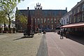
Category:Postkantoor Arnhem
Jump to navigation
Jump to search
| Object location | | View all coordinates using: OpenStreetMap |
|---|
 | |||||
| Upload media | |||||
| Instance of | |||||
|---|---|---|---|---|---|
| Location | Arnhem, Gelderland, Netherlands | ||||
| Street address |
| ||||
| Heritage designation |
| ||||
 | |||||
|
This is a category about rijksmonument number 8330
|
| Address |
|
Media in category "Postkantoor Arnhem"
The following 95 files are in this category, out of 95 total.
-
 Arnhem - Jansplein 56 - 1.jpg 1,944 × 2,592; 1.38 MB
-
 Arnhem - Jansplein 56 - 2.jpg 2,592 × 1,944; 1.55 MB
-
 Arnhem - Voormalig postkantoor 2.JPG 4,608 × 3,456; 4.65 MB
-
 Arnhem - Voormalig postkantoor.JPG 4,608 × 3,456; 5.17 MB
-
 Arnhem centrum P1060376.JPG 2,448 × 3,264; 3.56 MB
-
 Arnhem centrum P1060377.JPG 2,448 × 3,264; 3.48 MB
-
 Arnhem hoofdpostkantoor 1880 Architect Cornelis Hendrik Peters neogotiek renaissance.jpg 6,016 × 4,000; 11.32 MB
-
 Arnhem Jansplaats with lots of nice facades and terraces - panoramio.jpg 4,928 × 3,264; 6.54 MB
-
 Arnhem P1060374.JPG 3,264 × 2,448; 3.69 MB
-
 Arnhem P1060433.JPG 3,264 × 2,448; 3.75 MB
-
 Detail Postkantoor Arnhem P1060384.JPG 2,448 × 3,264; 3.62 MB
-
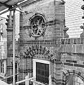
 Exterieur GEDEELTE VAN DE ZUIDGEVEL (BINNENPLAATS) - Arnhem - 20302274 - RCE.jpg 1,200 × 1,200; 289 KB
-
 Exterieur GEDEELTE VAN DE ZUIDGEVEL (BINNENPLAATS) - Arnhem - 20302275 - RCE.jpg 1,195 × 1,200; 362 KB
-
 Exterieur GEDEELTE VAN DE ZUIDGEVEL (BINNENPLAATS) - Arnhem - 20302276 - RCE.jpg 1,192 × 1,200; 330 KB
-
 Exterieur LINKER ZIJGEVEL, DETAIL VAN DE GEVELTOP - Arnhem - 20302293 - RCE.jpg 1,190 × 1,200; 331 KB
-
 Exterieur LINKER ZIJGEVEL, FRAGMENT VAN DE GEVELTOP - Arnhem - 20302280 - RCE.jpg 1,192 × 1,200; 330 KB
-
 Exterieur LINKER ZIJGEVEL, FRAGMENT VAN DE GEVELTOP - Arnhem - 20302286 - RCE.jpg 1,200 × 1,197; 312 KB
-
 Exterieur LINKER ZIJGEVEL, GEDEELTE VAN DE GEVELTOP - Arnhem - 20302284 - RCE.jpg 1,197 × 1,200; 330 KB
-
 Exterieur LINKER ZIJGEVEL, GEDEELTE VAN DE GEVELTOP - Arnhem - 20302289 - RCE.jpg 1,200 × 1,200; 352 KB
-
 Exterieur LINKER ZIJGEVEL, GEDEELTE VAN DE GEVELTOP - Arnhem - 20302290 - RCE.jpg 1,195 × 1,200; 330 KB
-
 Exterieur LINKER ZIJGEVEL, GEDEELTE VAN DE GEVELTOP - Arnhem - 20302291 - RCE.jpg 1,197 × 1,200; 318 KB
-
 Exterieur LINKER ZIJGEVEL, GEDEELTE VAN DE GEVELTOP - Arnhem - 20302296 - RCE.jpg 1,192 × 1,200; 356 KB
-
 Exterieur LINKER ZIJGEVEL, GEDEELTE VAN DE GEVELTOP, DAK - Arnhem - 20302287 - RCE.jpg 1,183 × 1,200; 288 KB
-
 Exterieur LINKER ZIJGEVEL, GEVELTOP - Arnhem - 20302281 - RCE.jpg 1,192 × 1,200; 330 KB
-
 Exterieur LINKER ZIJGEVEL, GEVELTOP, DETAIL - Arnhem - 20302295 - RCE.jpg 1,200 × 1,197; 349 KB
-
 Exterieur LINKER ZIJGEVEL, GEVELTOP, DICHTGEZET VENSTER - Arnhem - 20302278 - RCE.jpg 1,200 × 1,188; 327 KB
-
 Exterieur LINKER ZIJGEVEL, GEVELTOP, DICHTGEZET VENSTER - Arnhem - 20302279 - RCE.jpg 1,195 × 1,200; 334 KB
-
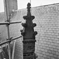
 Exterieur LINKER ZIJGEVEL, PINAKEL - Arnhem - 20302277 - RCE.jpg 1,193 × 1,200; 291 KB
-
 Exterieur LINKER ZIJGEVEL, PINAKEL - Arnhem - 20302294 - RCE.jpg 1,200 × 1,195; 323 KB
-
 Exterieur LINKER ZIJGEVEL, PINAKEL VAN DE GEVELTOP - Arnhem - 20302292 - RCE.jpg 1,190 × 1,200; 367 KB
-
 Exterieur LINKER ZIJGEVEL, PINAKEL, DAK VAN DE GEVELTOP - Arnhem - 20302285 - RCE.jpg 1,195 × 1,200; 263 KB
-
 Exterieur LINKER ZIJGEVEL, PINAKELS - Arnhem - 20302282 - RCE.jpg 1,190 × 1,200; 278 KB
-
 Exterieur LINKER ZIJGEVEL, PINAKELS - Arnhem - 20302283 - RCE.jpg 1,192 × 1,200; 275 KB
-
 Exterieur LINKER ZIJGEVEL, PINAKELS - Arnhem - 20302288 - RCE.jpg 1,192 × 1,200; 267 KB
-
 Exterieur VOORGEVEL, BEELD (LEEUW MET WAPENSCHILD) - Arnhem - 20302305 - RCE.jpg 1,188 × 1,200; 166 KB
-
 Exterieur VOORGEVEL, DETAIL VAN DE GEVELTOP - Arnhem - 20302322 - RCE.jpg 1,200 × 1,200; 345 KB
-
 Exterieur VOORGEVEL, FRAGMENT VAN DE GEVELTOP - Arnhem - 20302321 - RCE.jpg 1,197 × 1,200; 374 KB
-

-
 Exterieur VOORGEVEL, GEDEELTE VAN DE GEVELTOP - Arnhem - 20302301 - RCE.jpg 1,200 × 1,192; 346 KB
-
 Exterieur VOORGEVEL, GEDEELTE VAN DE GEVELTOP - Arnhem - 20302303 - RCE.jpg 1,195 × 1,200; 373 KB
-
 Exterieur VOORGEVEL, GEDEELTE VAN DE GEVELTOP - Arnhem - 20302310 - RCE.jpg 1,197 × 1,200; 307 KB
-
 Exterieur VOORGEVEL, GEDEELTE VAN DE GEVELTOP - Arnhem - 20302314 - RCE.jpg 1,200 × 1,195; 351 KB
-
 Exterieur VOORGEVEL, GEDEELTE VAN DE GEVELTOP - Arnhem - 20302316 - RCE.jpg 1,190 × 1,200; 341 KB
-
 Exterieur VOORGEVEL, GEDEELTE VAN DE GEVELTOP - Arnhem - 20302323 - RCE.jpg 1,198 × 1,200; 321 KB
-
 Exterieur VOORGEVEL, GEDEELTE VAN DE GEVELTOP - Arnhem - 20302324 - RCE.jpg 1,188 × 1,200; 291 KB
-
 Exterieur VOORGEVEL, GEDEELTE VAN DE GEVELTOP - Arnhem - 20302325 - RCE.jpg 1,190 × 1,200; 335 KB
-
 Exterieur VOORGEVEL, GEDEELTE VAN DE GEVELTOP - Arnhem - 20302328 - RCE.jpg 1,200 × 1,192; 350 KB
-
 Exterieur VOORGEVEL, GEDEELTE VAN DE GEVELTOP - Arnhem - 20302329 - RCE.jpg 1,190 × 1,200; 317 KB
-
 Exterieur VOORGEVEL, GEDEELTE VAN DE GEVELTOP - Arnhem - 20302330 - RCE.jpg 1,197 × 1,200; 309 KB
-
 Exterieur VOORGEVEL, GEDEELTE VAN DE GEVELTOP - Arnhem - 20302331 - RCE.jpg 1,188 × 1,200; 321 KB
-
 Exterieur VOORGEVEL, GEDEELTE VAN DE GEVELTOP - Arnhem - 20302334 - RCE.jpg 1,185 × 1,200; 318 KB
-
 Exterieur VOORGEVEL, GEVELTOP, DETAIL - Arnhem - 20302302 - RCE.jpg 1,200 × 1,190; 347 KB
-
 Exterieur VOORGEVEL, GEVELTOP, DETAIL - Arnhem - 20302304 - RCE.jpg 1,200 × 1,195; 324 KB
-
 Exterieur VOORGEVEL, GEVELTOP, DETAIL - Arnhem - 20302317 - RCE.jpg 1,197 × 1,200; 347 KB
-
 Exterieur VOORGEVEL, GEVELTOP, DETAIL - Arnhem - 20302318 - RCE.jpg 1,190 × 1,200; 319 KB
-
 Exterieur VOORGEVEL, GEVELTOP, DETAIL - Arnhem - 20302319 - RCE.jpg 1,195 × 1,200; 305 KB
-
 Exterieur VOORGEVEL, GEVELTOP, DETAIL - Arnhem - 20302320 - RCE.jpg 1,185 × 1,200; 352 KB
-
 Exterieur VOORGEVEL, GEVELTOP, DICHTGEZET VENSTER - Arnhem - 20302299 - RCE.jpg 1,200 × 1,200; 362 KB
-
 Exterieur VOORGEVEL, GEVELTOP, PINAKEL - Arnhem - 20302312 - RCE.jpg 1,200 × 1,200; 223 KB
-
 Exterieur VOORGEVEL, GEVELTOP, PINAKELS - Arnhem - 20302326 - RCE.jpg 1,200 × 1,192; 254 KB
-
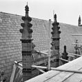
 Exterieur VOORGEVEL, OVERZICHT DAK, PINAKELS - Arnhem - 20302313 - RCE.jpg 1,188 × 1,200; 260 KB
-
 Exterieur VOORGEVEL, OVERZICHT PINAKEL - Arnhem - 20302307 - RCE.jpg 1,200 × 1,188; 229 KB
-
 Exterieur VOORGEVEL, OVERZICHT PINAKELS - Arnhem - 20302335 - RCE.jpg 1,195 × 1,200; 186 KB
-
 Exterieur VOORGEVEL, PINAKEL - Arnhem - 20302298 - RCE.jpg 1,200 × 1,200; 284 KB
-
 Exterieur VOORGEVEL, PINAKEL - Arnhem - 20302306 - RCE.jpg 1,195 × 1,200; 207 KB
-
 Exterieur VOORGEVEL, PINAKEL - Arnhem - 20302311 - RCE.jpg 1,192 × 1,200; 234 KB
-
 Exterieur VOORGEVEL, PINAKEL - Arnhem - 20302315 - RCE.jpg 1,200 × 1,200; 244 KB
-
 Exterieur VOORGEVEL, PINAKEL - Arnhem - 20302333 - RCE.jpg 1,200 × 1,200; 265 KB
-
 Exterieur VOORGEVEL, PINAKEL - Arnhem - 20302336 - RCE.jpg 1,178 × 1,200; 260 KB
-
 Exterieur VOORGEVEL, PINAKEL NAAST DE GEVELTOP - Arnhem - 20302300 - RCE.jpg 1,200 × 1,195; 294 KB
-
 Exterieur VOORGEVEL, PINAKELS - Arnhem - 20302297 - RCE.jpg 1,197 × 1,200; 288 KB
-
 Exterieur VOORGEVEL, PINAKELS - Arnhem - 20302308 - RCE.jpg 1,195 × 1,200; 251 KB
-
 Exterieur VOORGEVEL, PINAKELS - Arnhem - 20302327 - RCE.jpg 1,192 × 1,200; 263 KB
-
 Exterieur VOORGEVEL, PINAKELS - Arnhem - 20302332 - RCE.jpg 1,197 × 1,200; 248 KB
-
 Exterieur ZUIDGEVEL (BINNENPLAATS), OVERZICHT PINAKELS - Arnhem - 20302272 - RCE.jpg 1,185 × 1,200; 302 KB
-
 Exterieur ZUIDGEVEL (BINNENPLAATS), PINAKELS - Arnhem - 20302273 - RCE.jpg 1,185 × 1,200; 241 KB
-

-
 Jansplein 56, postkantoor, voorgevel - Arnhem - 20025387 - RCE.jpg 959 × 1,200; 217 KB
-
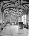 Lokethal - Arnhem - 20025010 - RCE.jpg 957 × 1,200; 187 KB
-
 Lokethal - Arnhem - 20025011 - RCE.jpg 941 × 1,200; 219 KB
-
 Original Postoffice anno 1888 Arnhem, now in use as a bookshop - panoramio.jpg 4,928 × 3,264; 5.19 MB
-
 Overzicht Hoofdpostkantoor - Arnhem - 20357590 - RCE.jpg 1,169 × 1,200; 443 KB
-
 Overzicht ingangspartij, Hoofdpostkantoor - Arnhem - 20357591 - RCE.jpg 1,181 × 1,200; 386 KB
-
 Polare Arnhem Gesloten 2.jpg 3,264 × 2,448; 1.97 MB
-
 Polare Arnhem Gesloten 3.jpg 3,264 × 2,448; 1.75 MB
-
 Polare Arnhem Gesloten 4.jpg 2,448 × 3,264; 1.44 MB
-
 Polare Arnhem Gesloten 5.jpg 3,264 × 2,448; 2.21 MB
-
 Polare Arnhem Gesloten 6.jpg 3,264 × 2,448; 2.49 MB
-
 Polare Arnhem Gesloten.jpg 2,448 × 3,264; 1.3 MB
-
 Postkantoor Arnhem P1060378.JPG 3,264 × 2,448; 3.77 MB
-
 Postkantoor Arnhem P1060380.JPG 3,264 × 2,448; 3.81 MB
-
 Postkantoor Arnhem P1060383.JPG 2,448 × 3,264; 3.73 MB
-
 Rijnstraat, 6811 Arnhem, Netherlands - panoramio.jpg 4,896 × 3,264; 3.05 MB
-

-
 Winterwalk at 11 Januari 2013 in Arnhem, building details - panoramio.jpg 5,375 × 4,499; 5.75 MB


_-_Arnhem_-_20302274_-_RCE.jpg)
_-_Arnhem_-_20302275_-_RCE.jpg)
_-_Arnhem_-_20302276_-_RCE.jpg)


_-_Arnhem_-_20302305_-_RCE.jpg)


_-_Arnhem_-_20302309_-_RCE.jpg)


,_OVERZICHT_PINAKELS_-_Arnhem_-_20302272_-_RCE.jpg)
,_PINAKELS_-_Arnhem_-_20302273_-_RCE.jpg)
_in_a_,_Neo_Gotic_style_in_the_eveningsunshine_of_14_April_2013_-_panoramio.jpg)


_Postoffice_in_Arnhem_center_in_a_neo_Gotic_style_._Now_a_bookshop,_but_still_a_National_architectural_Monument_-_panoramio.jpg)
