Category:Postcode maps covering the East Midlands
Jump to navigation
Jump to search
Media in category "Postcode maps covering the East Midlands"
The following 12 files are in this category, out of 12 total.
-
 CV postcode area map.svg 700 × 1,000; 867 KB
-
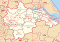
 DE postcode area map.svg 700 × 1,000; 633 KB
-
 DN postcode area map.svg 1,000 × 700; 940 KB
-
 DN postcode map.png 1,136 × 717; 36 KB
-
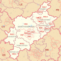
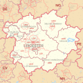 LE postcode area map.svg 1,000 × 1,000; 734 KB
-
 LN postcode area map.svg 1,000 × 1,000; 480 KB
-
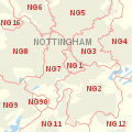 NG postcode area inset map.svg 500 × 500; 62 KB
-
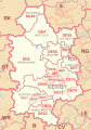
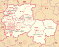 NG postcode area map.svg 1,000 × 800; 722 KB
-
 NN postcode area map.svg 1,000 × 1,000; 701 KB
-
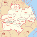
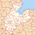 PE postcode area map.svg 1,000 × 1,000; 1.42 MB
-
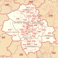 S postcode area map.svg 1,000 × 1,000; 664 KB
-
 SK postcode area map.svg 1,000 × 1,000; 649 KB


