Category:Postcode maps covering South East England
Jump to navigation
Jump to search
Media in category "Postcode maps covering South East England"
The following 28 files are in this category, out of 28 total.
-
 BN postcode area inset map.svg 500 × 500; 45 KB
-
 BN postcode area map.svg 1,000 × 500; 393 KB
-
 BR postcode area map.svg 1,000 × 700; 235 KB
-
 CR postcode area map.svg 1,000 × 1,000; 346 KB
-
 CT postcode area map.svg 1,000 × 1,000; 245 KB
-
 CT Postcodes.png 256 × 256; 8 KB
-
 DA postcode area map.svg 1,000 × 1,000; 389 KB
-
 GU postcode area map.svg 1,000 × 1,000; 1.04 MB
-
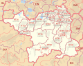
 HP postcode area map.svg 1,000 × 800; 626 KB
-
 KT postcode area map.svg 1,000 × 800; 559 KB
-
 ME postcode area map.svg 1,000 × 800; 422 KB
-
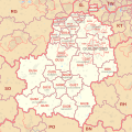
 MK postcode area map.svg 1,000 × 1,000; 557 KB
-
 OX postcode area map.svg 1,000 × 1,000; 908 KB
-
 OX-postcode area.png 256 × 256; 16 KB
-
 PO postcode area map.svg 1,000 × 700; 510 KB
-
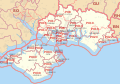
 PO-Postcodes.png 817 × 510; 162 KB
-
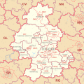
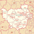 RG postcode area map.svg 1,000 × 1,000; 863 KB
-
 RH postcode area map.svg 1,000 × 1,000; 623 KB
-
 SL postcode area map.svg 1,000 × 1,000; 408 KB
-
 SM postcode area map.svg 800 × 1,000; 267 KB
-
 SM1 3-SM1 4.png 413 × 250; 22 KB
-
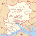 SO postcode area map.svg 1,000 × 1,000; 613 KB
-
 SO-Postcodes.png 529 × 629; 184 KB
-
 TN postcode area map.svg 1,000 × 1,000; 1.4 MB
-
 TW postcode area map.svg 800 × 480; 353 KB
-
 UB postcode area map.svg 1,000 × 1,000; 333 KB
-
 WD postcode area map.svg 1,000 × 700; 234 KB
-
 WD Postcode Map.jpg 6,840 × 4,498; 837 KB


