Category:Portolan charts by Willem and Johannes Blaeu
Jump to navigation
Jump to search
â
Media in category "Portolan charts by Willem and Johannes Blaeu"
The following 15 files are in this category, out of 15 total.
-
 1620 0 Europa Blaeu Rare.jpg 2,465 × 2,000; 5.33 MB
-
 1624 Zuijderdeel vd Belt Blaeu Rare.jpg 1,603 × 1,230; 2.32 MB
-
 1628 8 West Indische Blaeu.jpg 3,300 × 2,668; 2.91 MB
-
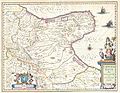 1630 Blaeu Map of Capitanata ( Foggia ), Italy - Geographicus - Capitanata-blaeu-1630.jpg 4,500 × 3,478; 3.61 MB
-
 1635 49 Zeel Com Blaeu crop.jpg 8,922 × 6,560; 29.59 MB
-
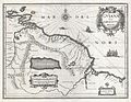 1635 Blaeu Map Guiana, Venezuela, and El Dorado - Geographicus - Guiana-blaeu-1635.jpg 4,000 × 3,084; 3.51 MB
-
 1685 9 Sumatra Blaeu ms Gallica.jpg 4,963 × 5,900; 7.43 MB
-
 4' 1608 Com Hollandia Blaeu HR.jpg 7,609 × 5,843; 31.12 MB
-
 AMH-5523-NA Map of Sumatra and the Malacca Straits.jpg 2,149 × 2,400; 929 KB
-
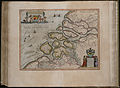
 Frisia Occidentalis Blaeu 1630.jpg 3,603 × 3,008; 5.84 MB
-
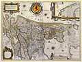 Willem Blaeu - Hollandia Comitatus.jpg 2,126 × 1,605; 3.5 MB
-
 Joan Blaeu, Atlas Maior - Venedig.png 700 × 600; 675 KB
-
 Map of Hven from copper etching of Blaeu Atlas 1663.jpg 6,304 × 4,939; 19.49 MB
-
 Nuevo Atlas o Teatro Mundo - Regiones Sub Polo Arctico.jpg 6,160 × 5,120; 4.26 MB
-
 Pascaarte van alle de Zee-custen van Europa de Willem, Pieter e Joan Blaeu (1677).jpg 10,742 × 8,668; 75.29 MB


,_Italy_-_Geographicus_-_Capitanata-blaeu-1630.jpg)


.jpg)