Category:Porthcawl
Jump to navigation
Jump to search
town in the county borough of Bridgend, Wales, UK _-_geograph.org.uk_-_1490500.jpg)  | |||||
| Upload media | |||||
| Instance of | |||||
|---|---|---|---|---|---|
| Location | Bridgend County Borough, Wales | ||||
| Population |
| ||||
| Area |
| ||||
| official website | |||||
 | |||||
Subcategories
This category has the following 13 subcategories, out of 13 total.
*
1
- Porthcawl in the 1900s (21 F)
B
C
- Coney Beach Amusement Park (5 F)
H
- Porthcawl Harbour (15 F)
J
- John Street, Porthcawl (20 F)
N
R
- Royal Porthcawl Golf Club (11 F)
S
T
- Transport in Porthcawl (7 F)
W
- Wig Fach (8 F)
Media in category "Porthcawl"
The following 200 files are in this category, out of 1,295 total.
(previous page) (next page)-
 -StormFrank brings angry seas- Porthcawl, south Wales, UK (23981662081).jpg 3,888 × 2,592; 3.16 MB
-
 19 Mary Street restaurant, Porthcawl - geograph.org.uk - 5296867.jpg 800 × 600; 111 KB
-
 2013 Porthcawl Harbour Works - geograph.org.uk - 3332265.jpg 2,592 × 1,944; 1.22 MB
-
 2013 Porthcawl Harbour Works - geograph.org.uk - 3332291.jpg 2,592 × 1,944; 1.22 MB
-
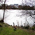
 24 Geese - geograph.org.uk - 4690894.jpg 2,244 × 1,656; 2.36 MB
-
 50 on Bridgend Road, Porthcawl - geograph.org.uk - 5250430.jpg 800 × 568; 117 KB
-

-
 A back lane in Porthcawl - geograph.org.uk - 5296302.jpg 800 × 800; 129 KB
-
 A bench with a view - geograph.org.uk - 6746353.jpg 2,048 × 1,536; 579 KB
-
 A busy Rest Bay car park on a glorious July day - geograph.org.uk - 3052487.jpg 4,752 × 3,168; 3.18 MB
-
 A farewell to St John's - geograph.org.uk - 5919310.jpg 3,264 × 2,448; 1.13 MB
-
 A late afternoon paddle near Hutchwns Point - geograph.org.uk - 3566142.jpg 4,000 × 3,000; 3.5 MB
-
 A straight section of Zig-zag Lane - geograph.org.uk - 4440953.jpg 481 × 640; 185 KB
-
 A study in fives and tens - geograph.org.uk - 6791933.jpg 1,280 × 720; 203 KB
-

-
 A view across Meadow Lake, Porthcawl - geograph.org.uk - 4227388.jpg 800 × 585; 286 KB
-

-

-
 A view from Tyn-y-caeau Lane - geograph.org.uk - 4649448.jpg 640 × 480; 187 KB
-

-
 A view north from Newton Burrows - geograph.org.uk - 6472189.jpg 800 × 734; 181 KB
-
 A view north from Tyn-y-caeau Lane - geograph.org.uk - 4646897.jpg 640 × 459; 178 KB
-
 A view of Newton Down - geograph.org.uk - 4841686.jpg 640 × 457; 174 KB
-
 A view over farmland to Pant yr Hyl - geograph.org.uk - 4435152.jpg 640 × 428; 70 KB
-
 A view over the Sandy Bowl, Porthcawl - geograph.org.uk - 6570223.jpg 1,024 × 768; 193 KB
-
 A view south from near Sker Point - geograph.org.uk - 3063569.jpg 800 × 362; 265 KB
-
 A view towards Newton Nottage Road - geograph.org.uk - 4652304.jpg 640 × 429; 177 KB
-
 A view towards Nottage - geograph.org.uk - 4225142.jpg 640 × 416; 80 KB
-
 A view towards Wig Fach - geograph.org.uk - 2936076.jpg 640 × 414; 170 KB
-

-
 Above Black Rocks beach - geograph.org.uk - 3565941.jpg 3,922 × 2,897; 4.23 MB
-
 Above Black Rocks beach looking towards Porthcawl - geograph.org.uk - 3565945.jpg 4,000 × 3,000; 3.16 MB
-
 Access road to New Road Court, Porthcawl - geograph.org.uk - 5145949.jpg 800 × 646; 137 KB
-
-
 Acer palmatum - geograph.org.uk - 6659141.jpg 4,032 × 3,024; 5.51 MB
-
 Acute angling - geograph.org.uk - 6392670.jpg 1,453 × 1,090; 547 KB
-
 Admiralty Chart No 1161 Plans on the South Coast of Wales, Published 1951.jpg 11,108 × 16,237; 71.79 MB
-

-

-
 Aldenham Road houses, Porthcawl - geograph.org.uk - 5062043.jpg 800 × 709; 115 KB
-
 Aldenham Road, Porthcawl - geograph.org.uk - 5145985.jpg 800 × 537; 113 KB
-
 All Saints Church, Porthcawl - geograph.org.uk - 5868578.jpg 4,320 × 3,240; 2.89 MB
-
 Allotments and St John’s Church - geograph.org.uk - 6788520.jpg 1,536 × 2,048; 1.5 MB
-
 Amateur champion.jpg 2,988 × 5,312; 7.3 MB
-
 Ancient woodland by Nottage - geograph.org.uk - 4167866.jpg 588 × 640; 196 KB
-

-

-

-
 Anglesey Way Porthcawl - geograph.org.uk - 5316564.jpg 800 × 595; 98 KB
-

-
 Antique Plough - geograph.org.uk - 4802237.jpg 2,448 × 3,264; 1.46 MB
-

-
 Arlington Road - South Road - geograph.org.uk - 6200231.jpg 1,024 × 768; 140 KB
-
 Austin Avenue semis, Newton, Porthcawl - geograph.org.uk - 5146221.jpg 800 × 596; 122 KB
-
 Austin Avenue, Newton, Porthcawl - geograph.org.uk - 5146014.jpg 800 × 471; 91 KB
-
 Awaiting demolition - geograph.org.uk - 6761359.jpg 2,048 × 1,536; 1.53 MB
-

-
 A^C Interiors, Porthcawl - geograph.org.uk - 4999924.jpg 800 × 640; 122 KB
-

-

-
 Bae Trecco Bay - geograph.org.uk - 4637535.jpg 640 × 480; 79 KB
-

-
 Balkwill Chemist, Porthcawl - geograph.org.uk - 5314163.jpg 685 × 800; 99 KB
-

-
 Bardsey Close, Nottage, Porthcawl - geograph.org.uk - 5320325.jpg 800 × 552; 106 KB
-
 Bargain Booze in Porthcawl - geograph.org.uk - 5296820.jpg 787 × 800; 134 KB
-
 Bargain Booze lorry in Newton, Porthcawl - geograph.org.uk - 4976091.jpg 800 × 600; 106 KB
-
 BATHING DANGEROUS notice, Porthcawl - geograph.org.uk - 5303545.jpg 800 × 600; 103 KB
-
 Bayview Coffee Shop, Porthcawl (geograph 6353609).jpg 1,600 × 1,550; 452 KB
-
 Beach art - geograph.org.uk - 6434140.jpg 3,165 × 1,904; 2.65 MB
-
 Beach Road - geograph.org.uk - 2222376.jpg 640 × 480; 51 KB
-
 Beach Road in Newton looking north - geograph.org.uk - 3052470.jpg 4,752 × 3,168; 3.04 MB
-

-
 Bell tower - geograph.org.uk - 6745841.jpg 1,536 × 2,048; 1.23 MB
-

-
 Bench beside Zig-zag Lane - geograph.org.uk - 4445278.jpg 640 × 480; 189 KB
-
 Bench by Tyn-y-caeau Lane - geograph.org.uk - 4430298.jpg 640 × 450; 166 KB
-
 Bend in West Drive, Porthcawl - geograph.org.uk - 5305028.jpg 800 × 530; 78 KB
-

-

-

-

-
 Bird’s nest - geograph.org.uk - 6373340.jpg 1,536 × 2,048; 843 KB
-
 Black Diamonds - geograph.org.uk - 5150899.jpg 3,264 × 2,448; 4.24 MB
-
 Black Rocks - geograph.org.uk - 6279445.jpg 3,221 × 2,415; 2.25 MB
-
 Black Rocks near Newton - geograph.org.uk - 3565931.jpg 4,000 × 3,000; 3.62 MB
-
 Black rocks on Newton Beach - geograph.org.uk - 6635540.jpg 3,824 × 2,868; 3.47 MB
-
 Black Rocks, Newton Bay - geograph.org.uk - 5144726.jpg 1,991 × 3,006; 4.04 MB
-
 Blackbird singing - geograph.org.uk - 6766048.jpg 743 × 1,064; 134 KB
-
 Blackthorn twig - geograph.org.uk - 6797996.jpg 1,536 × 2,048; 340 KB
-
 Blast Kiteboarding van in Porthcawl - geograph.org.uk - 5048705.jpg 800 × 741; 132 KB
-

-
 Blundell Avenue - Esplanade Avenue - geograph.org.uk - 6197319.jpg 1,024 × 723; 132 KB
-
 Blundell Avenue - The Green Avenue - geograph.org.uk - 6199809.jpg 1,024 × 745; 99 KB
-

-
 Boardwalk between Rest Bay and Pink Bay - geograph.org.uk - 4269210.jpg 640 × 512; 168 KB
-
 Boats in Porthcawl Harbour Basin - geograph.org.uk - 2900966.jpg 640 × 480; 59 KB
-

-
-

-

-
 Breaking waves - geograph.org.uk - 6746396.jpg 3,899 × 2,924; 1.69 MB
-

-
 Breeze Travel van, Eastern Promenade, Porthcawl - geograph.org.uk - 6353411.jpg 1,416 × 991; 291 KB
-
 Brian Crescent, Porthcawl - geograph.org.uk - 5007978.jpg 777 × 800; 122 KB
-
 Brick railway bridge - geograph.org.uk - 5660389.jpg 2,448 × 3,264; 2.26 MB
-

-

-

-

-
 Bridgend Road towards Laleston - geograph.org.uk - 4886921.jpg 800 × 687; 229 KB
-
 Bridgend UK community map (Porthcawl).svg 1,273 × 1,266; 392 KB
-
 Bristol Channel and North Devon - geograph.org.uk - 6428910.jpg 2,048 × 1,536; 1.03 MB
-
 Broomwagon Cafe, Porthcawl - geograph.org.uk - 4898215.jpg 800 × 600; 124 KB
-
 Builder's yard entrance, Porthcawl - geograph.org.uk - 5010162.jpg 800 × 768; 136 KB
-

-
 Bush Healthcare, Porthcawl - geograph.org.uk - 5296811.jpg 800 × 693; 100 KB
-
 Bwlch y Cariad - geograph.org.uk - 4053264.jpg 480 × 640; 118 KB
-
 Cae Canol, Nottage, Porthcawl - geograph.org.uk - 5319986.jpg 800 × 512; 74 KB
-
 Caldy Close, Nottage, Porthcawl - geograph.org.uk - 5320203.jpg 800 × 529; 89 KB
-

-
-
 Cantonese Take Away, Porthcawl - geograph.org.uk - 4898169.jpg 800 × 704; 135 KB
-
 Cardigan Close, Nottage, Porthcawl - geograph.org.uk - 5320291.jpg 800 × 653; 132 KB
-
 Carlton Place Porthcawl - geograph.org.uk - 3670557.jpg 800 × 486; 75 KB
-
 Cast ashore - geograph.org.uk - 5660191.jpg 3,133 × 2,351; 2.91 MB
-

-

-
 Cheltenham Road, Porthcawl - geograph.org.uk - 5295896.jpg 800 × 547; 86 KB
-

-

-

-
 Church of St John the Baptist, Newton - geograph.org.uk - 5868484.jpg 4,608 × 3,456; 3.78 MB
-
 Church of St John the Baptist, Newton - geograph.org.uk - 5868489.jpg 4,608 × 3,456; 3.83 MB
-
 Cirrus clouds - geograph.org.uk - 5866769.jpg 2,931 × 2,235; 792 KB
-
 Cleared area at Newton Burrows - geograph.org.uk - 6753880.jpg 1,024 × 768; 261 KB
-
 Clevis Crescent houses, Porthcawl - geograph.org.uk - 5048668.jpg 800 × 457; 78 KB
-
 Clock House, Nottage - geograph.org.uk - 4768991.jpg 3,264 × 2,448; 1.6 MB
-
 Clos y Mametz, Porthcawl - geograph.org.uk - 5251633.jpg 800 × 460; 91 KB
-
 Clos-y-Deri, Porthcawl - geograph.org.uk - 5313838.jpg 800 × 517; 87 KB
-
 Closure of St.Johns School, Porthcawl - geograph.org.uk - 4732214.jpg 3,264 × 2,448; 2.15 MB
-

-

-

-

-
 Coastguard Watchtower - Esplanade - geograph.org.uk - 6196233.jpg 1,024 × 821; 116 KB
-

-
 Colourful part of Mary Street, Porthcawl - geograph.org.uk - 5296909.jpg 769 × 800; 130 KB
-

-
 Coney Beach Car Park, Porthcawl - geograph.org.uk - 6353608.jpg 1,600 × 1,549; 397 KB
-

-

-
 Cornelly Quarry (eastern section) entrance - geograph.org.uk - 2624357.jpg 3,985 × 2,850; 3.33 MB
-
 Cornelly Quarry (eastern section) exit - geograph.org.uk - 2624364.jpg 4,000 × 3,000; 2.28 MB
-
 Cornelly Quarry (geograph 5774746).jpg 3,845 × 2,640; 4.95 MB
-
 Cornelly Quarry - geograph.org.uk - 4407446.jpg 1,782 × 1,337; 476 KB
-
 Cornelly Quarry - geograph.org.uk - 4757149.jpg 3,826 × 2,751; 5.5 MB
-

-

-

-

-

-

-

-

-

-
 Countryside to the north of Porthcawl - geograph.org.uk - 4166455.jpg 800 × 506; 279 KB
-

-
 Crazy Mouse in Porthcawl - geograph.org.uk - 5234583.jpg 800 × 624; 131 KB
-
 Crossfield Avenue - Lock's Lane - geograph.org.uk - 6199857.jpg 1,024 × 686; 80 KB
-

-
 Crow’s nest - geograph.org.uk - 6338288.jpg 2,048 × 1,536; 1.04 MB
-
 Cuckoo Bridge, nr Nottage from the west - geograph.org.uk - 4847247.jpg 640 × 457; 189 KB
-

-
 Curlew Close, Porthcawl - geograph.org.uk - 5295827.jpg 800 × 606; 96 KB
-
 Curlew Road, Porthcawl - geograph.org.uk - 5295825.jpg 800 × 544; 75 KB
-
 Curlew Road, Porthcawl - geograph.org.uk - 5316571.jpg 800 × 553; 84 KB
-
 Curly Tops and ECigg Lifestyle, Nottage - geograph.org.uk - 5300738.jpg 800 × 591; 151 KB
-

-

-
 Daffodils around an old stone, Porthcawl - geograph.org.uk - 5313215.jpg 800 × 660; 206 KB
-

-
 Daisies and St John’s Church - geograph.org.uk - 6428943.jpg 2,187 × 3,508; 3.36 MB
-
 Damaged BT phonebox on a Newton corner - geograph.org.uk - 4884297.jpg 640 × 556; 131 KB
-
 Dan y Lan Farm - geograph.org.uk - 4797430.jpg 3,264 × 2,448; 2.43 MB
-

-
 Danygraig House Care Home - geograph.org.uk - 4756971.jpg 5,472 × 3,648; 6.24 MB
-
 Dark clouds on the horizon - geograph.org.uk - 6428520.jpg 2,048 × 1,536; 774 KB
-
 Dawn 191119 - geograph.org.uk - 6324034.jpg 4,032 × 3,024; 1.75 MB
-
 Dawn sky - geograph.org.uk - 6697397.jpg 3,237 × 2,428; 811 KB
-
 De Clare Close, Porthcawl - geograph.org.uk - 5313972.jpg 800 × 410; 70 KB
-
 Death sentence - geograph.org.uk - 6745837.jpg 2,639 × 3,520; 4.74 MB
-

-
 Derelict shop on a Porthcawl corner - geograph.org.uk - 5013658.jpg 800 × 569; 100 KB
-
 Dereliction - geograph.org.uk - 6508481.jpg 2,866 × 3,822; 5.2 MB
-
 Descent towards central Porthcawl - geograph.org.uk - 5250489.jpg 800 × 565; 168 KB
-
 Desert winds^ - geograph.org.uk - 6279343.jpg 3,196 × 2,384; 2.32 MB
-
 Development opportunity^ - geograph.org.uk - 6351147.jpg 2,048 × 1,536; 1.62 MB
-

-
 Direction signs, New Road, Porthcawl - geograph.org.uk - 5190583.jpg 569 × 800; 103 KB
.jpg)


.jpg)


.svg)


_-_geograph.org.uk_-_6668449.jpg)


_entrance_-_geograph.org.uk_-_2624357.jpg)
_exit_-_geograph.org.uk_-_2624364.jpg)
.jpg)


_-_geograph.org.uk_-_4862936.jpg)


_-_geograph.org.uk_-_6580099.jpg)


