Category:Porth y Nant, Gwynedd
Jump to navigation
Jump to search

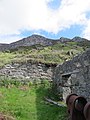
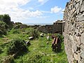
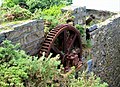
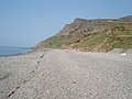
Taking its name from the adjacent beach, this was a quarrying community until part-way through World War II.
Media in category "Porth y Nant, Gwynedd"
The following 144 files are in this category, out of 144 total.
-

-
-

-

-

-
-

-

-

-
-

-
-
-
-
-

-

-

-

-

-
-
-

-

-

-

-

-

-

-

-

-

-

-

-
-

-

-

-

-

-

-
-
-

-

-

-

-
-

-
-

-

-

-

-

-

-
-

-

-
 Lathe name at Porth y Nant - geograph.org.uk - 1883671.jpg 1,600 × 1,070; 661 KB
-
 Nant Gwrtheyrn in 1972 - geograph.org.uk - 87427.jpg 640 × 440; 169 KB
-

-
 Old machinery at Porth y Nant - geograph.org.uk - 1883365.jpg 3,872 × 2,592; 2.38 MB
-
 Penrhyn Glas - geograph.org.uk - 202288.jpg 600 × 450; 110 KB
-
 Penrhyn Glas - geograph.org.uk - 752227.jpg 640 × 619; 100 KB
-
 Penrhyn Glas Viewed From Porth-y-nant - geograph.org.uk - 59983.jpg 640 × 353; 27 KB
-
 Porth y Nant (48445208861).jpg 12,821 × 2,874; 42.88 MB
-
 Porth y Nant (48445262361).jpg 5,007 × 3,338; 13.76 MB
-
 Porth y Nant (48445376232).jpg 9,969 × 2,935; 32.28 MB
-
 Porth y Nant - geograph.org.uk - 2148652.jpg 640 × 480; 66 KB
-
 Porth Y Nant - geograph.org.uk - 725875.jpg 640 × 427; 73 KB
-
 Porth y Nant bay - geograph.org.uk - 5756027.jpg 640 × 427; 97 KB
-
 Porth y Nant Bay from Carreg y Llam - geograph.org.uk - 635986.jpg 640 × 382; 35 KB
-
 Porth y Nant cottages - geograph.org.uk - 245628.jpg 576 × 432; 54 KB
-

-

-
 Porth y Nant, Lleyn Peninsula - geograph.org.uk - 6010480.jpg 5,184 × 2,920; 5.37 MB
-
 Porth y Nant, Lleyn Peninsula - geograph.org.uk - 6010485.jpg 5,184 × 2,920; 5.52 MB
-
 Porth-y-Nant Bay - geograph.org.uk - 1439689.jpg 426 × 640; 52 KB
-

-
 Quarry building at Porth y Nant - geograph.org.uk - 468179.jpg 640 × 480; 141 KB
-
 Road widening above Porth y Nant - geograph.org.uk - 717838.jpg 640 × 480; 59 KB
-

-
 Rust on the beach.jpg 3,872 × 2,592; 6.05 MB
-
 Rusty lathe at Porth y Nant - geograph.org.uk - 1883660.jpg 3,572 × 2,512; 3.15 MB
-
 Rusty metal at Porth y Nant - geograph.org.uk - 1885645.jpg 3,872 × 2,592; 3.73 MB
-
 Shingle beach at Porth y Nant - geograph.org.uk - 468193.jpg 640 × 480; 138 KB
-

-

-

-
 The new road to Porth y Nant - geograph.org.uk - 631360.jpg 640 × 337; 57 KB
-

-
 The old track to Porth-y-Nant - geograph.org.uk - 681994.jpg 640 × 480; 109 KB
-

-

-

-

-

-

-
 Ty-hên farmhouse, Porth-y-nant - geograph.org.uk - 5754122.jpg 640 × 427; 150 KB
-

-
 View along Porth y Nant, Lleyn Peninsula - geograph.org.uk - 6010487.jpg 5,184 × 2,920; 4.94 MB
-

-
 View north along the Porth y Nant beach - geograph.org.uk - 715221.jpg 640 × 480; 100 KB
-

-

-

-

-

-

-

-

-

-

-

-

-
 Berms on Porth y Nant beach - geograph.org.uk - 720394.jpg 640 × 480; 101 KB
-

-
 Coast South of Porth y Nant - geograph.org.uk - 437434.jpg 640 × 480; 148 KB
-
 Coastal wood and Penrhyn Glas - geograph.org.uk - 437439.jpg 640 × 480; 142 KB
-

-

-
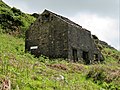
 Disused quarry building at Porth y Nant - geograph.org.uk - 468185.jpg 640 × 480; 142 KB
-

-

-
 Hilltop farmhouse above Porth y Nant bay - geograph.org.uk - 437444.jpg 640 × 480; 142 KB
-
 Path at Porth y Nant - geograph.org.uk - 468183.jpg 640 × 480; 138 KB
-
 Plas y Nant - geograph.org.uk - 632903.jpg 640 × 382; 74 KB
-
 Porth y Nant - geograph.org.uk - 245625.jpg 576 × 432; 66 KB
-
 Porth Y Nant - geograph.org.uk - 245626.jpg 576 × 432; 74 KB
-
 Porth-y-Nant before restoration - geograph.org.uk - 322932.jpg 640 × 429; 88 KB
-
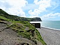
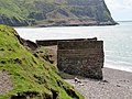
 Remains of the pier at Porth y Nant - geograph.org.uk - 468190.jpg 640 × 480; 141 KB
-

-
 Rock outcrops above Porth y Nant - geograph.org.uk - 632524.jpg 640 × 386; 67 KB
-
 Sharp bend on the Porth-y-Nant road - geograph.org.uk - 681952.jpg 640 × 480; 94 KB
-

-
 The abandoned Ty Uchaf Farm - geograph.org.uk - 632889.jpg 640 × 480; 101 KB
-
 The bay at Porth y Nant - geograph.org.uk - 468176.jpg 640 × 480; 134 KB
-

-

-

-
 The ruined Ty Hen at Porth y Nant - geograph.org.uk - 631513.jpg 640 × 528; 106 KB
-

-
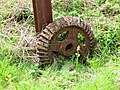
 Winding gear at Porth y Nant - geograph.org.uk - 468187.jpg 640 × 480; 146 KB


.jpg)


.jpg)
.jpg)