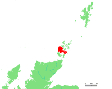
Category:Populated places on Orkney Mainland
Jump to navigation
Jump to search
Wikimedia category | |||||
| Upload media | |||||
| Instance of | |||||
|---|---|---|---|---|---|
| Category combines topics | |||||
| Mainland | |||||
main island of the Orkney Islands, Scotland, UK | |||||
| Instance of | |||||
| Part of | |||||
| Location | Orkney Islands, Scotland | ||||
| Located in or next to body of water | |||||
| Capital | |||||
| Width |
| ||||
| Length |
| ||||
| Population |
| ||||
| Area |
| ||||
 | |||||
Subcategories
This category has the following 29 subcategories, out of 29 total.
C
- Cairston (4 F)
D
E
F
G
- Greenigoe (11 F)
H
- Heddle, Orkney Islands (14 F)
- Houton (79 F)
K
O
Q
- Quholm, Stromness (1 F)
R
S
- Skaill, Deerness (4 F)
- Skaill, Orphir (5 F)
- St Mary's, Orkney Islands (47 F)
T
- Tingwall, Orkney Islands (45 F)
- Toab, Orkney Islands (15 F)
V
- Voy (5 F)
Y
Media in category "Populated places on Orkney Mainland"
The following 14 files are in this category, out of 14 total.
-
A964 to Orphir - geograph.org.uk - 1077111.jpg 640 × 426; 35 KB
-
A966 in Rendall - geograph.org.uk - 1082856.jpg 640 × 422; 64 KB
-
From Hindatoon towards Vola - geograph.org.uk - 1084609.jpg 640 × 426; 69 KB
-
Grey Day at Norseman Village. - geograph.org.uk - 1082245.jpg 640 × 407; 56 KB
-
Groatster and the A960 - geograph.org.uk - 1076161.jpg 640 × 426; 57 KB
-
Groatster, looking SW - geograph.org.uk - 1076156.jpg 640 × 378; 34 KB
-
Junction with A966 - geograph.org.uk - 1082240.jpg 640 × 435; 47 KB
-
New housing, Stanley Hill - geograph.org.uk - 1084654.jpg 640 × 423; 63 KB
-
Newhouse and Netherhouse - geograph.org.uk - 1226433.jpg 640 × 343; 77 KB
-
Newhouse from the west - geograph.org.uk - 1226418.jpg 640 × 419; 110 KB
-
Settlement at Keigar, Deerness - geograph.org.uk - 233204.jpg 640 × 480; 107 KB
-
The hamlet of Easter Voy - geograph.org.uk - 1092130.jpg 640 × 425; 82 KB
-
The lane from Netherhouse - geograph.org.uk - 1226427.jpg 640 × 402; 104 KB
-
Through the hamlet - geograph.org.uk - 1084630.jpg 640 × 426; 57 KB


