Category:Pontymoel
Jump to navigation
Jump to search

suburb of Pontypool and a community in Torfaen County Borough in south east Wales   | |||||
| Upload media | |||||
| Pronunciation audio | |||||
|---|---|---|---|---|---|
| Instance of | |||||
| Location | Torfaen, Wales | ||||
| Population |
| ||||
| Area |
| ||||
 | |||||
Subcategories
This category has the following 12 subcategories, out of 12 total.
A
- Afon Lwyd aqueduct, Pontymoel (12 F)
B
C
P
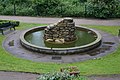
- Pontymoel fountain (3 F)
- Pontypool Park gates (3 F)
T
- Torfaen Museum (6 F)
Media in category "Pontymoel"
The following 200 files are in this category, out of 955 total.
(previous page) (next page)-
 'Five Houses', Upper Race - geograph.org.uk - 6568870.jpg 5,179 × 3,451; 4.7 MB
-

-
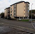 21st century Ty Llwyd flats, Pontypool - geograph.org.uk - 5707918.jpg 800 × 785; 137 KB
-
 7 Osborne Road, Pontypool - geograph.org.uk - 3785232.jpg 800 × 631; 141 KB
-

-

-
 A corner of Pontypool Market - geograph.org.uk - 6655377.jpg 1,600 × 1,200; 512 KB
-

-

-

-
 A small pond in Pontypool - geograph.org.uk - 3996459.jpg 1,600 × 1,064; 747 KB
-

-

-
 A.C.Puddle, Pontypool - geograph.org.uk - 2394742.jpg 640 × 582; 78 KB
-
 A4043 at Pontypool - geograph.org.uk - 3999855.jpg 1,600 × 1,465; 565 KB
-

-
 A4043 looking north - geograph.org.uk - 3790116.jpg 640 × 481; 46 KB
-
 A472 and Rockhill Road, Pontypool - geograph.org.uk - 2460612.jpg 640 × 480; 82 KB
-

-

-
 A472 at Pontymoel - geograph.org.uk - 5922710.jpg 2,980 × 2,062; 1.67 MB
-
 A472 between two bridges, Pontypool - geograph.org.uk - 2451763.jpg 640 × 480; 72 KB
-
-

-
 A472 east of Albion Road, Pontypool - geograph.org.uk - 2427139.jpg 640 × 592; 101 KB
-

-
 A472 near Old Furnace - geograph.org.uk - 2751534.jpg 640 × 480; 62 KB
-
 A472 near Old Furnace - geograph.org.uk - 6178210.jpg 1,024 × 770; 150 KB
-
 Abandoned roadside site, Old Furnace - geograph.org.uk - 2427894.jpg 640 × 480; 106 KB
-

-
 Access road to Snow White Laundries, Pontypool - geograph.org.uk - 6579510.jpg 1,600 × 1,526; 454 KB
-
 Access road to the Tesco Superstore, Pontypool - geograph.org.uk - 6553284.jpg 879 × 1,024; 175 KB
-
 Across Forge Lane, Pontypool - geograph.org.uk - 4731326.jpg 800 × 600; 126 KB
-
 Across Town Bridge, Pontypool - geograph.org.uk - 5707972.jpg 800 × 577; 132 KB
-

-
 Afon Llwyd, Pontypool - geograph.org.uk - 4636366.jpg 4,770 × 3,451; 6.02 MB
-
 Afon Lwyd - geograph.org.uk - 3750591.jpg 1,024 × 680; 278 KB
-
 Afon Lwyd below leisure centre, Pontypool - geograph.org.uk - 5700625.jpg 5,179 × 3,451; 5.04 MB
-
 Afon Lwyd Close, Pontypool - geograph.org.uk - 2392984.jpg 640 × 496; 82 KB
-

-

-
 Afon Lwyd flows through Pontypool Park - geograph.org.uk - 2251379.jpg 640 × 480; 103 KB
-

-

-
 Afon Lwyd, Trosnant Street, Pontypool - geograph.org.uk - 5700610.jpg 5,179 × 3,451; 4.2 MB
-
 Albion Road flats, Pontypool - geograph.org.uk - 2426792.jpg 640 × 481; 92 KB
-

-
 Allegretto at the Junction.jpg 5,472 × 3,648; 10.67 MB
-
 Amberley Place, Pontypool - geograph.org.uk - 3369978.jpg 430 × 640; 83 KB
-
 Aneurin Bevan Court, Pontypool - geograph.org.uk - 4328799.jpg 800 × 566; 106 KB
-

-
 Aqueduct Cruisers.jpg 5,472 × 3,648; 10.28 MB
-
 Argos Pontypool not yet reopen in late July 2020 - geograph.org.uk - 6549243.jpg 1,296 × 1,600; 385 KB
-
 Argos, Pontypool - geograph.org.uk - 2437305.jpg 480 × 640; 69 KB
-

-
 Art deco shop in Pontypool - geograph.org.uk - 3179137.jpg 640 × 480; 77 KB
-
 Asiana in Pontypool - geograph.org.uk - 5707911.jpg 800 × 527; 84 KB
-

-
 Auto Service, Pontypool - geograph.org.uk - 5739082.jpg 800 × 508; 90 KB
-

-
 Backstop of Victorian rifle range, Cwm Lickey - geograph.org.uk - 2884949.jpg 3,772 × 2,504; 3.17 MB
-
 Barclays Bank, Pontypool - geograph.org.uk - 2291549.jpg 3,000 × 4,000; 2.31 MB
-
 Barclays Pontypool - geograph.org.uk - 1853886.jpg 490 × 640; 74 KB
-
 Barclays Pontypool - geograph.org.uk - 4727530.jpg 800 × 600; 160 KB
-
 Bargain Box, Pontypool - geograph.org.uk - 4325895.jpg 714 × 800; 132 KB
-

-

-
 Bellamy's Pad, 22 Clarence Street, Pontypool - geograph.org.uk - 6337052.jpg 1,488 × 1,600; 323 KB
-
 Belle Femme and Asiana in Pontypool - geograph.org.uk - 5445386.jpg 800 × 707; 128 KB
-
 Belle Femme, Pontypool - geograph.org.uk - 4728888.jpg 800 × 592; 112 KB
-

-
 Benches and trees in Pontypool Park - geograph.org.uk - 6026040.jpg 1,000 × 1,024; 328 KB
-
 Best Butties, Pontypool - geograph.org.uk - 4728953.jpg 800 × 642; 152 KB
-
 Betfred in Pontypool town centre - geograph.org.uk - 5216362.jpg 800 × 759; 150 KB
-
 Betfred Pontypool - geograph.org.uk - 3474376.jpg 708 × 800; 154 KB
-
 Betty's Cafe, Pontypool - geograph.org.uk - 2505619.jpg 640 × 500; 76 KB
-
 Bigham's Row, Upper Race, Pontypool - geograph.org.uk - 2452305.jpg 640 × 572; 80 KB
-
 Bilingual direction sign, Pontypool - geograph.org.uk - 5758412.jpg 800 × 675; 131 KB
-
-
 Bilingual name sign on a Pontypool corner - geograph.org.uk - 6657018.jpg 1,545 × 1,600; 903 KB
-
 Black signpost on a Pontypool corner - geograph.org.uk - 5541954.jpg 699 × 800; 191 KB
-
 Blaenavon TV Services, Pontypool - geograph.org.uk - 4726427.jpg 800 × 667; 98 KB
-

-
 Blaendare Road houses, Pontypool - geograph.org.uk - 2451885.jpg 640 × 512; 72 KB
-

-
 Blaendare Road, Upper Race, Pontypool - geograph.org.uk - 3996505.jpg 1,600 × 1,064; 421 KB
-
 Blissfully Vintage in Pontypool - geograph.org.uk - 5445411.jpg 800 × 754; 109 KB
-

-
 Bluebells and Stone Circle - geograph.org.uk - 1913218.jpg 1,024 × 576; 252 KB
-

-
 Boarded-up Up ^ Under, Pontypool - geograph.org.uk - 2392798.jpg 640 × 436; 73 KB
-
 Boarded-up White Hart, Pontypool - geograph.org.uk - 2393312.jpg 544 × 640; 78 KB
-
 Boats moored on the canal, Pontymoel - geograph.org.uk - 2291587.jpg 3,990 × 2,620; 4.38 MB
-
 Boots, 4 George Street, Pontypool - geograph.org.uk - 6550386.jpg 785 × 1,024; 151 KB
-
 Bowling Green pavilion, Pontypool Park - geograph.org.uk - 3195378.jpg 640 × 480; 111 KB
-
 Bradbury House, Pontypool - geograph.org.uk - 2392814.jpg 640 × 480; 66 KB
-
 Bread of Heaven, Pontypool - geograph.org.uk - 3329414.jpg 549 × 640; 84 KB
-
 Brexit Party office on a town centre corner, Pontypool - geograph.org.uk - 6336873.jpg 1,600 × 1,229; 343 KB
-

-
 Bridge carrying the A472 - geograph.org.uk - 3750586.jpg 1,024 × 680; 238 KB
-

-

-
 BrightHouse, Pontypool - geograph.org.uk - 5216522.jpg 800 × 600; 104 KB
-

-
 Broadway houses, Pontypool - geograph.org.uk - 3370142.jpg 640 × 472; 69 KB
-

-
 Bryngwyn Road houses, Pontypool - geograph.org.uk - 2417278.jpg 640 × 480; 63 KB
-
 BT phonebox, Rockhill Road, Pontypool - geograph.org.uk - 5739149.jpg 800 × 735; 140 KB
-
 Budget Furniture, Pontypool - geograph.org.uk - 3474497.jpg 778 × 800; 173 KB
-
-

-
 Bus stop and shelter outside Argos, Pontypool - geograph.org.uk - 6549250.jpg 1,600 × 1,268; 461 KB
-
 Bus stop in Tesco's car park, Pontypool - geograph.org.uk - 4328581.jpg 800 × 490; 122 KB
-

-

-
 Buzz in Pontypool - geograph.org.uk - 4325894.jpg 690 × 800; 117 KB
-
 Campus building, Pontypool - geograph.org.uk - 2452301.jpg 640 × 427; 58 KB
-
 Canal Cafe - geograph.org.uk - 2616813.jpg 800 × 600; 226 KB
-
 Canal side Junction Cottage, Pontymoel - geograph.org.uk - 5860124.jpg 5,179 × 3,451; 5.17 MB
-
 Canal toll house, Mon ^ Brec Canal - geograph.org.uk - 3665870.jpg 1,024 × 768; 150 KB
-
 Capel Street, Pontypool - geograph.org.uk - 4325403.jpg 749 × 800; 146 KB
-

-
 Car park on a slope, Pontypool - geograph.org.uk - 6552164.jpg 1,600 × 1,551; 635 KB
-
 Card Factory shop, Pontypool - geograph.org.uk - 5216541.jpg 769 × 800; 144 KB
-

-

-
-

-
 Ceramic Tiler in Pontypool - geograph.org.uk - 6553060.jpg 1,600 × 1,200; 366 KB
-
 Chaintree Cottage, Penyrheol - geograph.org.uk - 2666992.jpg 640 × 406; 74 KB
-
 Cherrytree Cottage, Penyrheol - geograph.org.uk - 2666995.jpg 640 × 471; 76 KB
-
 Chevroflex Ultra, A4042, Pontypool - geograph.org.uk - 4324286.jpg 800 × 506; 151 KB
-
 Christian Bookshop, Pontypool - geograph.org.uk - 3329309.jpg 640 × 513; 85 KB
-
 Christmas tree in Pontypool town centre - geograph.org.uk - 6347270.jpg 1,404 × 1,600; 430 KB
-
 Church Wood houses, Pontypool - geograph.org.uk - 2429706.jpg 640 × 477; 96 KB
-
 Churchwood Close, Pontypool - geograph.org.uk - 2429727.jpg 640 × 480; 93 KB
-
 Citizens Advice Bureau in Pontypool - geograph.org.uk - 5267423.jpg 800 × 779; 103 KB
-
 Civic Centre Car Park No. 1, Pontypool - geograph.org.uk - 6656091.jpg 1,600 × 1,262; 418 KB
-
-
 Civil Defences War Memorial, Pontypool - geograph.org.uk - 5226722.jpg 746 × 800; 190 KB
-
 Civil Defences War Memorial, Pontypool - geograph.org.uk - 6025872.jpg 936 × 1,024; 261 KB
-
 Clarence Corner car park, Pontypool - geograph.org.uk - 4726452.jpg 800 × 531; 153 KB
-
 Clarence Road pelican crossing, Pontypool - geograph.org.uk - 6579519.jpg 1,105 × 1,410; 298 KB
-
 Clarence Road Pontypool - geograph.org.uk - 2438282.jpg 640 × 480; 87 KB
-

-
 Clarence Street roundabout - geograph.org.uk - 6230635.jpg 3,024 × 1,701; 1.24 MB
-
 Clock tower, Rockhill Road, Pontypool - geograph.org.uk - 5739780.jpg 792 × 800; 112 KB
-
 Clos Afon Llwyd, Pontypool - geograph.org.uk - 4636389.jpg 640 × 418; 98 KB
-
 Closeup view of rugby mosaic, Pontypool - geograph.org.uk - 2393145.jpg 640 × 591; 118 KB
-
-
 Coat of Arms on Pontypool Town Hall - geograph.org.uk - 2590029.jpg 440 × 640; 43 KB
-
 Coed Cae Place, Pontypool - geograph.org.uk - 4325434.jpg 800 × 698; 145 KB
-
 Cold Soul Collective, Pontypool - geograph.org.uk - 4728838.jpg 798 × 800; 126 KB
-
 Colourful van in Pontypool town centre - geograph.org.uk - 5445433.jpg 800 × 751; 139 KB
-

-
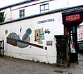 Commercial Street mural, Pontypool - geograph.org.uk - 5846417.jpg 1,024 × 912; 229 KB
-
 Commercial Street, Pontypool - geograph.org.uk - 4730005.jpg 800 × 600; 124 KB
-
 Commercial Street, Pontypool - geograph.org.uk - 5226629.jpg 728 × 800; 119 KB
-
 Commercial van ^ truck centre in Pontypool - geograph.org.uk - 6579617.jpg 1,024 × 704; 140 KB
-
 Construction of footbridge, Afon Lwyd, Pontypool - geograph.org.uk - 5799257.jpg 5,179 × 3,451; 4.99 MB
-
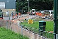 Construction of new path, Pontypool Park - geograph.org.uk - 5799282.jpg 5,179 × 3,451; 5.06 MB
-
 Contrasts in central Pontypool - geograph.org.uk - 2484856.jpg 621 × 640; 77 KB
-
 Convenient on a Sunday, Hanbury Road, Pontypool - geograph.org.uk - 6656163.jpg 1,600 × 1,548; 858 KB
-

-

-
 Crane Street Chambers, Pontypool - geograph.org.uk - 6550367.jpg 992 × 1,600; 257 KB
-

-
 Crumlin Street, Pontypool - geograph.org.uk - 4325446.jpg 800 × 595; 137 KB
-
 Cwm Farm, Pontypool - geograph.org.uk - 2460685.jpg 640 × 480; 69 KB
-
 Cwm Fields area of Pontypool - geograph.org.uk - 2665860.jpg 640 × 588; 122 KB
-
 Cwmynyscoy Hall, Pontypool - geograph.org.uk - 2461805.jpg 640 × 509; 72 KB
-
 Cwmynyscoy Road, Pontypool - geograph.org.uk - 2889282.jpg 640 × 486; 85 KB
-

-
 Cymru Chiropractic Clinic, Pontypool - geograph.org.uk - 3329287.jpg 441 × 640; 80 KB
-
 Dam wall of the Cwm Lickey pond reservoir - geograph.org.uk - 2884972.jpg 4,000 × 3,000; 4.96 MB
-
 Dark green cabinet, Trosnant Street, Pontypool - geograph.org.uk - 6657277.jpg 1,477 × 1,600; 514 KB
-
 Darren Lewis, Pontypool - geograph.org.uk - 4726349.jpg 800 × 679; 127 KB
-

-
 December 5th 2019 Tesco fuel prices, Pontypool - geograph.org.uk - 6337011.jpg 1,024 × 832; 233 KB
-
 Dekan barber shop in Pontypool - geograph.org.uk - 6550479.jpg 1,449 × 1,600; 375 KB
-
 Derelict buildings, Clarence Road, Pontypool - geograph.org.uk - 6553710.jpg 1,573 × 1,600; 620 KB
-
 Derelict former Blaenavon TV Services shop, Pontypool - geograph.org.uk - 6337077.jpg 1,276 × 1,600; 469 KB
-

-

-

-

-

-
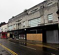 Dereliction in Pontypool town centre - geograph.org.uk - 5445436.jpg 800 × 739; 129 KB
-
 Destan's Cafe ^ Takeaway, Pontypool - geograph.org.uk - 5707908.jpg 800 × 708; 137 KB
-
 Directions at the edge of Pontypool Park, Pontypool - geograph.org.uk - 6347275.jpg 1,600 × 1,589; 501 KB
-

-
 Directions sign in Pontypool town centre - geograph.org.uk - 5445428.jpg 740 × 800; 122 KB
-

-
 Disused George V postbox, Penyrheol - geograph.org.uk - 2666985.jpg 302 × 640; 76 KB
-
 Do not walk under barrier, Pontypool - geograph.org.uk - 4328593.jpg 800 × 535; 113 KB
-

-

-
 Down Glantorvaen Road, Pontypool - geograph.org.uk - 6656118.jpg 1,600 × 1,286; 467 KB
-

-


