Category:Pont Henri, Carmarthenshire
Jump to navigation
Jump to search
village in Wales  | |||||
| Upload media | |||||
| Instance of | |||||
|---|---|---|---|---|---|
| Location | Carmarthenshire, Wales | ||||
 | |||||
Media in category "Pont Henri, Carmarthenshire"
The following 17 files are in this category, out of 17 total.
-

-

-
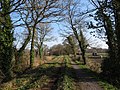
 Footpath and disused railway line in Ponthenry (geograph 7129381).jpg 4,000 × 3,000; 4.68 MB
-
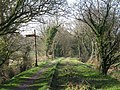
 Footpath and disused railway line near Ponthenry (geograph 7129379).jpg 4,000 × 3,000; 6.86 MB
-
 Footpath and disused railway line near Pontyates (geograph 7129368).jpg 4,000 × 3,000; 5.81 MB
-
 Footpath and disused railway line near Pontyates (geograph 7129371).jpg 4,000 × 3,000; 5.74 MB
-
 Footpath and disused railway line near Pontyates (geograph 7129385).jpg 4,000 × 3,000; 6.38 MB
-
 Footpath, bridge and disused railway line near Pontyates (geograph 7129373).jpg 4,000 × 3,000; 7.03 MB
-
 Leaving Ponthenri to the north west - geograph.org.uk - 1243645.jpg 640 × 425; 107 KB
-
 Llwybr ym Mhont Henri - Path in Pont-Henri (geograph 6229433).jpg 1,024 × 768; 267 KB
-
 New housing development - geograph.org.uk - 250658.jpg 640 × 480; 45 KB
-
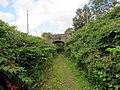
 Old disused railway - geograph.org.uk - 250645.jpg 640 × 480; 81 KB
-

-
 Pont-Henri & Gwendraeth Fawr (geograph 3972815).jpg 640 × 480; 116 KB
-
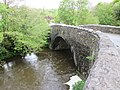
 Pont-Henri Railway Bridge (geograph 3972803).jpg 480 × 640; 130 KB
-
 The Baltic Inn and Restaurant (7836381792).jpg 2,048 × 1,536; 758 KB
-
 Ysgol Gynradd Ponthenri - geograph.org.uk - 1243590.jpg 640 × 425; 89 KB


.jpg)
.jpg)
.jpg)
.jpg)
.jpg)
.jpg)
.jpg)


.jpg)
.jpg)
.jpg)
