Category:Pomp (Rijsbergen)
Jump to navigation
Jump to search
| Object location | | View all coordinates using: OpenStreetMap |
|---|
 | |||||
| Upload media | |||||
| Instance of | |||||
|---|---|---|---|---|---|
| Location | Rijsbergen, North Brabant, Netherlands | ||||
| Street address |
| ||||
| Heritage designation |
| ||||
 | |||||
|
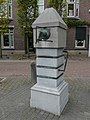
This is a category about rijksmonument number 519330
|
| Address |
|
Media in category "Pomp (Rijsbergen)"
The following 2 files are in this category, out of 2 total.
-
 P1030517 copyPomp in Rijsbergen.jpg 2,448 × 3,264; 2.47 MB
-
 Pomp - Rijsbergen - 20187505 - RCE.jpg 1,200 × 1,184; 345 KB
