Category:Polmont
Jump to navigation
Jump to search
village in Falkirk, Scotland, UK  | |||||
| Upload media | |||||
| Instance of | |||||
|---|---|---|---|---|---|
| Location |
| ||||
| Population |
| ||||
| Area |
| ||||
 | |||||
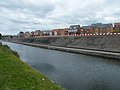
English: Polmont is a village in the Falkirk council area of Central Scotland. It lies towards the east of the town of Falkirk, north of the Union Canal, which runs adjacent to the village.
Русский: Полмонт (англ. Polmont, гэл. Poll-Mhonaidh) — город в центральной части Шотландии, административный центр области Полмонт.
Scots: Powmont ( Inglis: Polmont; Scots Gaelic: Poll-Mhonaidh (Pool o the Hill)) is a clachan that lees fower mile (6.5 km) tae the aest o Fawkirk, Scotland. It lees close tae the M9 motorwey connectin Edinburgh an Glesca. Powmont railwey station is locate on the main Edinburgh tae Glesca railwey line.
Subcategories
This category has the following 6 subcategories, out of 6 total.
C
- Cats of Polmont (3 F)
F
- Falkirk Travelodge (2 F)
G
L
- Lathallan Bridge 52A (2 F)
P
- Polmont railway station (13 F)
Media in category "Polmont"
The following 74 files are in this category, out of 74 total.
-

-
 Avondale Quarry. - geograph.org.uk - 85182.jpg 640 × 480; 78 KB
-
 Bin day, Polmont - geograph.org.uk - 85187.jpg 640 × 480; 67 KB
-
 Bridge - panoramio (149).jpg 4,000 × 6,016; 13.17 MB
-
 Burnout by the landfill. - geograph.org.uk - 85185.jpg 640 × 480; 103 KB
-
 Cadgers Brae - geograph.org.uk - 548266.jpg 640 × 319; 43 KB
-
 Erskinehill.jpg 640 × 480; 88 KB
-
 Foggy roadside - panoramio.jpg 1,200 × 897; 380 KB
-
 From the Union Canal - geograph.org.uk - 63579.jpg 480 × 640; 109 KB
-
 Garden Centre - geograph.org.uk - 545188.jpg 640 × 275; 49 KB
-
 Give way - panoramio.jpg 4,339 × 1,494; 1.07 MB
-
 Grangemouth, UK - panoramio (1).jpg 4,000 × 3,000; 2.16 MB
-
 Grazing in the fog - panoramio.jpg 1,200 × 897; 523 KB
-
 Greenpark centre - panoramio.jpg 4,512 × 3,000; 5.79 MB
-
 Housing in Polmont near Falkirk - geograph.org.uk - 17099.jpg 640 × 480; 95 KB
-
 Inchyra Grange Hotel - geograph.org.uk - 545202.jpg 640 × 330; 51 KB
-
 Land and Sea Chip Shop - panoramio.jpg 4,000 × 3,000; 3.2 MB
-
 Main Street, Polmont - geograph.org.uk - 1478662.jpg 640 × 480; 89 KB
-
 Meadowbanklibrary.jpg 2,592 × 1,936; 2.01 MB
-
 New housing at Polmont - geograph.org.uk - 900470.jpg 640 × 480; 68 KB
-
 Parkhillpolmont.jpg 2,592 × 1,936; 672 KB
-
 Path - panoramio (35).jpg 6,016 × 4,000; 13.58 MB
-
 Polmont Co-op - panoramio.jpg 1,673 × 2,421; 602 KB
-
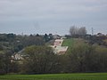 Polmont Hill Ski Slope - geograph.org.uk - 81879.jpg 640 × 480; 56 KB
-
 Polmont old parish church hall - panoramio.jpg 1,600 × 1,200; 207 KB
-
 Polmont Park.jpg 640 × 480; 87 KB
-
 Polmont Post Office - geograph.org.uk - 901653.jpg 640 × 480; 58 KB
-
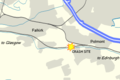 Polmont rail accident location.png 300 × 200; 20 KB
-
 Polmont Sports Centre - panoramio.jpg 4,000 × 3,000; 2.61 MB
-
 Polmont Station (geograph 4304540).jpg 800 × 600; 427 KB
-
 Polmont(Location).png 553 × 933; 178 KB
-
 Polmont, UK - panoramio (1).jpg 4,000 × 3,000; 707 KB
-
 Polmont, UK - panoramio (10).jpg 4,000 × 3,000; 2.56 MB
-
 Polmont, UK - panoramio (11).jpg 4,000 × 3,000; 2.56 MB
-
 Polmont, UK - panoramio (12).jpg 4,000 × 3,000; 4.4 MB
-
 Polmont, UK - panoramio (13).jpg 4,000 × 3,000; 4.5 MB
-
 Polmont, UK - panoramio (14).jpg 3,701 × 2,695; 2.74 MB
-
 Polmont, UK - panoramio (15).jpg 2,159 × 2,839; 1.27 MB
-
 Polmont, UK - panoramio (16).jpg 2,184 × 1,299; 468 KB
-
 Polmont, UK - panoramio (17).jpg 4,512 × 3,000; 7.73 MB
-
 Polmont, UK - panoramio (18).jpg 800 × 538; 282 KB
-
 Polmont, UK - panoramio (19).jpg 2,319 × 1,067; 620 KB
-
 Polmont, UK - panoramio (2).jpg 4,000 × 3,000; 4.05 MB
-
 Polmont, UK - panoramio (20).jpg 4,512 × 3,000; 5.46 MB
-
 Polmont, UK - panoramio (21).jpg 4,000 × 6,016; 12.17 MB
-
 Polmont, UK - panoramio (22).jpg 3,000 × 4,512; 7.01 MB
-
 Polmont, UK - panoramio (23).jpg 3,000 × 4,512; 6.02 MB
-
 Polmont, UK - panoramio (24).jpg 3,000 × 4,512; 6.79 MB
-
 Polmont, UK - panoramio (25).jpg 4,512 × 3,000; 7.46 MB
-
 Polmont, UK - panoramio (26).jpg 4,512 × 3,000; 6.72 MB
-
 Polmont, UK - panoramio (27).jpg 4,512 × 3,000; 4.84 MB
-
 Polmont, UK - panoramio (3).jpg 4,000 × 3,000; 2.29 MB
-
 Polmont, UK - panoramio (4).jpg 4,000 × 3,000; 3.13 MB
-
 Polmont, UK - panoramio (5).jpg 4,000 × 3,000; 2.6 MB
-
 Polmont, UK - panoramio (6).jpg 4,000 × 3,000; 2.02 MB
-
 Polmont, UK - panoramio (7).jpg 4,000 × 3,000; 3.31 MB
-
 Polmont, UK - panoramio (8).jpg 4,000 × 3,000; 1.93 MB
-
 Polmont, UK - panoramio (9).jpg 4,000 × 3,000; 2.56 MB
-
 Polmont, UK - panoramio.jpg 4,000 × 3,000; 1.21 MB
-
 Polmont1.JPG 640 × 480; 85 KB
-
 Polmontgolf.jpg 2,048 × 1,536; 631 KB
-
 Polmontgolfcourse.jpg 2,048 × 1,536; 756 KB
-
 Pylon the pressure - geograph.org.uk - 81888.jpg 480 × 640; 63 KB
-
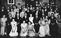 Redding Co-operative Society party at Polmont Masonic Hall.jpg 1,200 × 752; 134 KB
-
 School, Polmont. - geograph.org.uk - 90415.jpg 640 × 452; 60 KB
-
 Shops on Polmont main street - geograph.org.uk - 1264404.jpg 640 × 480; 49 KB
-
 Small shopping centre - geograph.org.uk - 1264454.jpg 640 × 480; 87 KB
-
 Station Road, Polmont - geograph.org.uk - 70185.jpg 640 × 480; 111 KB
-
 The A803 heading for Linlithgow - geograph.org.uk - 1214386.jpg 640 × 440; 58 KB
-
 The Black Bull - panoramio.jpg 3,104 × 2,429; 1.4 MB
-
 Train approaching Polmont Station - geograph.org.uk - 1444025.jpg 640 × 480; 88 KB
-
 Tunnel - panoramio (26).jpg 6,016 × 4,000; 11.59 MB
-
 Union Canal, Polmont (1).jpg 640 × 480; 63 KB
-
 War memorial, Polmont - panoramio.jpg 1,375 × 1,600; 205 KB


.jpg)


.jpg)


.jpg)


.jpg)
.png)
.jpg)
.jpg)
.jpg)
.jpg)
.jpg)
.jpg)
.jpg)
.jpg)
.jpg)
.jpg)
.jpg)
.jpg)
.jpg)
.jpg)
.jpg)
.jpg)
.jpg)
.jpg)
.jpg)
.jpg)
.jpg)
.jpg)
.jpg)
.jpg)
.jpg)
.jpg)
.jpg)


.jpg)
.jpg)
