Category:Political maps of the canton of Lucerne
Jump to navigation
Jump to search
Media in category "Political maps of the canton of Lucerne"
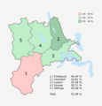
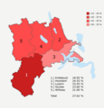
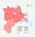
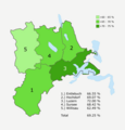
The following 12 files are in this category, out of 12 total.
-
 Volksabstimmungsergebnis Luzern 2000 03 12 Vorlage 01.png 2,066 × 2,158; 282 KB
-
 Volksabstimmungsergebnis Luzern 2000 05 21 Vorlage 01.png 2,066 × 2,158; 288 KB
-
 Volksabstimmungsergebnis Luzern 2000 05 21 Vorlage 02.png 2,066 × 2,158; 282 KB
-
 Volksabstimmungsergebnis Luzern 2004 02 08 Vorlage 01.png 2,066 × 2,158; 318 KB
-
 Volksabstimmungsergebnis Luzern 2004 11 28 Vorlage 04.png 2,066 × 2,158; 287 KB
-
 Volksabstimmungsergebnis Luzern 2004 11 28 Vorlage 05.png 2,066 × 2,158; 283 KB
-
 Volksabstimmungsergebnis Luzern 2005 09 25 Vorlage 02.png 2,066 × 2,158; 290 KB
-
 Volksabstimmungsergebnis Luzern 2008 09 28 Vorlage 01.png 2,066 × 2,158; 304 KB
-
 Volksabstimmungsergebnis Luzern 2009 02 08 Vorlage 01.png 2,066 × 2,158; 291 KB
-
 Volksabstimmungsergebnis Luzern 2009 05 17 Vorlage 02.png 2,066 × 2,158; 282 KB
-
 Volksabstimmungsergebnis Luzern 2009 11 29 Vorlage 01.png 2,066 × 2,158; 291 KB
-
 Volksabstimmungsergebnis Luzern 2009 11 29 Vorlage 02.png 2,066 × 2,158; 287 KB


