Category:Political maps of the German Democratic Republic
Jump to navigation
Jump to search
Subcategories
This category has the following 2 subcategories, out of 2 total.
Media in category "Political maps of the German Democratic Republic"
The following 4 files are in this category, out of 4 total.
-
 DDR Verwaltung 060415.png 1,500 × 2,036; 205 KB
-
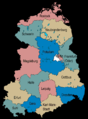
 Germany Laender 1947 1990 DDR.png 444 × 612; 16 KB
-
 NATO und Warschauer Pakt - Truppenstärke - (1973).png 1,165 × 1,200; 352 KB
-
 Probable Axes of Attack.jpg 646 × 890; 351 KB


.png)
