Category:Political maps of the Caucasus
Jump to navigation
Jump to search
Media in category "Political maps of the Caucasus"
The following 24 files are in this category, out of 24 total.
-
카프카스 지도.svg 972 × 922; 308 KB
-
Base Map of the Southern Caucasus.png 2,913 × 2,166; 295 KB
-
Caucasus central asia political map 2000.jpg 1,390 × 1,036; 164 KB
-
Caucasus regions map svenska.svg 2,006 × 1,618; 271 KB
-
Caucasus regions map3.png 2,384 × 2,048; 652 KB
-
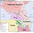
Caucasus-political pl.svg 972 × 922; 500 KB
-
Caucasus-vector-map.svg 9,000 × 5,904; 405 KB
-
Eastern Turkey and vicinity..jpg 2,268 × 1,355; 2.81 MB
-
Jan Osetiya urushi 2008.png 676 × 400; 55 KB
-
Kaukasien-politik.png 801 × 605; 36 KB
-
Kaukasus klein.png 593 × 515; 99 KB
-
Kaukasus politiek.png 500 × 427; 130 KB
-
Kaukasus-schrijfweek-nl-wiki.svg 982 × 892; 314 KB
-
Kavkasia.png 400 × 302; 22 KB
-
Northern Caucasus regions map.png 2,084 × 1,069; 337 KB
-
Republics of the North Caucasus.png 1,503 × 789; 656 KB
-
Russian Northern Caucasus Base Map.png 2,884 × 2,170; 300 KB
-
Vector-map of Caucasus (hy).svg 9,000 × 5,904; 202 KB
-
Vector-map of Caucasus.svg 512 × 350; 237 KB
-
Zemlje kavkaza.PNG 512 × 352; 14 KB
-
Zona d'influència de l'idioma "rútul" al Caucas.png 613 × 350; 19 KB
-
Геополитичка мапа Кавказа.svg 972 × 922; 372 KB
-
Закавказье.png 512 × 352; 43 KB
-
Закавказье2.png 512 × 352; 25 KB


