Category:Political maps of Wyandot County, Ohio as of the 2000 United States Census
Jump to navigation
Jump to search
Media in category "Political maps of Wyandot County, Ohio as of the 2000 United States Census"
The following 24 files are in this category, out of 24 total.
-
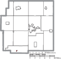
 Map of Wyandot County Ohio Highlighting Antrim Township.png 495 × 480; 19 KB
-
 Map of Wyandot County Ohio Highlighting Carey Village.png 495 × 480; 19 KB
-
 Map of Wyandot County Ohio Highlighting Crane Township.png 495 × 480; 19 KB
-
 Map of Wyandot County Ohio Highlighting Crawford Township.png 495 × 480; 19 KB
-
 Map of Wyandot County Ohio Highlighting Eden Township.png 495 × 480; 19 KB
-
 Map of Wyandot County Ohio Highlighting Harpster Village.png 495 × 480; 19 KB
-
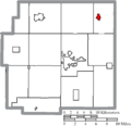
 Map of Wyandot County Ohio Highlighting Jackson Township.png 495 × 480; 19 KB
-
 Map of Wyandot County Ohio Highlighting Kirby Village.png 495 × 480; 19 KB
-
 Map of Wyandot County Ohio Highlighting Marseilles Township.png 495 × 480; 19 KB
-
 Map of Wyandot County Ohio Highlighting Marseilles Village.png 495 × 480; 19 KB
-
 Map of Wyandot County Ohio Highlighting Mifflin Township.png 495 × 480; 19 KB
-
 Map of Wyandot County Ohio Highlighting Nevada Village.png 495 × 480; 19 KB
-
 Map of Wyandot County Ohio Highlighting Pitt Township.png 495 × 480; 19 KB
-
 Map of Wyandot County Ohio Highlighting Richland Township.png 495 × 480; 19 KB
-
 Map of Wyandot County Ohio Highlighting Ridge Township.png 495 × 480; 19 KB
-
 Map of Wyandot County Ohio Highlighting Salem Township.png 495 × 480; 19 KB
-
 Map of Wyandot County Ohio Highlighting Sycamore Township.png 495 × 480; 19 KB
-
 Map of Wyandot County Ohio Highlighting Sycamore Village.png 495 × 480; 19 KB
-
 Map of Wyandot County Ohio Highlighting Tymochtee Township.png 495 × 480; 19 KB
-
 Map of Wyandot County Ohio Highlighting Upper Sandusky City.png 495 × 480; 19 KB
-
 Map of Wyandot County Ohio Highlighting Wharton Village.png 495 × 480; 19 KB
-
 Map of Wyandot County Ohio With Municipal and Township Labels.PNG 495 × 480; 34 KB
-
 Map of Wyandot County, Ohio No Text, Municipalities Distinct.png 495 × 480; 19 KB
-
 Map of Wyandot County, Ohio No Text.png 495 × 480; 19 KB


