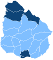
Category:Political maps of Uruguay
Jump to navigation
Jump to search
Countries of the Americas: Argentina · Bolivia · Brazil · Canada · Chile · Colombia · Costa Rica · Ecuador · El Salvador · Grenada · Honduras · Jamaica · Mexico · Panama · Paraguay · Peru · Saint Vincent and the Grenadines · Trinidad and Tobago · United States of America · Uruguay · Venezuela
Other areas: French Guiana · Guadeloupe · Martinique · Saint Barthélemy · Saint-Martin · Saint Pierre and Miquelon · United States Virgin Islands
Other areas: French Guiana · Guadeloupe · Martinique · Saint Barthélemy · Saint-Martin · Saint Pierre and Miquelon · United States Virgin Islands
Subcategories
This category has the following 3 subcategories, out of 3 total.
I
T
Media in category "Political maps of Uruguay"
The following 2 files are in this category, out of 2 total.
-
Fuerza politica mas votada por departamento.png 765 × 765; 17 KB
-
Ruling Parties of Uruguay.svg 595 × 666; 61 KB

