Category:Political maps of Tuscarawas County, Ohio as of the 2000 United States Census
Jump to navigation
Jump to search
Media in category "Political maps of Tuscarawas County, Ohio as of the 2000 United States Census"
The following 44 files are in this category, out of 44 total.
-
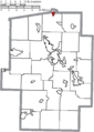
 Map of Tuscarawas County Ohio Highlighting Auburn Township.png 486 × 683; 31 KB
-
 Map of Tuscarawas County Ohio Highlighting Baltic Village.png 486 × 683; 31 KB
-
 Map of Tuscarawas County Ohio Highlighting Barnhill Village.png 486 × 683; 31 KB
-
 Map of Tuscarawas County Ohio Highlighting Bolivar Village.png 486 × 683; 31 KB
-
 Map of Tuscarawas County Ohio Highlighting Bucks Township.png 486 × 683; 31 KB
-
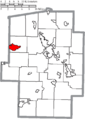
 Map of Tuscarawas County Ohio Highlighting Clay Township.png 486 × 683; 31 KB
-
 Map of Tuscarawas County Ohio Highlighting Dennison Village.png 486 × 683; 31 KB
-
 Map of Tuscarawas County Ohio Highlighting Dover City.png 486 × 683; 31 KB
-
 Map of Tuscarawas County Ohio Highlighting Dover Township.png 486 × 683; 32 KB
-
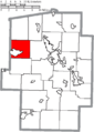
 Map of Tuscarawas County Ohio Highlighting Fairfield Township.png 486 × 683; 31 KB
-
 Map of Tuscarawas County Ohio Highlighting Franklin Township.png 486 × 683; 31 KB
-
 Map of Tuscarawas County Ohio Highlighting Gnadenhutten Village.png 486 × 683; 31 KB
-
 Map of Tuscarawas County Ohio Highlighting Goshen Township.png 486 × 683; 32 KB
-
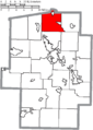
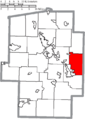
 Map of Tuscarawas County Ohio Highlighting Jefferson Township.png 486 × 683; 31 KB
-
 Map of Tuscarawas County Ohio Highlighting Lawrence Township.png 486 × 683; 31 KB
-
 Map of Tuscarawas County Ohio Highlighting Midvale Village.png 486 × 683; 31 KB
-
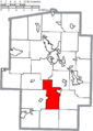
 Map of Tuscarawas County Ohio Highlighting Mill Township.png 486 × 683; 32 KB
-
 Map of Tuscarawas County Ohio Highlighting Mineral City Village.png 486 × 683; 31 KB
-
 Map of Tuscarawas County Ohio Highlighting New Philadelphia City.png 486 × 683; 32 KB
-
 Map of Tuscarawas County Ohio Highlighting Newcomerstown Village.png 486 × 683; 31 KB
-
 Map of Tuscarawas County Ohio Highlighting Oxford Township.png 486 × 683; 31 KB
-
 Map of Tuscarawas County Ohio Highlighting Parral Village.png 486 × 683; 31 KB
-
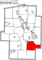
 Map of Tuscarawas County Ohio Highlighting Perry Township.png 486 × 683; 31 KB
-

-
 Map of Tuscarawas County Ohio Highlighting Roswell Village.png 486 × 683; 31 KB
-
 Map of Tuscarawas County Ohio Highlighting Rush Township.png 486 × 683; 31 KB
-
 Map of Tuscarawas County Ohio Highlighting Salem Township.png 486 × 683; 31 KB
-
 Map of Tuscarawas County Ohio Highlighting Sandy Township.png 486 × 683; 31 KB
-
 Map of Tuscarawas County Ohio Highlighting Stone Creek Village.png 486 × 683; 31 KB
-
 Map of Tuscarawas County Ohio Highlighting Strasburg Village.png 486 × 683; 31 KB
-
 Map of Tuscarawas County Ohio Highlighting Sugar Creek Township.png 486 × 683; 31 KB
-
 Map of Tuscarawas County Ohio Highlighting Sugarcreek Village.png 486 × 683; 31 KB
-
 Map of Tuscarawas County Ohio Highlighting Tuscarawas Village.png 486 × 683; 31 KB
-
 Map of Tuscarawas County Ohio Highlighting Uhrichsville City.png 486 × 683; 31 KB
-
 Map of Tuscarawas County Ohio Highlighting Union Township.png 486 × 683; 31 KB
-
 Map of Tuscarawas County Ohio Highlighting Warren Township.png 486 × 683; 31 KB
-
 Map of Tuscarawas County Ohio Highlighting Warwick Township.png 486 × 683; 31 KB
-
 Map of Tuscarawas County Ohio Highlighting Washington Township.png 486 × 683; 31 KB
-
 Map of Tuscarawas County Ohio Highlighting Wayne Township.png 486 × 683; 31 KB
-
 Map of Tuscarawas County Ohio Highlighting York Township.png 486 × 683; 31 KB
-
 Map of Tuscarawas County Ohio Highlighting Zoar Village.png 486 × 683; 31 KB
-
 Map of Tuscarawas County Ohio With Municipal and Township Labels.PNG 486 × 683; 61 KB
-
 Map of Tuscarawas County, Ohio No Text, Municipalities Distinct.png 486 × 683; 31 KB
-
 Map of Tuscarawas County, Ohio No Text.png 486 × 683; 31 KB


