Category:Political maps of Summit County, Ohio as of the 2000 United States Census
Jump to navigation
Jump to search
Media in category "Political maps of Summit County, Ohio as of the 2000 United States Census"
The following 34 files are in this category, out of 34 total.
-
 Map of Summit County Ohio Highlighting Akron City.png 450 × 700; 31 KB
-
 Map of Summit County Ohio Highlighting Barberton City.png 450 × 700; 30 KB
-
 Map of Summit County Ohio Highlighting Bath Township.png 450 × 700; 30 KB
-
 Map of Summit County Ohio Highlighting Boston Heights Village.png 450 × 700; 30 KB
-
 Map of Summit County Ohio Highlighting Boston Township.png 450 × 700; 30 KB
-
 Map of Summit County Ohio Highlighting Clinton Village.png 450 × 700; 30 KB
-
 Map of Summit County Ohio Highlighting Copley Township.png 450 × 700; 30 KB
-
 Map of Summit County Ohio Highlighting Coventry Township.png 450 × 700; 30 KB
-
 Map of Summit County Ohio Highlighting Cuyahoga Falls City.png 450 × 700; 30 KB
-
 Map of Summit County Ohio Highlighting Fairlawn City.png 450 × 700; 30 KB
-
 Map of Summit County Ohio Highlighting Green City.png 450 × 700; 30 KB
-
 Map of Summit County Ohio Highlighting Hudson City.png 450 × 700; 30 KB
-
 Map of Summit County Ohio Highlighting Lakemore Village.png 450 × 700; 30 KB
-
 Map of Summit County Ohio Highlighting Macedonia City.png 450 × 700; 30 KB
-
 Map of Summit County Ohio Highlighting Mogadore Village.png 450 × 700; 30 KB
-
 Map of Summit County Ohio Highlighting Munroe Falls City.png 450 × 700; 30 KB
-
 Map of Summit County Ohio Highlighting New Franklin City.png 450 × 700; 30 KB
-
-
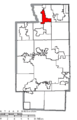
 Map of Summit County Ohio Highlighting Northfield Village.png 450 × 700; 30 KB
-
 Map of Summit County Ohio Highlighting Norton City.png 450 × 700; 30 KB
-
 Map of Summit County Ohio Highlighting Peninsula Village.png 450 × 700; 30 KB
-
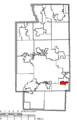
 Map of Summit County Ohio Highlighting Reminderville Village.png 450 × 700; 30 KB
-
 Map of Summit County Ohio Highlighting Richfield Township.png 450 × 700; 30 KB
-
 Map of Summit County Ohio Highlighting Richfield Village.png 450 × 700; 30 KB
-
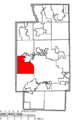
 Map of Summit County Ohio Highlighting Sagamore Hills Township.png 450 × 700; 30 KB
-
 Map of Summit County Ohio Highlighting Silver Lake Village.png 450 × 700; 30 KB
-
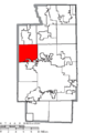
 Map of Summit County Ohio Highlighting Springfield Township.png 450 × 700; 30 KB
-
 Map of Summit County Ohio Highlighting Stow City.png 450 × 700; 30 KB
-
 Map of Summit County Ohio Highlighting Tallmadge City.png 450 × 700; 30 KB
-
 Map of Summit County Ohio Highlighting Twinsburg City.png 450 × 700; 30 KB
-
 Map of Summit County Ohio Highlighting Twinsburg Township.png 450 × 700; 30 KB
-
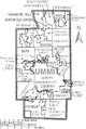 Map of Summit County Ohio With Municipal and Township Labels.PNG 493 × 734; 63 KB
-
 Map of Summit County, Ohio No Text, Municipalities Distinct.png 493 × 734; 31 KB
-
 Map of Summit County, Ohio No Text.png 493 × 734; 34 KB


