Category:Political maps of Jackson County, Ohio as of the 2000 United States Census
Jump to navigation
Jump to search
Media in category "Political maps of Jackson County, Ohio as of the 2000 United States Census"
The following 19 files are in this category, out of 19 total.
-
 Map of Jackson County Ohio Highlighting Bloomfield Township.png 438 × 572; 20 KB
-
 Map of Jackson County Ohio Highlighting Coal Township.png 438 × 572; 20 KB
-
 Map of Jackson County Ohio Highlighting Coalton Village.png 438 × 572; 19 KB
-
 Map of Jackson County Ohio Highlighting Franklin Township.png 438 × 572; 20 KB
-
 Map of Jackson County Ohio Highlighting Hamilton Township.png 438 × 572; 20 KB
-
 Map of Jackson County Ohio Highlighting Jackson City.png 438 × 572; 20 KB
-
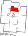
 Map of Jackson County Ohio Highlighting Jackson Township.png 438 × 572; 20 KB
-
 Map of Jackson County Ohio Highlighting Jefferson Township.png 438 × 572; 20 KB
-
 Map of Jackson County Ohio Highlighting Liberty Township.png 438 × 572; 20 KB
-
 Map of Jackson County Ohio Highlighting Lick Township.png 438 × 572; 20 KB
-
 Map of Jackson County Ohio Highlighting Madison Township.png 438 × 572; 20 KB
-
 Map of Jackson County Ohio Highlighting Milton Township.png 438 × 572; 20 KB
-
 Map of Jackson County Ohio Highlighting Oak Hill Village.png 438 × 572; 19 KB
-
 Map of Jackson County Ohio Highlighting Scioto Township.png 438 × 572; 20 KB
-
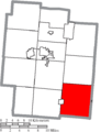
 Map of Jackson County Ohio Highlighting Washington Township.png 438 × 572; 20 KB
-
 Map of Jackson County Ohio Highlighting Wellston City.png 438 × 572; 20 KB
-
 Map of Jackson County Ohio With Municipal and Township Labels.PNG 438 × 572; 32 KB
-
 Map of Jackson County, Ohio No Text, Municipalities Distinct.png 438 × 572; 19 KB
-
 Map of Jackson County, Ohio No Text.png 438 × 572; 19 KB


