Category:Political maps of Hancock County, Ohio as of the 2000 United States Census
Jump to navigation
Jump to search
Media in category "Political maps of Hancock County, Ohio as of the 2000 United States Census"
The following 64 files are in this category, out of 64 total.
-

-
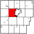
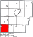
 Map of Hancock County Ohio Highlighting Allen Township.png 504 × 561; 22 KB
-
-
 Map of Hancock County Ohio Highlighting Amanda Township.png 504 × 561; 22 KB
-
 Map of Hancock County Ohio Highlighting Arcadia Village.png 504 × 561; 22 KB
-
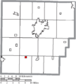
 Map of Hancock County Ohio Highlighting Arcadia.png 309 × 308; 4 KB
-
 Map of Hancock County Ohio Highlighting Arlington Village.png 504 × 561; 22 KB
-
 Map of Hancock County Ohio Highlighting Arlington.png 309 × 308; 4 KB
-
 Map of Hancock County Ohio Highlighting Benton Ridge Village.png 504 × 561; 22 KB
-
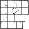
 Map of Hancock County Ohio Highlighting Benton Ridge.png 309 × 308; 4 KB
-

-
 Map of Hancock County Ohio Highlighting Biglick Township.png 504 × 561; 22 KB
-

-
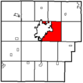
 Map of Hancock County Ohio Highlighting Blanchard Township.png 504 × 561; 22 KB
-
 Map of Hancock County Ohio Highlighting Bluffton Village.png 504 × 561; 22 KB
-
 Map of Hancock County Ohio Highlighting Bluffton.png 309 × 308; 4 KB
-

-
 Map of Hancock County Ohio Highlighting Cass Township.png 504 × 561; 22 KB
-
-
 Map of Hancock County Ohio Highlighting Delaware Township.png 504 × 561; 22 KB
-
-
 Map of Hancock County Ohio Highlighting Eagle Township.png 504 × 561; 22 KB
-
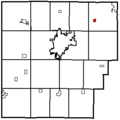
 Map of Hancock County Ohio Highlighting Findlay City.png 504 × 561; 22 KB
-
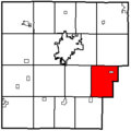
 Map of Hancock County Ohio Highlighting Findlay.png 309 × 308; 4 KB
-
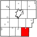
 Map of Hancock County Ohio Highlighting Fostoria City.png 504 × 561; 22 KB
-
 Map of Hancock County Ohio Highlighting Fostoria.png 309 × 308; 4 KB
-

-
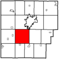
 Map of Hancock County Ohio Highlighting Jackson Township.png 504 × 561; 22 KB
-
 Map of Hancock County Ohio Highlighting Jenera Village.png 504 × 561; 22 KB
-
 Map of Hancock County Ohio Highlighting Jenera.png 309 × 308; 4 KB
-
-
 Map of Hancock County Ohio Highlighting Liberty Township.png 504 × 561; 22 KB
-

-
 Map of Hancock County Ohio Highlighting Madison Township.png 504 × 561; 22 KB
-
-
 Map of Hancock County Ohio Highlighting Marion Township.png 504 × 561; 22 KB
-
 Map of Hancock County Ohio Highlighting McComb Village.png 504 × 561; 22 KB
-
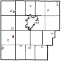
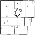
 Map of Hancock County Ohio Highlighting McComb.png 309 × 308; 4 KB
-
 Map of Hancock County Ohio Highlighting Mount Blanchard Village.png 504 × 561; 22 KB
-
 Map of Hancock County Ohio Highlighting Mount Blanchard.png 309 × 308; 4 KB
-
 Map of Hancock County Ohio Highlighting Mount Cory Village.png 504 × 561; 22 KB
-
 Map of Hancock County Ohio Highlighting Mount Cory.png 309 × 308; 4 KB
-

-
 Map of Hancock County Ohio Highlighting Orange Township.png 504 × 561; 22 KB
-

-
 Map of Hancock County Ohio Highlighting Pleasant Township.png 504 × 561; 22 KB
-
-
 Map of Hancock County Ohio Highlighting Portage Township.png 504 × 561; 22 KB
-
 Map of Hancock County Ohio Highlighting Rawson Village.png 504 × 561; 22 KB
-
 Map of Hancock County Ohio Highlighting Rawson.png 309 × 308; 4 KB
-

-
 Map of Hancock County Ohio Highlighting Union Township.png 504 × 561; 22 KB
-

-
 Map of Hancock County Ohio Highlighting Van Buren Township.png 504 × 561; 22 KB
-
 Map of Hancock County Ohio Highlighting Van Buren Village.png 504 × 561; 22 KB
-
 Map of Hancock County Ohio Highlighting Van Buren.png 309 × 308; 4 KB
-
 Map of Hancock County Ohio Highlighting Vanlue Village.png 504 × 561; 22 KB
-
 Map of Hancock County Ohio Highlighting Vanlue.png 309 × 308; 4 KB
-

-
 Map of Hancock County Ohio Highlighting Washington Township.png 504 × 561; 22 KB
-
-
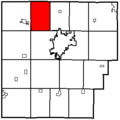
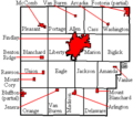
 Map of Hancock County Ohio With Municipal and Township Labels.PNG 504 × 561; 44 KB
-
 Map of Hancock County, Ohio No Text, Municipalities Distinct.png 504 × 561; 22 KB
-
 Map of Hancock County, Ohio No Text.png 504 × 561; 21 KB


