Category:Political maps of Gilgit-Baltistan
Jump to navigation
Jump to search
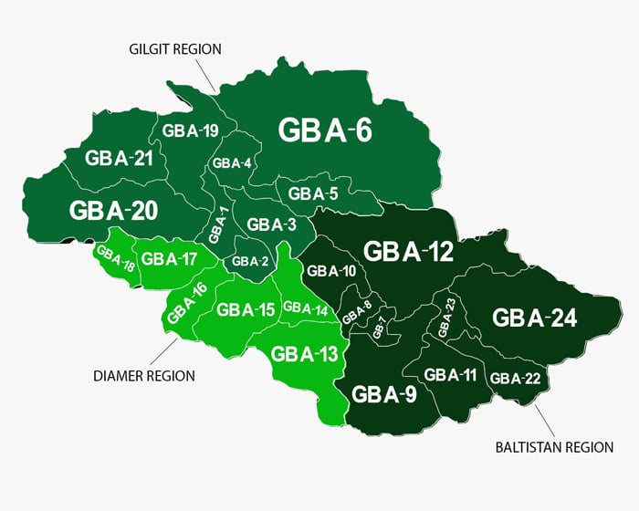
English: This category shows constituency maps of Gilgit-Baltistan, specifically pertaining to the Gilgit-Baltistan legislative assembly. These maps were created in Gimp using a combination of data from polling station lists made by the Gilgit-Baltistan Election Commission (compiled using Google MyMaps), Tehsil-wise and drainage maps created by the government of Gilgit-Baltistan back when it was called the Northern Areas (this drainage map I have linked is one example), this map made by Geo TV, and this map made by SAMAA.
Subcategories
This category has only the following subcategory.
E
Media in category "Political maps of Gilgit-Baltistan"
The following 25 files are in this category, out of 25 total.
-
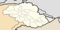 2020 Gilgit-Baltistan Assembly Election Constituency Map - Blank.png 4,500 × 2,250; 186 KB
-
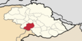
 Locator map of GBA-1 (Gilgit-I).png 4,500 × 2,250; 187 KB
-
 Locator map of GBA-10 (Skardu-IV).png 4,500 × 2,250; 187 KB
-
 Locator map of GBA-11 (Kharmang).png 4,500 × 2,250; 186 KB
-
 Locator map of GBA-12 (Shigar).png 4,500 × 2,250; 199 KB
-
 Locator map of GBA-13 (Astore-I).png 4,500 × 2,250; 186 KB
-
 Locator map of GBA-14 (Astore-II).png 4,500 × 2,250; 187 KB
-
 Locator map of GBA-15 (Diamer-I).png 4,500 × 2,250; 187 KB
-
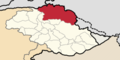
 Locator map of GBA-16 (Diamer-II).png 4,500 × 2,250; 187 KB
-
 Locator map of GBA-17 (Diamer-III).png 4,500 × 2,250; 187 KB
-
 Locator map of GBA-18 (Diamer-IV).png 4,500 × 2,250; 186 KB
-
 Locator map of GBA-19 (Ghizer-I).png 4,500 × 2,250; 187 KB
-
 Locator map of GBA-2 (Gilgit-II).png 4,500 × 2,250; 186 KB
-
 Locator map of GBA-20 (Ghizer-II).png 4,500 × 2,250; 187 KB
-
 Locator map of GBA-21 (Ghizer-III).png 4,500 × 2,250; 186 KB
-
 Locator map of GBA-22 (Ghanche-I).png 4,500 × 2,250; 186 KB
-
 Locator map of GBA-23 (Ghanche-II).png 4,500 × 2,250; 186 KB
-
 Locator map of GBA-24 (Ghanche-III).png 4,500 × 2,250; 187 KB
-
 Locator map of GBA-3 (Gilgit-III).png 4,500 × 2,250; 187 KB
-
 Locator map of GBA-4 (Nagar-I).png 4,500 × 2,250; 187 KB
-
 Locator map of GBA-5 (Nagar-II).png 4,500 × 2,250; 186 KB
-
 Locator map of GBA-6 (Hunza).png 4,500 × 2,250; 187 KB
-
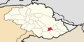 Locator map of GBA-7 (Skardu-I).png 4,500 × 2,250; 186 KB
-
 Locator map of GBA-8 (Skardu-II).png 4,500 × 2,250; 186 KB
-
 Locator map of GBA-9 (Skardu-III).png 4,500 × 2,250; 186 KB
.png)
.png)
.png)
.png)
.png)
.png)
.png)
.png)
.png)
.png)
.png)
.png)
.png)
.png)
.png)
.png)
.png)
.png)
.png)
.png)
.png)
.png)
.png)
.png)