Category:Political maps of Ashtabula County, Ohio as of the 2000 United States Census
Jump to navigation
Jump to search
Media in category "Political maps of Ashtabula County, Ohio as of the 2000 United States Census"
The following 42 files are in this category, out of 42 total.
-
 Future covered bridge in Ashtabula County Ohio Dot Map.png 547 × 1,175; 94 KB
-
 Giddings Road Covered Bridge Dot Map.png 547 × 1,175; 94 KB
-
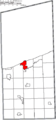
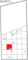
 Map of Ashtabula County Ohio Highlighting Andover Township.png 547 × 1,175; 41 KB
-
 Map of Ashtabula County Ohio Highlighting Andover Village.png 547 × 1,175; 41 KB
-
 Map of Ashtabula County Ohio Highlighting Ashtabula City.png 547 × 1,175; 41 KB
-
 Map of Ashtabula County Ohio Highlighting Ashtabula Township.png 547 × 1,175; 41 KB
-
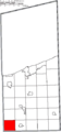
 Map of Ashtabula County Ohio Highlighting Austinburg Township.png 547 × 1,175; 41 KB
-
 Map of Ashtabula County Ohio Highlighting Cherry Valley Township.png 547 × 1,175; 41 KB
-
 Map of Ashtabula County Ohio Highlighting Colebrook Township.png 547 × 1,175; 41 KB
-
 Map of Ashtabula County Ohio Highlighting Conneaut City.png 547 × 1,175; 41 KB
-
 Map of Ashtabula County Ohio Highlighting Denmark Township.png 547 × 1,175; 41 KB
-
 Map of Ashtabula County Ohio Highlighting Dorset Township.png 547 × 1,175; 41 KB
-
 Map of Ashtabula County Ohio Highlighting Geneva City.png 547 × 1,175; 41 KB
-
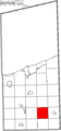
 Map of Ashtabula County Ohio Highlighting Geneva Township.png 547 × 1,175; 41 KB
-
 Map of Ashtabula County Ohio Highlighting Geneva-on-the-Lake Village.png 547 × 1,175; 41 KB
-
 Map of Ashtabula County Ohio Highlighting Harpersfield Township.png 547 × 1,175; 41 KB
-
 Map of Ashtabula County Ohio Highlighting Hartsgrove Township.png 547 × 1,175; 41 KB
-
 Map of Ashtabula County Ohio Highlighting Jefferson Township.png 547 × 1,175; 41 KB
-
 Map of Ashtabula County Ohio Highlighting Jefferson Village.png 547 × 1,175; 41 KB
-
 Map of Ashtabula County Ohio Highlighting Kingsville Township.png 547 × 1,175; 41 KB
-
 Map of Ashtabula County Ohio Highlighting Lenox Township.png 547 × 1,175; 41 KB
-
 Map of Ashtabula County Ohio Highlighting Monroe Township.png 547 × 1,175; 41 KB
-
 Map of Ashtabula County Ohio Highlighting Morgan Township.png 547 × 1,175; 41 KB
-
 Map of Ashtabula County Ohio Highlighting New Lyme Township.png 547 × 1,175; 41 KB
-
 Map of Ashtabula County Ohio Highlighting North Kingsville Village.png 547 × 1,175; 41 KB
-
 Map of Ashtabula County Ohio Highlighting Orwell Township.png 547 × 1,175; 41 KB
-
 Map of Ashtabula County Ohio Highlighting Orwell Village.png 547 × 1,175; 41 KB
-
 Map of Ashtabula County Ohio Highlighting Pierpont Township.png 547 × 1,175; 41 KB
-
 Map of Ashtabula County Ohio Highlighting Plymouth Township.png 547 × 1,175; 41 KB
-
 Map of Ashtabula County Ohio Highlighting Richmond Township.png 547 × 1,175; 41 KB
-
 Map of Ashtabula County Ohio Highlighting Roaming Shores Village.png 547 × 1,175; 41 KB
-
 Map of Ashtabula County Ohio Highlighting Rock Creek Village.png 547 × 1,175; 41 KB
-
 Map of Ashtabula County Ohio Highlighting Rome Township.png 547 × 1,175; 41 KB
-
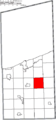
 Map of Ashtabula County Ohio Highlighting Saybrook Township.png 547 × 1,175; 41 KB
-
 Map of Ashtabula County Ohio Highlighting Sheffield Township.png 547 × 1,175; 41 KB
-
 Map of Ashtabula County Ohio Highlighting Trumbull Township.png 547 × 1,175; 41 KB
-
 Map of Ashtabula County Ohio Highlighting Wayne Township.png 547 × 1,175; 41 KB
-
 Map of Ashtabula County Ohio Highlighting Williamsfield Township.png 547 × 1,175; 41 KB
-
 Map of Ashtabula County Ohio Highlighting Windsor Township.png 547 × 1,175; 41 KB
-
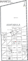
 Map of Ashtabula County Ohio With Municipal and Township Labels.PNG 547 × 1,175; 75 KB
-
 Map of Ashtabula County, Ohio No Text, Municipalities Distinct.png 547 × 1,175; 41 KB
-
 Map of Ashtabula County, Ohio No Text.png 547 × 1,175; 40 KB


