Category:Political maps of Andhra Pradesh
Jump to navigation
Jump to search
States of India: Andhra Pradesh · Arunachal Pradesh · Assam · Bihar · Chhattisgarh · Goa · Gujarat · Haryana · Himachal Pradesh · Jharkhand · Karnataka · Kerala · Madhya Pradesh · Maharashtra · Manipur · Meghalaya · Mizoram · Nagaland · Odisha · Punjab · Rajasthan · Sikkim · Tamil Nadu · Telangana · Tripura · Uttar Pradesh · Uttarakhand · West Bengal
Union territories: Andaman and Nicobar Islands · Chandigarh · Dadra and Nagar Haveli and Daman and Diu · Delhi · Jammu and Kashmir · Ladakh · Lakshadweep · Puducherry
Former states of India: Jammu and Kashmir ·
Former union territories:
Union territories: Andaman and Nicobar Islands · Chandigarh · Dadra and Nagar Haveli and Daman and Diu · Delhi · Jammu and Kashmir · Ladakh · Lakshadweep · Puducherry
Former states of India: Jammu and Kashmir ·
Former union territories:
Subcategories
This category has only the following subcategory.
*
Media in category "Political maps of Andhra Pradesh"
The following 5 files are in this category, out of 5 total.
-
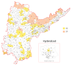
 Andhra Pradesh Loksabha constituencies (2019 - ).svg 1,054 × 861; 250 KB
-
 Andhra Pradesh Wahlkreise Lok Sabha (2014-).svg 660 × 550; 1.08 MB
-
 Lok Sabha constituencies of Andhra Pradesh (1956-2014).png 480 × 452; 52 KB
-
 Wahlkreise zur Vidhan Sabha von Andhra Pradesh (2008-2014).svg 1,182 × 947; 928 KB
-
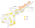 Wahlkreise zur Vidhan Sabha von Andhra Pradesh (2014-).svg 974 × 787; 363 KB
.svg)
.svg)
.png)
.svg)
.svg)