Category:Poland in the 2nd century
Appearance
| Country map |
|---|
Subcategories
This category has the following 35 subcategories, out of 35 total.
*
.
A
C
H
M
N
P
V
W
Media in category "Poland in the 2nd century"
The following 24 files are in this category, out of 24 total.
-
0009 T. Wandalische Funde aus Waldkarpaten 2-4. Jh. n. Chr. 1. 1. 1.JPG 857 × 629; 342 KB
-
01960 (2) Goods from grave 2 found in the princely burial at Łęg Piekarski.jpg 1,482 × 885; 455 KB
-
01960. Goods from grave 2 found in the princely burial at Lęg Piekarski.jpg 1,246 × 861; 333 KB
-
01987 Goods from grave 2 found in the princely burial at Lęg Piekarski.jpg 1,479 × 1,042; 349 KB
-
Bicurgium.jpg 536 × 439; 259 KB
-
Blaeu 1645 - Germaniae veteris typus.jpg 3,635 × 3,046; 1.64 MB
-
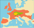
Celts.svg 1,068 × 891; 322 KB
-
Imperium Romanum Germania-ar.png 700 × 491; 182 KB
-
Imperium Romanum Germania.png 700 × 491; 203 KB
-
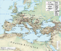
L'EMPIRE ROMAIN 125.svg 2,380 × 1,884; 5.01 MB
-
Maps-roman-empire-peak-150AD.jpg 2,620 × 2,076; 1.12 MB
-
Roman Empire 125 (Lugii).png 2,186 × 1,817; 4.69 MB
-
Roman Empire 125 general map-zh.png 2,732 × 2,271; 6.07 MB
-
Roman Empire 125 general map-zh.svg 2,732 × 2,271; 6.55 MB
-
Roman Empire 125 general map.SVG 2,186 × 1,817; 1.77 MB
-
Roman Empire 125 political map-de.svg 2,186 × 1,817; 6.32 MB
-
Roman Empire 125 political map-zh.png 2,049 × 1,703; 2.99 MB
-
Roman Empire 125 political map-zh.svg 2,732 × 2,271; 2.02 MB
-
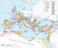
Roman Empire 125 political map.png 2,186 × 1,817; 3.21 MB
-
Roman Empire 125 political map.svg 2,186 × 1,817; 3.25 MB
-
Roman Empire 125.png 2,186 × 1,817; 4.43 MB
-
Silver denari Przeworsk Culture, Cracow.jpg 3,889 × 2,813; 6.46 MB

