Category:Point Roberts, Washington
Jump to navigation
Jump to search
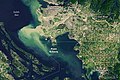
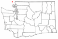
English: Media related to Point Roberts, a land exclave of the United States (in northern Whatcom County, Washington) that is located on the southernmost tip of the Tsawwassen Peninsula (south of Vancouver in British Columbia).
census-designated place in Whatcom County, Washington State, United States .jpeg)  | |||||
| Upload media | |||||
| Instance of |
| ||||
|---|---|---|---|---|---|
| Location | Whatcom County, Washington, Pacific Northwest, Washington, Pacific States Region | ||||
| Inception |
| ||||
| Population |
| ||||
| Area |
| ||||
| Elevation above sea level |
| ||||
| official website | |||||
 | |||||
Subcategories
This category has only the following subcategory.
Media in category "Point Roberts, Washington"
The following 49 files are in this category, out of 49 total.
-
 147-pr (2622687976).jpg 3,342 × 2,541; 3.72 MB
-
 A modern border marker in Monument Park.jpg 3,264 × 4,928; 2.86 MB
-
 Blue Bliss - panoramio.jpg 2,560 × 1,920; 2.81 MB
-
 Boundary Bay Map.png 597 × 385; 188 KB
-
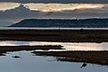 Boundary Bay Sunset.jpg 4,583 × 3,055; 730 KB
-
 Boundary Bay, Tsawwassen and Point Roberts (539674842).jpg 2,272 × 1,704; 1.71 MB
-
 C-FBXA-2007-10-13-under.jpg 1,989 × 1,369; 745 KB
-
 C-FXMU-2007-10-13-1RL.jpg 1,717 × 1,525; 541 KB
-
 Condos in Canada, road in USA - panoramio.jpg 3,072 × 2,304; 1.64 MB
-
 County Plaque.jpg 3,207 × 4,843; 1.96 MB
-
 East cliff-face Lily Point.jpg 3,072 × 2,048; 3.14 MB
-

-

-
-
 FMIB 33383 Salmon-Net Fishing on 'The Reef' at Point Roberts.jpeg 699 × 1,194; 140 KB
-
 FMIB 44392 Indian Fishermen's Village, Pt Roberts.jpeg 1,162 × 339; 214 KB
-
 I was here first - panoramio.jpg 2,560 × 1,920; 2.81 MB
-
 ISS022-E-49270 - View of Washington.jpg 4,288 × 2,848; 615 KB
-
 Let's explore - panoramio.jpg 2,560 × 1,920; 1.74 MB
-

-
 Point bob postcard snowfall.jpg 1,161 × 541; 235 KB
-
 Point Roberts aerial view.jpg 2,272 × 1,704; 1.17 MB
-
 Point roberts airpark.jpg 800 × 600; 85 KB
-
 Point Roberts Benchmark (2710308909).jpg 500 × 375; 136 KB
-
 Point Roberts border xing.jpg 307 × 205; 29 KB
-
 Point Roberts boundary marker and post.jpg 2,112 × 2,816; 2.98 MB
-
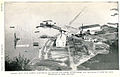
 Point Roberts cannery, Washington, ca 1918 (COBB 185).jpeg 768 × 632; 148 KB
-
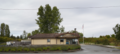
 Point roberts elementary school.jpg 3,072 × 2,048; 2.47 MB
-
 Point Roberts Post Office.png 4,945 × 2,225; 13.38 MB
-
 Point Roberts United States Post Office.jpg 2,142 × 1,163; 1.02 MB
-
 Point Roberts USGS map cropped.JPG 1,315 × 692; 269 KB
-
 Point Roberts WA Border Station - panoramio.jpg 1,469 × 901; 240 KB
-
 Point Roberts, United States (Unsplash).jpg 3,888 × 2,592; 1.44 MB
-
 Point Roberts, Washington.JPG 4,912 × 3,264; 10.93 MB
-
 Point Roberts.jpg 2,500 × 1,667; 1.11 MB
-
 PointRoberts APAcannery 1913.jpg 260 × 139; 38 KB
-
 PointRoberts GeorgeAndBarkerWharf 1913.jpg 260 × 154; 37 KB
-
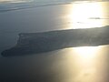
 Pointrobertswide oli 2020210 lrg.jpg 2,695 × 1,797; 5.68 MB
-
 Pointrobertswide oli 2020210.jpg 720 × 480; 508 KB
-
 Pointrobertszm oli 2020210.jpg 720 × 600; 368 KB
-
 Semiahmoo-Bay-3630.jpg 2,560 × 1,920; 1.63 MB
-
 Semiahmoo-Bay-Looking-west-3620.JPG 2,560 × 1,920; 1.61 MB
-
 Semiahmoo-mud-flats-seagulls-3626.jpg 2,560 × 1,920; 1.63 MB
-
 Sun behind trees in Point Roberts - panoramio.jpg 2,304 × 3,072; 2.4 MB
-
 US-border-notice.jpg 3,072 × 2,304; 1.1 MB
-
 View from Monument Park.jpg 3,237 × 4,887; 1.16 MB
-
 WAMap-doton-Point Roberts.png 300 × 202; 10 KB
-
 Warning sign at Point Roberts.jpg 3,648 × 2,736; 4.44 MB
-
 What's Up - panoramio (1).jpg 2,560 × 1,920; 2.82 MB
.jpg)


.jpg)


.jpg)


.jpeg)


.jpg)


.jpg)


.jpg)